05P becomes Yasa, forecast to pass near Fiji; invest intensifies into Tropical Storm 06P, forecast to pass near Tonga and Niue

The South Pacific now has given birth to its first named storm, Yasa, and a new tropical storm.
Tropical Storm Yasa (02F/05P) is located near 15.6 degrees south, 172.3 degrees east, approximately 381 nautical miles to the west-northwest of Suva, Fiji. The storm has sustained winds of 50 mph (85 km/h), with gusts up to 65 mph (100 km/h) and a minimum pressure of 995 millibars. The storm is currently moving west-southwest at 5 knots (5 mph; 10 km/h) and is gaining strength at every minute.
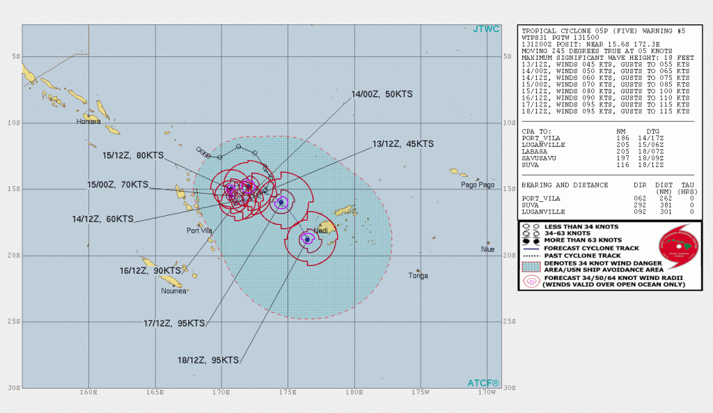
Models are trending about a Fiji pass, and the JTWC forecasts a pass near Fiji as well, but it is noted that they have low confidence for their forecast as of now due to a complex trough-ridge interaction that results into a dynamic steering environment. The warning center is forecasting a peak of 110 mph (175 km/h) on the Saffir-Simpson Scale, while the RSMC of the basin, the Fiji Meteorological Service, is forecasting a category 3 on the Australian scale.
Meanwhile, the invest designated yesterday had intensified into a tropical storm, earning the designation of 06P by the JTWC, and 03F by the FMS. Tropical Storm 06P (03F) is located near 17 degrees south, 173.4 degrees west, approximately 225 nautical miles to the southwest of Pago Pago, American Samoa. The storm has maximum sustained winds of 40 mph (65 km/h), with gusts up to 50 mph (85 km/h), and a minimum pressure of 1003 millibars. The storm is moving west-southwest at 12 knots (14 mph; 22 km/h) and is not a threat to the islands of Tonga and Niue.
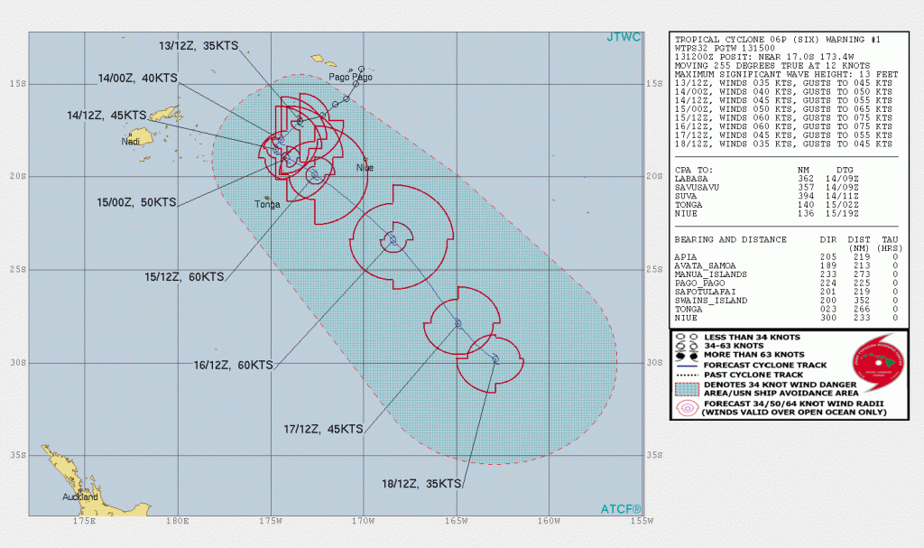
The storm is expected to pass comfortably close to the islands, but is not a threat as of now. Stay tuned for updates.
