Ana made landfall over Fiji, causing extensive damage. More storms are ready to ramp up in the tropics too.

The tropics of Australia and the South Pacific are heating up quickly at the inter-tropical convergence zone (ITCZ), with invest 98S in Western Australia, tropical storms 16P, newly named Lucas (17P), and Ana lining up in the South Pacific tropics. Among them, the strongest one, Ana made landfall over Viti Levu, Fiji at around 5 am FJT, January 31st as a category 1 cyclone in the SSHS. Massive flooding and significant destruction have been done to the main islands (Viti Levu and Vanua Levu) of Fiji.
In this article, we will focus on the developmental process of Ana and the damages caused by it.
Developmental Process
Ana was named by Fiji Meteorological Office in their advisory issued at 06:00 FJT, January 30th. And with low wind shear, 30C of sea surface temperature plus an abundant supply of moisture air in the ITCZ, Ana started to intensify significantly, with a decent look of banding feature and a well-developed central dense overcast (CDO) with cloud tops colder than -90C. In the evening, a low-level eye started to pop out and kept improving until it made landfall. What is more, Ana stalled offshore for 2 hours before landfall, hence the eyewall has brushed the northern part of Suva Island hard.
Nadi Airport weather station with a 13m elevation, reported the lowest pressure of 985hPa at 04:00 FJT, while Nausori Airport weather station with a 5m elevation, reported 991hPa at the same time, but the lowest pressure recorded in Nausori was 11 hours after that when Ana’s center directly flew over Nausori with a pressure of 983hPa. Based on that, Force Thirteen has called that a landfall occurred at 04:00FJT on January 31st, with 1-minute sustained winds of 75mph and a pressure of 978mb.
Current Storm Information, Forecast Track
As of 06:00UTC (18:00FJT), according to the latest advisory from Fiji Meteorological Service, Ana is located at 18.9S 178.6E, with 10-minute sustained winds of 55kts (105km/h) and pressure of 975hPa, moving SSE at 10kts (19km/h).
While at the same time, according to the latest Force Thirteen operational analysis, Ana is located at 18.9S, 178.6E, with 1-minute sustained winds of 60mph (95km/h) and pressure of 983mb, moving SSE at 14mph (22km/h).
Ana has a structure with the eastern side stronger than the western side, as there was a strong spiral rainband at the eastern quadrants, which brought strong winds and over 30mm/hr rainfall to areas of impact. After landfall, due to land interaction, the radar eye of Ana disintegrated. In addition to proximity to land, shear is another factor that weakens Ana significantly. As shown in radar, the core disappears, leaving a strong arc of rainband displaced the south, which means the northerly shear is strengthening and is tearing Ana off. Despite that, the outer bands are still bringing heavy showers to Fiji and nearby areas.
It is expected to continue weakening substantially due to wind shear and decreasing sea surface temperature, as well as turning from SSE to SE while accelerating. Finally, it is prognosticated to turn extratropical 2 days after.
Impacts
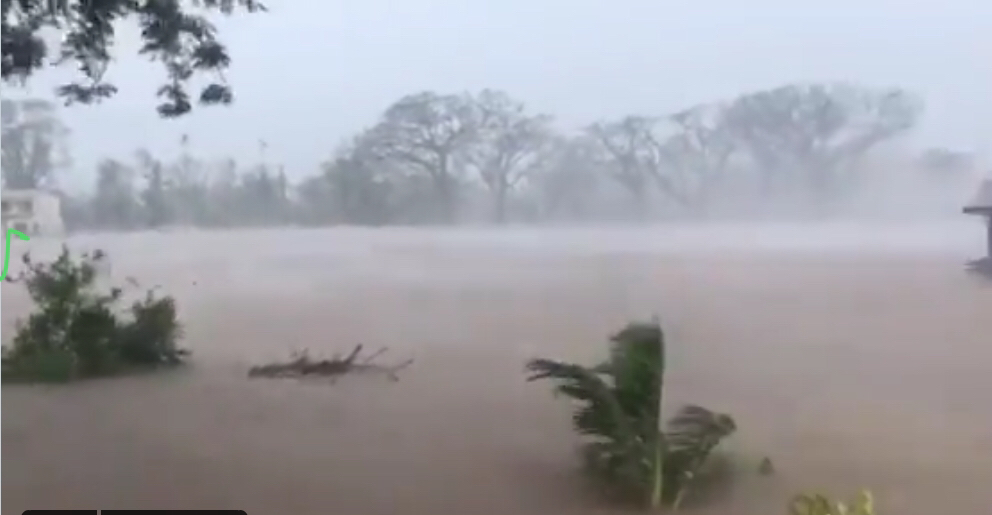
Ana brought extensive flooding to Fiji as >300mm rainfall recorded, and even more in Vanua Levu, Lomaiviti, and the eastern parts of Viti Levu. Many areas reported flooding, and the situation is even worse for areas near river channels, low-lying areas, as well as regions that received more rainfall, with floodwater depth up to 1.5m, causing severe disruption to air and road traffic as many roads are flooded. So far one person died by drowning and 5 are missing, including a 3-year-old boy. Currently, a total of 7,612 people are taking shelter in 204 evacuation centers across the nation.
This storm is the second cyclone to hit Fiji in just over a month after Cyclone Yasa brushed Fiji as a category 4 (SSHS), killed four people and severely damaged villages in December, and Ana is apparent an obstacle to the recovery jobs.
Elsewhere in the tropics
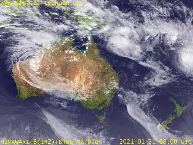
The situation is white-hot with 5 systems persisting in the southern hemisphere. 13S is still surviving in the southwest Indian Ocean as a remnant low, fighting against shear all alone. It is expected not to intensify in the next 5 days under strong wind shear. While in the Australian and South Pacific regions, along with Ana, 3 more systems, 98S, Lucas (17P), and 16P are spinning together in the tropics.
98S is currently inland but intensifying due to brown-ocean-effect. Later on, it is expected to enter the sea and intensify further, continuing its impact on northern Western Australia. 17P has just been named Lucas by the Bureau of Meteorology. It is expected to intensify to be a significant cyclone and bearing towards New Caledonia after weakening from peak intensity. Microwave imagery has revealed that Lucas has formed a low-level eye already. 16P is expected to follow Ana’s back and remain fairly weak due to the influence of Ana. 16P will likely be absorbed by Ana.
