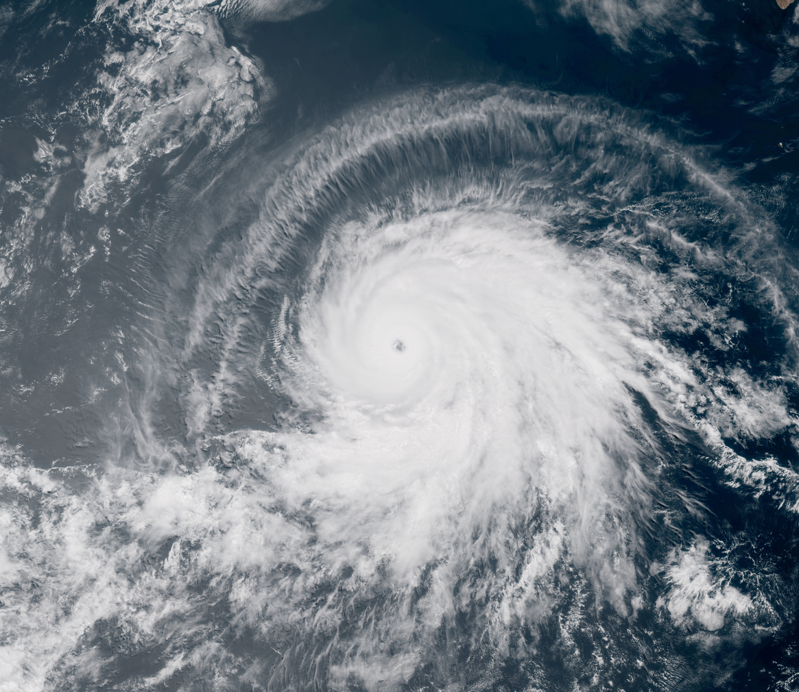
Barbara Rapidly Intensifies into a Powerful Category 4 Hurricane

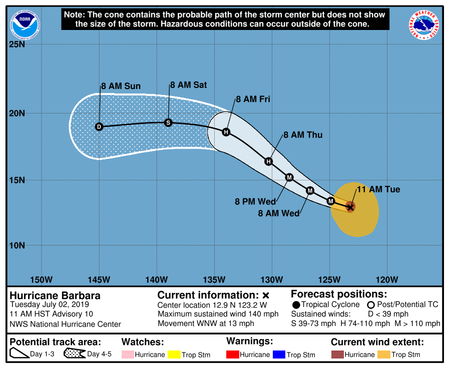
Hurricane Barbara’s intensification during the past 24 hours has been remarkable. After being upgraded to a hurricane Monday evening, the cyclone proceeded to rapidly intensify, becoming a Category 4 hurricane at 12:30 UTC today, as reflected in an update statement issued by the National Hurricane Center (NHC). As of the center’s most recent advisory at 11:00 AM HST (21:00 UTC), the center of Hurricane Barbara was located at 12.9°N, 123.2°W, about 1110 mi (1790 km) southwest of the southern tip of the Baja California Peninsula. Barbara had maximum sustained winds of 140 mph (220 km/h), gusting to 165 mph (265 km/h), and the minimum central pressure was 945 mb (27.91 inches). The cyclone was moving west-northwestward at 13 mph (20 km/h), and this general motion is expected to continue over the next day or so, after which time the cyclone is expected to turn northwestward, and then westward with an increase in forward speed. Barbara still has about 12 hours left for additional intensification while it remains over warm ocean waters and in a favorable atmospheric environment. By Wednesday, the hurricane will likely begin to slowly weaken as sea surface temperatures gradually decline and the environment becomes more stable and less conducive to intensification. By the time Barbara reaches the Central North Pacific basin sometime during the weekend, it is likely to have weakened to a tropical storm or depression.
Track and Intensity Guidance

Barbara’s rate of intensification has exceeded that which was shown by most computer models, although its track has closely resembled the model forecast tracks. Most computer models show some additional strengthening before the hurricane is expected to begin weakening, and given Barbara’s continued intensification throughout today, this seems quite likely. The NHC’s most recent forecast is in agreement with the models, and shows Barbara attaining winds of 150 mph (240 km/h) early tomorrow morning. The models are also in good agreement in regards to Barbara’s future track. They show the cyclone turning northwestward during the middle of the week, and then assuming a westward motion at the end of the week as the cyclone weakens. None of the models keep Barbara particularly intense as it enters the Central Pacific, as it is likely to have weakened significantly by that time due to entering an unfavorable environment. The ECMWF (European) and the GFS (American) ensembles suggest that Barbara could approach the Hawaiian islands as a weakened cyclone. Although it is still too early to determine what, if any, impacts Barbara could have in the islands, residents in this area should closely monitor Barbara and have a tropical cyclone plan prepared in the event that Barbara does affect the islands. Even as a weakened system, the cyclone still has the potential to produce heavy rainfall, which could cause flash flooding and mud slides, especially in low-lying and mountainous areas.
You can follow the progress of Tropical Storm Barbara through Force Thirteen’s official outlets. Live updates on Barbara can be found at the official Force Thirteen YouTube channel, and further information can be found on the Force Thirteen Twitter and Facebook pages.
