Cyclone Faraji continues to intensify, no threat to land

Tropical Cyclone Faraji has been fluctuating in intensity over the past few hours, and has now intensified into a 140 mph category 4-equivalent cyclone over the open Indian Ocean.
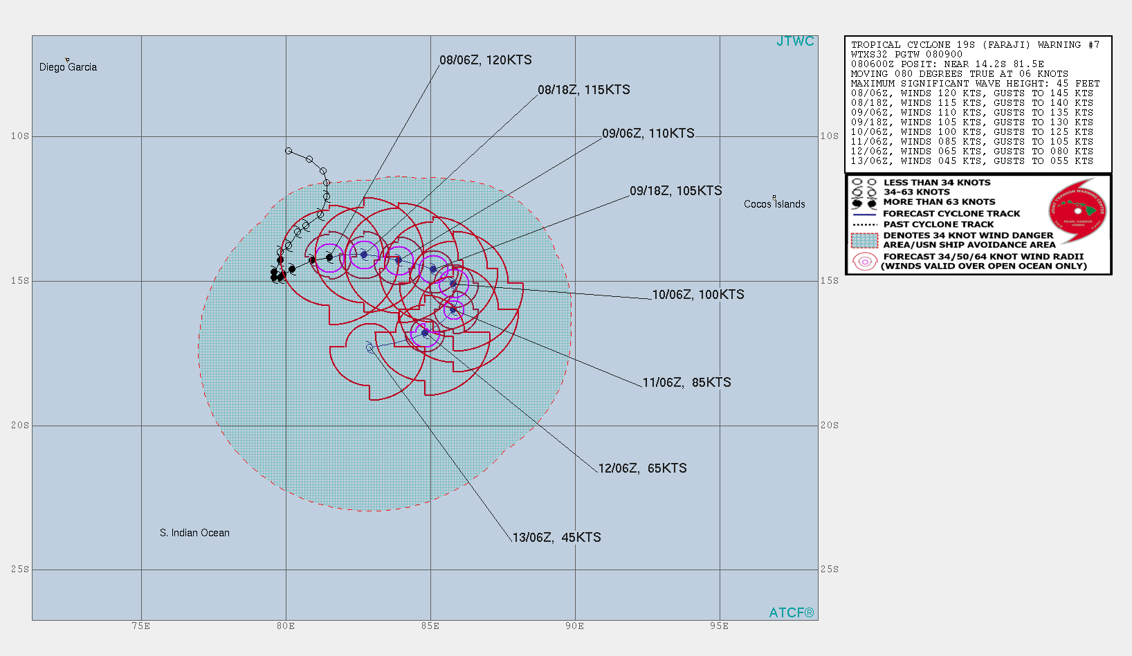
Faraji is currently located near 14.2 degrees south, 81.5 degrees east, with maximum 1-minute sustained winds of 140 mph (220 km/h), with sustained gusts up to 165 mph (270 km/h) with a minimum central pressure of 938 millibars, according to the Joint Typhoon Warning Center. Meteo-France, the basin’s Regional Specialized Meteorological Centre, or RSMC, currently has Faraji at intense tropical cyclone (major hurricane-equivalent) status, with maximum 10-minute sustained winds of 120 mph (195 km/h), and a minimum central pressure of 940 millibars. The storm is currently moving east at 7 mph (11 km/h) according to the JTWC, and is no threat to land.
Stay tuned for updates. You could also track Faraji real-time in our Cyclone Tracker: Cyclone Tracker – Force Thirteen (force-13.com)
References:
- The Joint Typhoon Warning Center’s 09z text advisory for Faraji: https://www.metoc.navy.mil/jtwc/products/sh1921web.txt
- The Joint Typhoon Warning Center’s forecast cone for Faraji: sh1921.gif (1636×948) (navy.mil)
- The Meteo-France’s 06z advisory for Faraji: http://www.meteo.fr/temps/domtom/La_Reunion/webcmrs9.0/anglais/activiteope/bulletins/cmrs/CMRSA_202102080600_FARAJI.pdf
