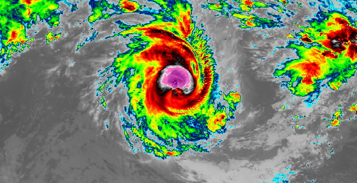
Cyclone Marian intensifying in the Indian Ocean, no threat to land

The Australian Region basin has produced yet another named cyclone of the 2020-21 season, Marian, and is currently in the open ocean, with no threat to land.
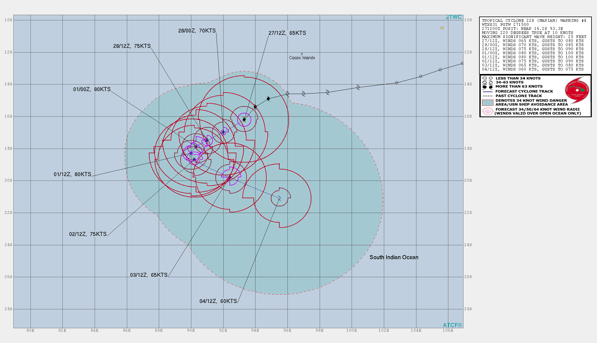
Tropical Cyclone Marian is currently located near 16.2 degrees south, 93.3 degrees east, approximately 320 nautical miles to the southwest of the Cocos (Keeling) Islands of Australia. The storm currently has 1-minute sustained winds of 75 mph (120 km/h), with sustained gusts up to 90 mph (150 km/h), and a minimum central pressure of 979 millibars, according to the Joint Typhoon Warning Center. The Bureau of Meteorology, the official Regional Specialized Meteorological Centre (or RSMC) of the basin, has Marian at category 2 tropical cyclone status, with 10-minute sustained winds of 70 mph (110 km/h) and a minimum central pressure of 976 millibars.

Force Thirteen estimates has put up Marian at 80 mph (130 km/h), slightly higher than the mentioned centers’ estimates, with a minimum central pressure of 976 millibars, same as the BoM’s pressure estimate. The storm is currently moving southwest at 12 mph (19 km/h) and is no threat to land at this time of writing. Marian is forecast to move southwest, briefly entering the Meteo-France’s area of responsibility, then recurve towards the southeast, while weakening.
Stay tuned for updates. You can track Marian real-time through our Cyclone Tracker: Cyclone Tracker – Force Thirteen (force-13.com)
References:
- The Joint Typhoon Warning Center’s text advisory for Marian: https://www.metoc.navy.mil/jtwc/products/sh2221web.txt
- The Bureau of Meteorology’s Tropical Cyclone Technical Bulletin for Marian: Tropical Cyclone Technical Bulletin 1 (WA) (bom.gov.au)
- The Joint Typhoon Warning Center’s forecast cone for Marian: sh2221.gif (2056×1182) (navy.mil)
