Cyclone Tauktae continuing its intensification phase as it scrapes the coast of India
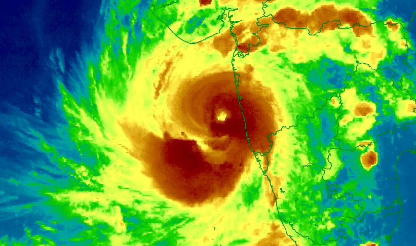
Cyclone Tauktae is continuing to intensify as it scrapes along the coast of India. Tauktae is currently 260km (161mi) away from Mumbai. As of 12:00 UTC; F13 now has Tauktae as a 200kph (125mph) system (1-min winds) making it a Category 3 hurricane equivalent cyclone with an estimated pressure of 951Mb, while the India Meteorological Department (IMD) officially has it as a 130kph (80mph) system (1-min winds) with an estimated pressure of 972Mb. Force Thirteen is currently predicting a high-end Category 4 hurricane equivalent cyclone with winds of 240kph (150mph) (1-min winds), while the IMD is predicting a 145kph (90mph) peak.
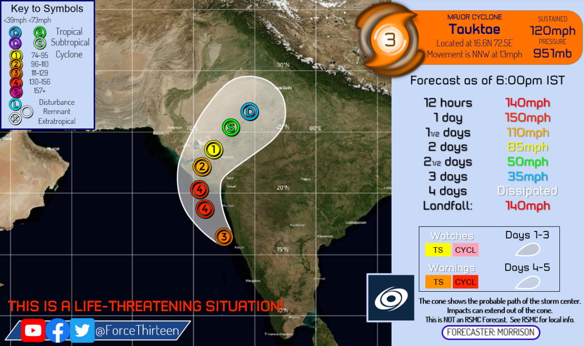
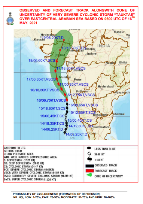
Over the past few hours, Tauktae has brought heavy winds and rains to the western coastal parts of India and the situation is expected to worsen from there. Six deaths are already reported as of May 16, 2021, 2 confirmed in Kerala and another 6 confirmed in Karnataka. The cyclone has already brought heavy rainfall to Karnataka causing light to moderate damages over there. Cyclone Tauktae is expected to make landfall in Gujarat as a very strong category 4 hurricane equivalent cyclone. The IMD is currently forecasting a 3.6-meter storm surge in Una, Gujarat, the highest forecasted surge. In Gujarat, Chief Minister Vijay Rupani ensures that his state is taking the needed precautions to prepare for the cyclone which is expected to make landfall on Monday, May 17, 2021.
Warnings and Watches:
| Cyclone Warning Cyclonic storm conditions expected within 24 hours. |
|
Source: https://mausam.imd.gov.in/imd_latest/contents/cyclone.php#.
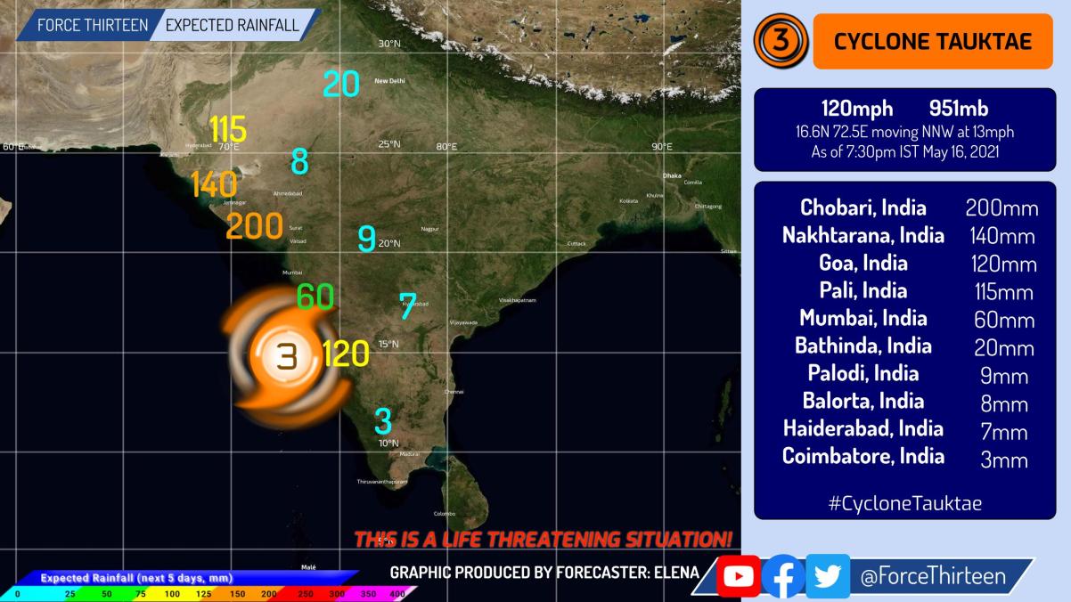
Here is our latest rainfall forecast for Cyclone Tauktae, take a look.
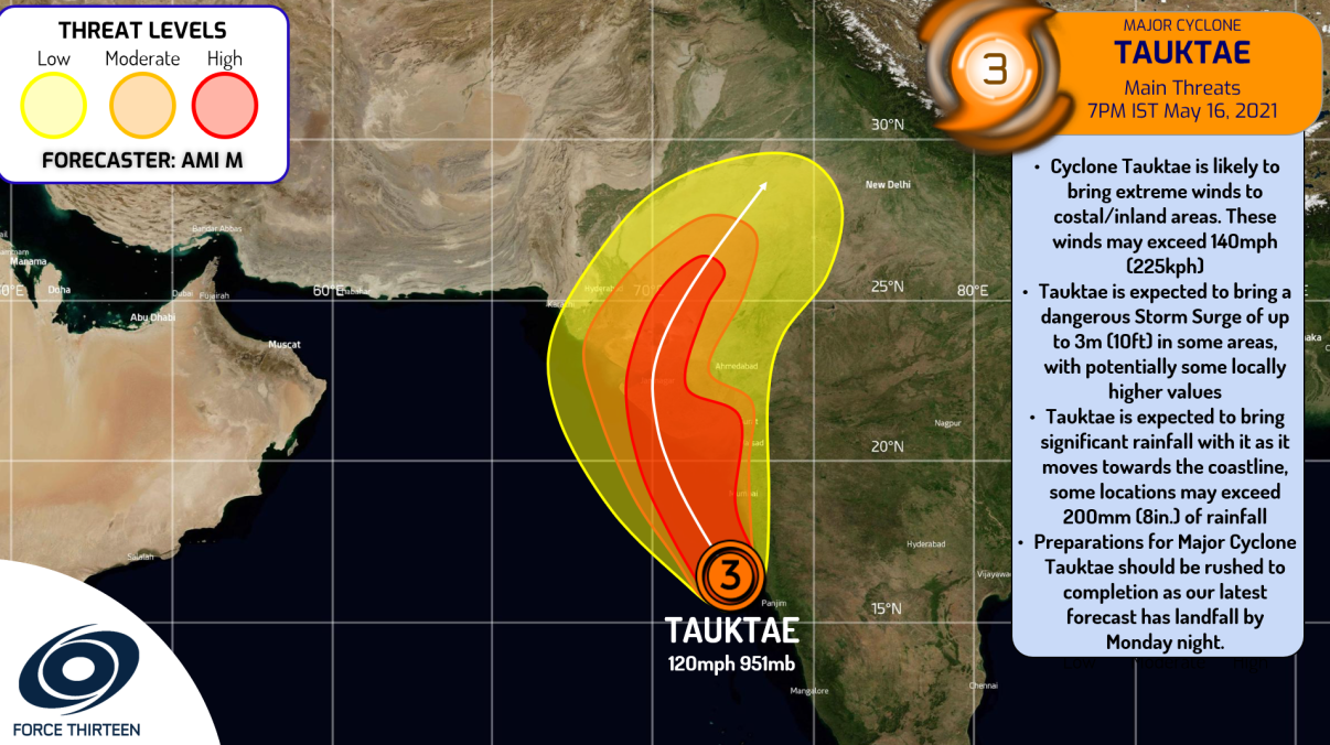
Here is our latest Key Messages Graphic:
The Latest IMD Storm Surge Forecast Map:
If you’re in the forecast cone, please be prepared for this storm. Stay updated with your local officials, and evacuate if needed. Stay tuned for more updates on this storm. This could be the most significant landfall in Gujarat since the 1998 Gujarat Cyclone.
Watch our Live Stream on Cyclone Tauktae!
Notice: F13 has given a special fix for Tauktae at 13:30 UTC – 16.8°N 72.4°E 110kt 946Mb (C3) – moving NNW at 13mph
