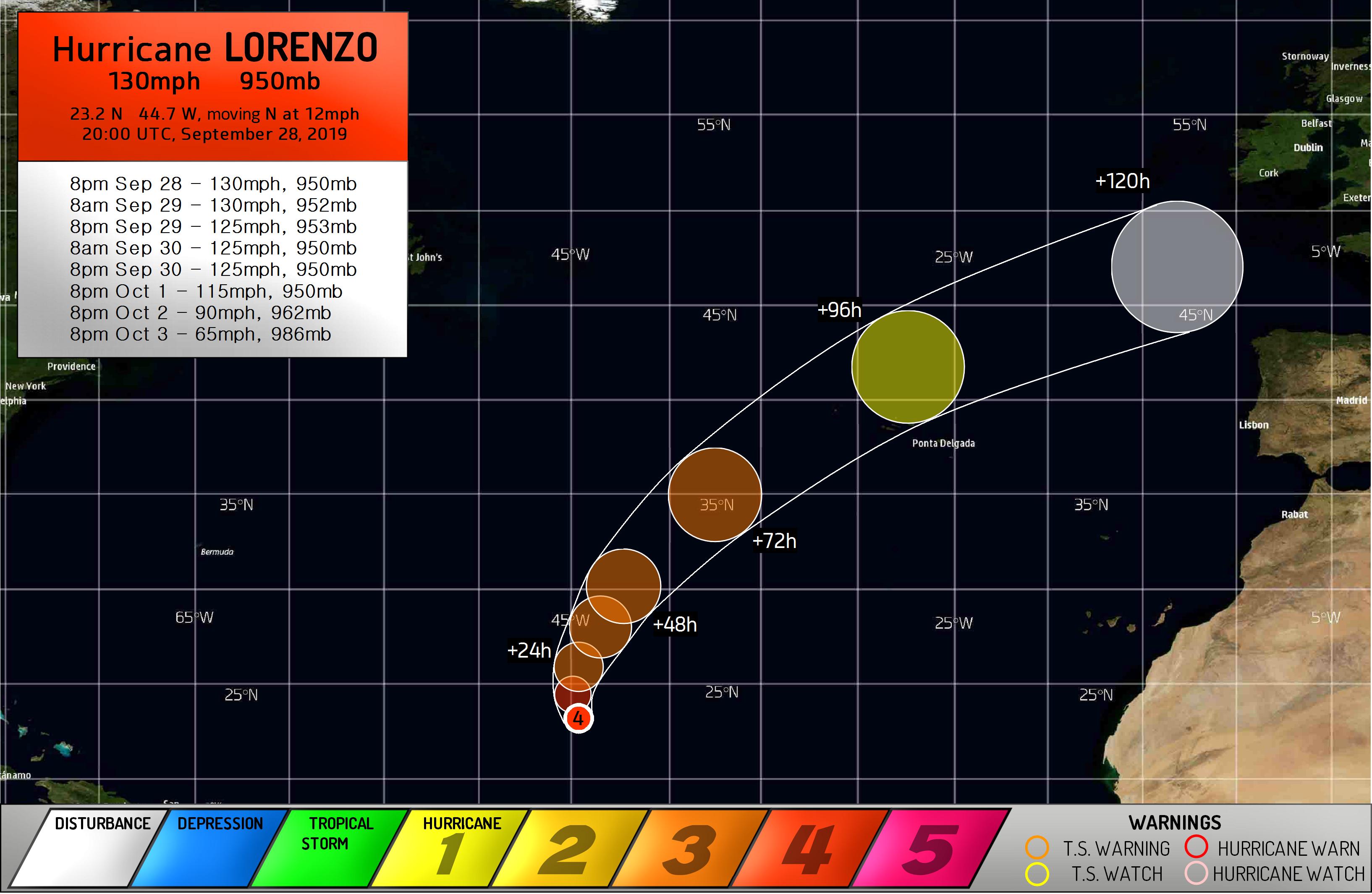
MAJOR HURRICANE 13L (LORENZO)
PUBLIC ADVISORY #19
FORCE THIRTEEN HQ MANCHESTER UK
2000 UTC SAT SEP 28 2019

...LORENZO INTENSIFYING AGAIN...

SUMMARY OF 1800 UTC...INFORMATION
-----------------------------------
LOCATION...NEAR 23.2 N 44.7 W
MAXIMUM SUSTAINED WINDS...130MPH...210KM/H
MINIMUM CENTRAL PRESSURE...950MB

WATCHES AND WARNINGS
-----------------------------------
NO WARNINGS IN EFFECT

DISCUSSION
-----------------------------------------------------------------------------------
Hurricane Lorenzo has substantially intensified again this afternoon, and furtheraaaaaaaaaaaaaaaaa
intensification may be ongoing at this time. Whilst satellite imagery appears that
the eyewall may still be partially open, this has become less of a dominant feature
recently and the eye has deepened, along with an increase in cloud top heights.
All indications are pointing towards an intensifying storm - potentially rapidly -
and with fairly low wind shear ahead of the storm, Lorenzo could remain intense
for some time. SATIED estimates of 143mph and 147mph taken three hours apart are
likely a little optimistic, but all the same, the current appearance of the storm
and reconnaissance plane indications show that Lorenzo may yet reach that intensity
or higher later on.

Cyclone Destruction Potential Scale rating: 5
Lorenzo threatens to be the most intense hurricane on record for the Azores, with
major damages possible on the western islands if the current forecast verifies.

NEXT FULL ADVISORY AT 0200 UTC

$$
FORECASTER FOY
