• STORM FLOATER •
TROPICAL DEPRESSION 10E (TEN)
***FINAL BULLETIN***
PUBLIC ADVISORY #4
FORCE THIRTEEN SINGAPORE, SINGAPORE
2100 UTC FRI AUG 14 2020

...DEPRESSION CONTINUES TO DEGRADE...

SUMMARY OF 2100 UTC...INFORMATION
-----------------------------------
LOCATION...NEAR 13.5 N 132.7 W...
MAXIMUM SUSTAINED WINDS...35MPH...55KM/H
MINIMUM CENTRAL PRESSURE...1004MB

WATCHES AND WARNINGS
-----------------------------------
NO WARNINGS IN EFFECT.
DISCUSSION
-----------------------------------
ASCAT-B data valid around 1900 UTC showed max winds a little higher
than 30 kt associated with the rain-free circulation of the
depression. However, since that time, the convective structure of
the cyclone has degraded substantially and if it was previously
producing winds of tropical-storm-force, it likely no longer is
doing so at this time. Only minor fluctuations in the intensity and structure of the
depression are expected for the next 3 days due to strong
northeasterly wind shear. Assuming the system doesn't dissipate at
some point during that period of time, the upper-level winds could
become less hostile early next week. The dynamical guidance
generally indicates that the tropical cyclone will hang on and
modest strengthening is possible early next week.

LOCAL AND OFFICIAL SOURCES BELOW
National Hurricane Center (East Pacific)

THIS IS THE LAST REGULARLY SCHEDULED BULLETIN, NO MORE BULLETINS WILL BE ISSUED.
SHOULD THIS SYSTEM RE-INTENSIFY, ADVISORIES WILL BE ISSUED AGAIN.

$$
Forecaster Knack
• OFFICIAL JTWC FORECAST •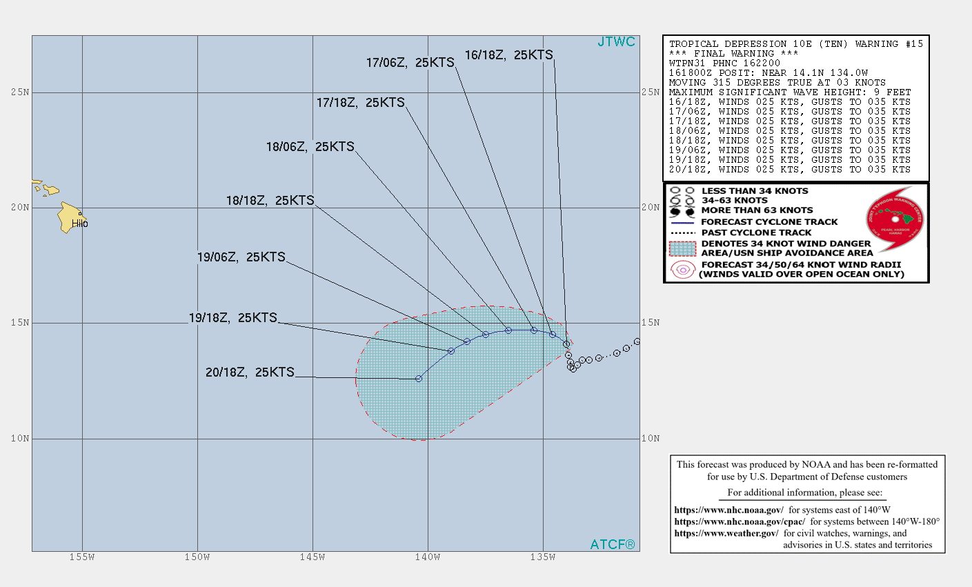
• NATIONAL HURRICANE CENTER FORECAST •

