TROPICAL STORM 19W (MITAG) PUBLIC ADVISORY #12
FORCE THIRTEEN
1600UTC OCTOBER 01, 2019
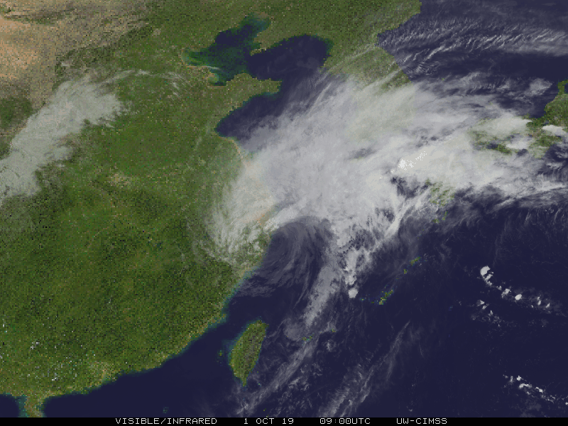
…MITAG STRUGGLES NEAR THE COAST OF CHINA AND WEAKENS TO A TROPICAL STORM…
SUMMARY OF 1600UTC… INFORMATION
LOCATION… 30.7N 122.8E
MAXIMUM SUSTAINED WINDS…70MPH…110KM/H
MINIMUM CENTRAL PRESSURE… 983MB
MOVEMENT… NNE AT 15MPH
WATCHES AND WARNINGS
See local forecast office for latest watches and warnings.
FORECAST DISCUSSION
Mitag has really been struggling recently under a high shear environment. There is an exposed center, and all satellite estimates point toward a probably generous 60 knots for this advisory. Mitag is forecast to strike South Korea in around 24-36 hours as a weak to minimal tropical storm. Heavy rainfall should be the main threat there. Along the coast of China, high winds associated with the outer bands and near the center along the extreme edges of the coastline should be the main threats.
INT… 70mph
12HRS… 60mph
24HRS… 50mph
36HRS… 45mph
48HRS… 40mph
72HRS… 35mph
96HRS… 30mph
120HRS… POST-TROPICAL
Next complete advisory to be issued at 0000UTC
FORECASTER BRUNING
Ads by 