Cyclone Trevor Set to Impact the Cape York Peninsula

Tropical Storm Trevor has developed east of the Cape York Peninsula of Australia with winds of 40mph and a pressure of 1003mb. It is currently listed as a category 1 tropical cyclone on the Australian scale and is located approximately 225km northeast of the tip Cape Melville.
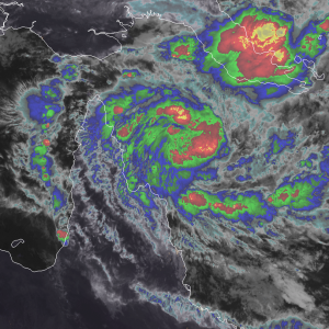
Trevor developed from a broad area of low pressure that was previously located over the Solomon Sea. Since then, the system split over the Papuan Peninsula, and the southwestern circulation became dominant, developing into Trevor. Currently, the storm is gaining organization as it slowly progresses westward. The storm has developed well-defined outflow and inflow channels and is tightening its central dense overcast. As of now, it remains only a minimal tropical storm, but intensification is expected as it approaches the Cape York Peninsula.
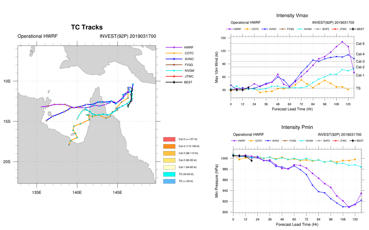
Trevor is currently under relatively weak steering currents, as it is far enough south of the monsoon trough that the flow isn’t overwhelmingly westward, but there also aren’t any synoptic bodies, such as a ridge or trough, in the vicinity of the storm. As a result, the general easterly trade flow is dominant, which will slowly push Trevor into the Cape York Peninsula by Tuesday evening local time. The Bureau of Meteorology is currently forecasting the storm to be a category 2 cyclone, which corresponds to a strong tropical storm or weak category 1 TC on the Saffir-Simpson scale, when it makes landfall south of Lockhart River. This is because the environment ahead of Trevor is favorable for intensification, as sea surface temperatures are warm, vertical wind shear is quite low, and dry air has been far removed from the system. Trevor is then forecast to weaken over land and emerge into the Gulf of Carpentaria by Wednesday afternoon as a tropical low. Past this point, the forecast track appears to take the storm west across the northern GoC while a ridge develops over the continent, likely making landfall somewhere along the coastline of the Northern Territory from Nhulunbuy to the border with Queensland sometime around Friday and Saturday. The uncertainty mainly lies with the intensity. Some models bring the storm in as a tropical storm while others bring it in as a powerful cyclone. At this point, it still remains a bit too far out to determine where and how strong Trevor will be after it crosses the Cape York Peninsula, so please stay tuned to your local authorities and the Bureau of Meteorology for the latest information for your specific area.

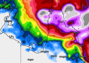
The primary threats associated with Trevor with its first landfall will be heavy rainfall, as the storm is relatively slow-moving and is quite broad. Rainfall has just begun along the Cape York Peninsula and will likely persist into the next several days as Trevor crawls westward. Rainfall totals exceeding 30cm in some areas cannot be ruled out, which can lead to dangerous flash flooding. Gusty winds will also be a concern, especially for coastal communities. These can cause localized power outages and downed trees. Rough seas will be an issue as well, with some minor coastal flooding possible south of the landfall zone. As for areas in the Northern Territory, it remains to be seen what the main threats will be from Trevor, if any, but those with interests in this part of Australia should be vigilant to the forecast over the next several days. Have a plan ready just in case the storm comes toward you.