Depression becomes Tropical Storm Gonzalo, forecast to become hurricane

Tropical Storm Gonzalo was named this morning, and has already began to strengthen as it tracks westward over the central Atlantic Ocean.
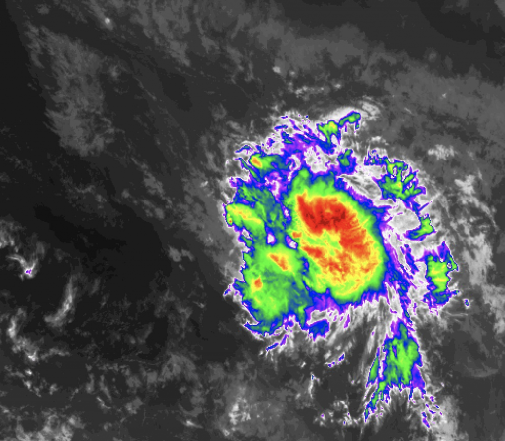
By 15:00 UTC on July 22, Gonzalo had strengthened significantly, having received its name only 3 hours earlier. At this time, Gonzalo was tracking westward with winds of 50 mph and a pressure of 1000 mbar, with banding features and a hint of an eye-like feature starting to become present on satellite imagery. However, Gonzalo has had a struggle against dry air, although it still is intensifying despite this.
Gonzalo’s forecast is still uncertain, although it is increasingly likely that it will strengthen into a hurricane- the first of the 2020 season should it do so. The National Hurricane Center is forecasting an 80 mph peak for Gonzalo a day or two before it enters the Caribbean, although there is uncertainty to how the dry air will impact the intensification trend.
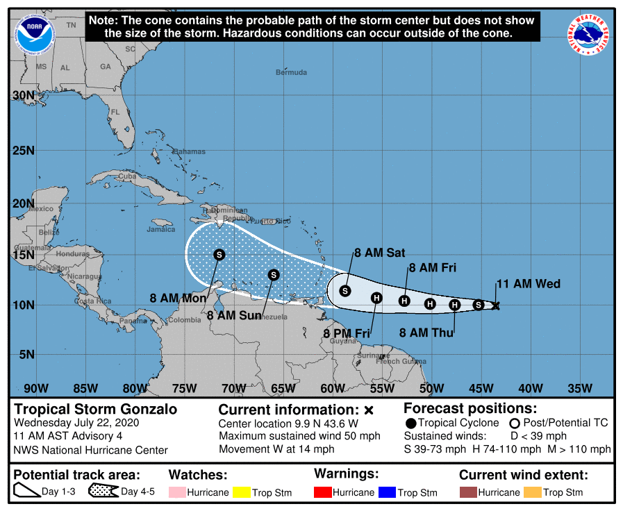
As we head into the weekend, the Windward Islands may see tropical storm and/or hurricane conditions from Gonzalo. The degree of the impacts are currently uncertain, although it seems likely that watches and warnings may be issued in the coming days.
For the latest official information, please refer to the National Hurricane Center.
Force Thirteen also produces regular updates on their Twitter page and YouTube channel.
