Disturbance Likely to Become a Tropical or Subtropical Cyclone off the East Coast of Florida

A broad area of low pressure, labeled Invest 90L by the United States Navy, and currently located over the Straits of Florida, is being monitored by the National Hurricane Center (NHC) for tropical or subtropical cyclone development. As of 18:00 UTC May 15, Invest 90L was located near 23.7°N and 81.2°W. Maximum sustained winds were 25 kt (30 mph), and the minimum barometric pressure was 1013 millibars. Gradual development is expected over the next couple of days, and this system is likely to become a tropical or subtropical depression or storm on Saturday as it moves north-northeastward to northeastward off the Florida coast. The NHC has marked this system as having a high (80 percent) chance of becoming a tropical or subtropical cyclone within the next 48 hours, and a high (80 percent) chance of becoming a tropical or subtropical cyclone within the next five days. If this system becomes a tropical or subtropical cyclone, it will receive the name Arthur, which is first on the predetermined list of names to be used this year in this basin.
Potential Track and Intensity
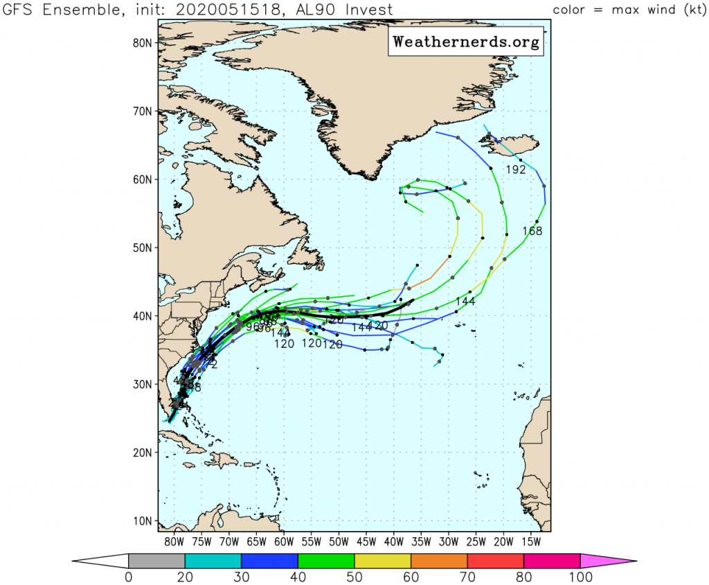
Numerical Weather Models are generally in good agreement on Invest 90L taking a northeastward track off the East Coast of the United States. Both the GFS and ECMWF models take the disturbance on a north-northeasterly to northeasterly track through Monday, followed by a more easterly component on Tuesday as the system encounters high pressure to its north over the Canadian Maritimes. The GFS global model, on the other hand, although with some run-to-run inconsistency, currently takes the system on a more northerly track, having the disturbance interact with and eventually be absorbed by an upper-level low over the Eastern United States. All ensemble members and global models show the system intensifying, but the future intensity of this system is largely dependent on its track. While sea surface temperatures are quite warm over the Gulf Stream, much cooler shelf waters lie just to the west. If the system were to take a track closer to the coast, it would likely struggle to maintain deep convection and would likely be weaker, whereas a track over the Gulf Stream would likely result in more strengthening. By Wednesday, the window of opportunity for intensification will likely have passed as the system will be either moving over cooler waters or will have become post-tropical.
Impact and Areas at Risk
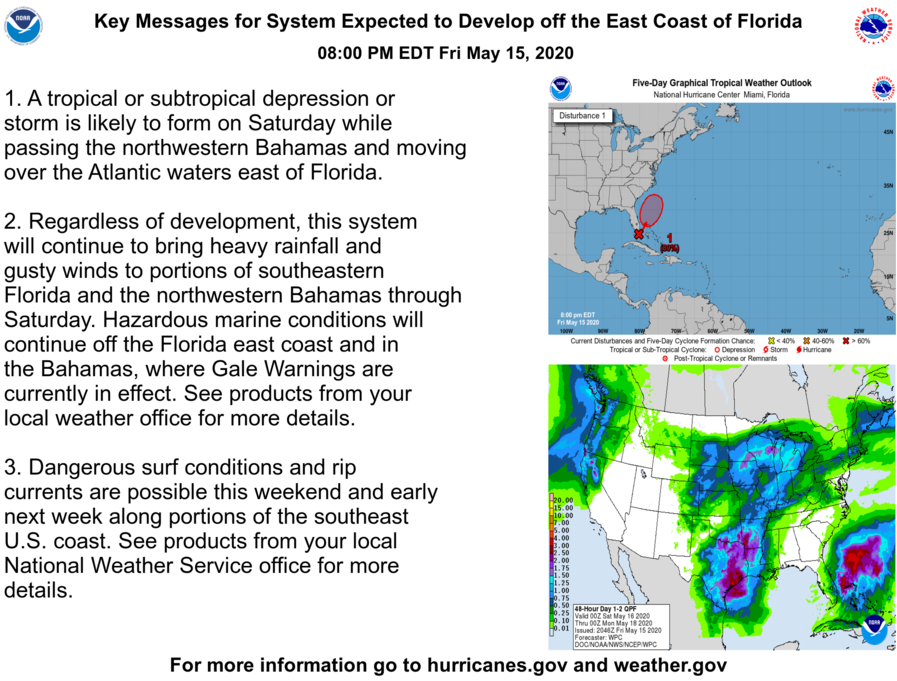
Regardless of whether or not this system becomes a tropical or subtropical cyclone, heavy rainfall and gusty winds are expected to continue across portions of southeastern Florida and the northwestern Bahamas through Saturday. In addition, hazardous marine conditions will continue off the east coast of Florida and near the northern Bahamas, where gale warnings are currently in effect. Dangerous surf and sea conditions are expected to develop off the southeastern U.S coast this weekend and early next week. In addition, an upper-level low which is anticipated to develop and interact with this system could have a large impact on conditions in the Eastern United States next week. Widespread rainfall, and, as a result, flood concerns may develop during that time. Please refer to products from the National Hurricane Center and your local National Weather Service office for more information.
Please refer to the National Hurricane Center and National Weather Service websites for further information regarding Invest 90L as well as watches and warnings in effect. Force Thirteen will be providing daily updates on this system when conditions warrant. More information can be found at Force Thirteen’s official outlets, including its Twitter and Facebook pages.
