East Pacific Disturbance Could Become First Cyclone of the Year

A tropical disturbance, labeled Invest 93E by the United States Navy, and currently located over the eastern North Pacific Ocean, is being monitored by the National Hurricane Center (NHC) for tropical cyclone development. As of 00:00 UTC June 24, Invest 93E was located in the Northeast Pacific basin at 11.8°N and 98.2°W. Maximum sustained winds were 20 kt (25 mph), and the minimum barometric pressure was 1009 millibars. The system, a tropical wave, has a medium chance (50 percent) of developing into a tropical cyclone during the next 48 hours, and a high chance (70 percent) of developing into a tropical cyclone during the next five days, as of the NHC’s most recent Tropical Weather Outlook from 5:00 PDT (00:00 UTC). Gradual development of this system is likely as it moves west-northwestward, out to sea, as is typical of many tropical cyclones that form in the Northeast Pacific Ocean. If this system becomes a tropical storm, it will receive the name Alvin, which is first on the predetermined list of names to be used this year in this basin.
Potential Track and Intensity
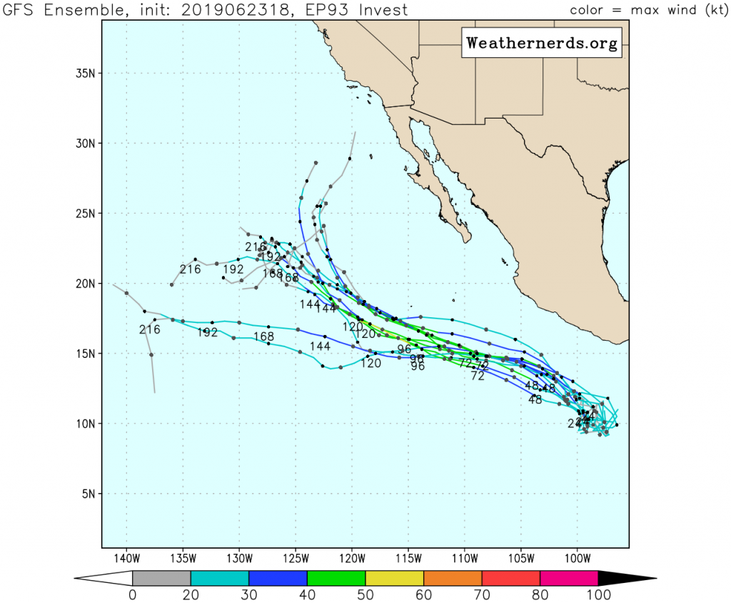
Weather Models are in good agreement that Invest 93E will remain over the open waters of the Eastern North Pacific Ocean and not directly affect land. However, the system could still enhance surf along the Pacific coast of Mexico. The intensity forecast of this system is more complicated. The GFS ensembles develop a tropical storm with maximum winds up to 60 mph (95 km/h), while the ECMWF ensembles display a much weaker system. Conversely, the SHIPS guidance develops the system into a Category 1 hurricane. The disturbance is currently situated over warm waters of around 28°C (82.4°C). However, much cooler waters which are unfavorable for intensification are present beginning at around 20°N. The system should be able to intensify over the next few days as it remains over warm waters, but other factors including wind shear and ocean heat content could also affect the system’s future intensity.
A Dearth of Cyclones
Although the Eastern North Pacific hurricane season officially began on May 15, the basin has not seen any tropical cyclone formation as of this writing. This makes 2019 the latest-starting Pacific hurricane season since 1969, which saw its first tropical cyclone (as listed in HURDAT, the official tropical cyclone database for the Atlantic and Eastern Pacific) develop on July 3. 2019 is also the latest-starting Pacific hurricane season since the beginning of reliable records in the Eastern North Pacific. However, tropical cyclone activity is likely to increase in the Eastern North Pacific during the next week with the passage of a Convectively-Coupled Kelvin Wave and a positive configuration of the Madden-Julian Oscillation. The late start to the season should not be taken as a sign of an uneventful year, as significant tropical cyclones can form at any time. Residents in tropical cyclone-prone areas should always be prepared in the event of a tropical cyclone at any time.
Further information regarding Invest 93E can be found at Force Thirteen’s official outlets, which includes its YouTube Channel, Twitter, and Facebook.
