Eloise made landfall in Mozambique, causing devastation

Eloise peaked as a category 2 cyclone and made landfall over Buzi District, Sofala, Mozambique. Yesterday it started to intensify significantly, recovering from land interaction when Eloise passes through the northern parts of Madagascar. At night, its eye cleared up and continue its west-southwesst movement, while gaining the advantage of the concave coastline of Sofala Province and shoot up to category 2 strength, then made landfall at around 3am Eastern African Time (EAT). Currently it is still a high-end tropical storm despite of entering inland for over half a day, and continues to bring destructive winds and torrential rainfall to Mozambique, and later to Zimbabwe, while continuing its weakening trend.
Development Process (Mozambique Channel)
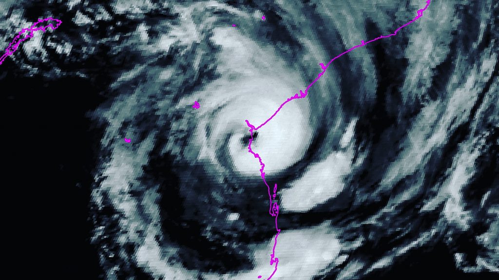
(Image provided by our image manager, Isaac G.)
After landfall on Madagascar, the core has disintegrated and struggled due to land interaction and subducting air from the easterly leeward wind that Eloise created by itself, which created some dry airmass and intruded to its center. But by time, it gained the advantage of over 30C sea surface temperature and low wind shear and reorganized, and rolled a large eye early on 22nd. The intensification trend continued under favourable environment still as it kept moving WSW, parallel to the coast of Sofala, when the spiral bands was sweeping there too. A ragged but clear eye came up after several convective bursts, and Dvorak T number reached 4.5 to 5 at that point. Near midnight UTC, its eye temperature rose to near 20C, with strongest SE side at the dangerous semicircle, it can be seen that Eloise had gone further to category 2 in SSHS. At 23:00UTC, Beira Airport reported a mean-sea-level pressure (MSLP) of 974mb around 36km from Eloise, which means after extrapolation, the central pressure estimation of Eloise lies at high 960s range, as well as Beira is within the radius of maximum winds of it. At 04:00EAT, it made landfall on Buzi district with winds of 105mph and a pressure of 968mb, based of the ground observations and satellite estimations, according to JTWC best track and Force Thirteen operational analysis.
Current Storm Information, Forecast Track
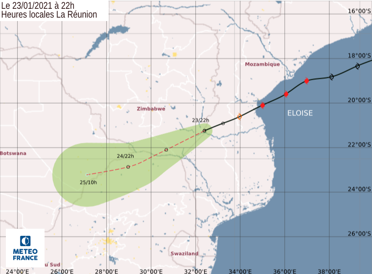
As of 18:00UTC (21:00EAT) January 23rd, according to the latest ATCF, it was located at 21.3S 32.5E with maximum 1-minute sustain winds of 50mph and a pressure of 993mb.
While at the same time, according to MFR estimate, Eloise was located at 21.2S 32.4E, with a significantly lower winds of 45km/h 10-min sustain and gusts over 65km/h, as well as a pressure of 990mb, moving WSW at 17km/h.
Notwithstanding a landfall happened, Eloise maintained a decent structure still. 5 hours after landfall, MHS METOP-B polar satellite stated that a microwave was still discernable. That was likely due to rather low relief and very moisture mid-level relative humidity of air that slowed down the weakening rate. But as it continues to move west-southwestward to Zimbabwe, the terrain level rises drastically which gives much higher frictional force to Eloise. The convection right now is deteriorating quickly although clear circulation is still there. It is expected to continue weakening and dissipate on the next day or two.
Preparations and Impact to Mozambique
Beira has bashed by several intense cyclones like Idai and Kenneth in 2019, and currently Beira is still recovering from Chalane, and now another intense cyclone, Eloise, arrived. Before the arrival, the International Organization for Migration (IOM) and other more humanitarian organizations like World Food Programme and UN Children’s Fund helped working with the local communities to prepare the arrival of Eloise. They displaced residents under main affecting or flood-prone region to accommodation centers and schools, as well as provided food, hygiene kits and COVID-19 prevention materials to them, with over 3000 people in Buzi District followed.
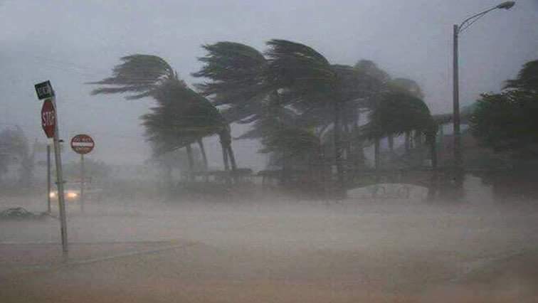
As expected, Eloise brought torrential rain and dangerous winds to Sofala Province as the bands brushed along the coast and the core slammed Beira and Buzi District. There’s already 100,000 people remain in resettlement sites since the annihilation by cyclone Idai 2019, which also have been battered by the recent rains. Eloise clearly is yet another stumbling block to their recovery of their homes and even own safety. It brought catastrophic flooding to the coast of Sofala as of over 200mm of rainfall dumped and the major impact areas are floodplains at the lower course of river, which is vulnerable to flooding. What’s more, over 19,000 people was affected by heavy rainfall and the discharge of water from the Chicamba dam and the Mavuzi reservoir, both in west Beira. So far 4 people died due to this cyclone, and the death toll will probably increase still as the floodwater falls and more searching jobs can be conducted. Besides, with over 160km/h winds bashing, the some roof of buildings has been blown away and power lines network collapsed, causing likely a power outage in the city.
Please stay safe under poor conditions and remain cautious as potential danger still exists after a storm’s passing through and listen to the latest information from officials and the assisting organizations.
Elsewhere in the tropics, 14S has dissipated after making landfall east of Port Hedland as a tropical storm, and 13S still persists in open southeast Indian Ocean and is forecasted to remain as a mere tropical storm and stay in open sea.

Mass destruction has already been seen from this storm. Hope everyone there is safe!