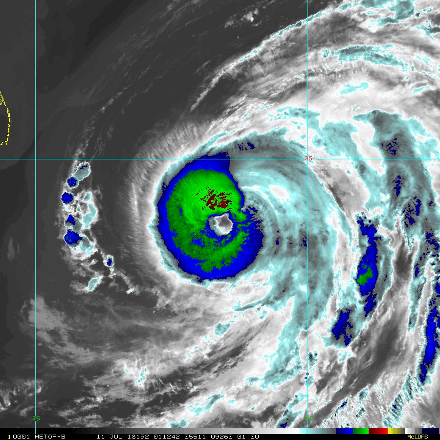
Hurricane Gert vs Hurricane Chris – which was stronger?

Clearly the answer is Hurricane Gert.
Some speculation this week emerged that Chris looked like a Category 3 hurricane, just as Force Thirteen’s analysis of last year’s Hurricane Gert rated it at a similar intensity. But what are the differences, and how do they compare?
Well, firstly, both storms began much differently to each other. Gert began in the tropical Atlantic and drifted towards the northwest, slowly but gradually developing as it approached the Eastern Seaboard of the United States in August 2017. Gert was named, stalled a little, and then shot up the piping hot Gulf Stream one month before the typical peak in water temperatures in the basin.
Chris, therefore, had a disadvantage from the start. The sea surface temperatures still needed more time to get up to speed with the warm temperatures, and an abrupt temperature fall awaited him off the coast of Atlantic Canada.
Chris first developed pretty nicely although its slow movement eventually became an issue with upwelling of the seas. However, when it started to move out towards the east, intensification ensued and for a time, Chris certainly looked the part.

Eye temperatures reached positive temperatures, up to around +12 degrees Celsius in the end and a flourishing eyewall, but it didn’t last for very long. The eye began to become lopsided, lost temperature, and struggled into July 11th. Chris had another go, but didn’t quite reach the heights of its first peak.
The National Hurricane Center gave Chris a peak of 105mph, and this seems fair.

So this is what Chris looked like at 105mph. Below is Gert at its peak intensity, which Force Thirteen estimates to be at 115mph.

The cloud tops are beyond dispute, clearly. The pertinent question is, how about the eye? Was Gert’s eye good enough for major status? I think, given the eyewall it had compared to Chris, yes it was. Barely.
