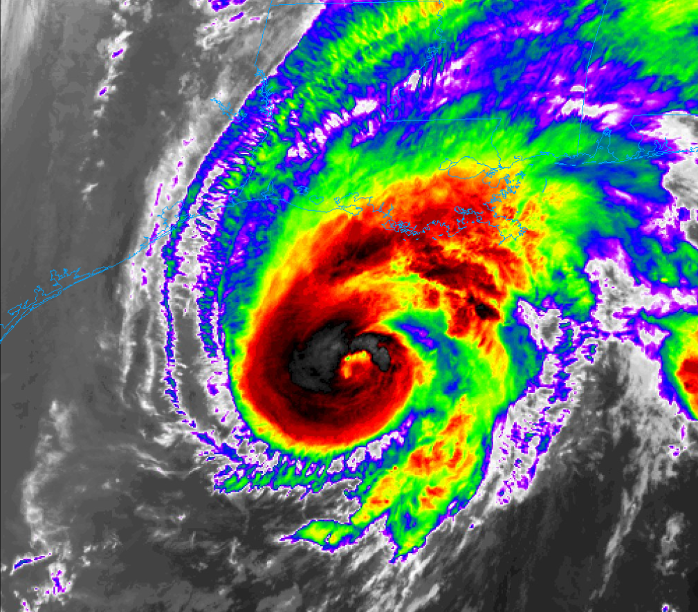
Hurricane Zeta: Significant Landfall in Louisiana Today

Hurricane Zeta has organized overnight and quickly intensified into a powerful category 1 hurricane with further strengthening possible up until landfall. Little time remains to protect life and property ahead of the storm as this storm will be severe at landfall.
Current Information

Hurricane Zeta is located at 26.9N 91.7W or about 220 miles South of the mouth of the Mississippi River or 235 miles South of New Orleans, Louisiana moving North at 18mph. Maximum sustained winds have increased overnight to 90mph making the storm a high end Category 1 hurricane with a window remaining open to become a Category 2 hurricane. The pressure had also continued to fall and is down to 976 millibars. Hurricane Warnings remain in effect for a large swatch of the coast, stretching from Morgan City, LA to the MS/AL border including Lakes Pontchartrain and Maurepas as well as New Orleans Metro. A Tropical Storm Warning is also in effect from the MS/AL border to the Walton/Bay County Line in Florida. A Storm Surge Warning is in effect as well from the Mouth of the Atchafalaya River to Navarre, Florida including Lakes Borgne and Pontchartrain and well as Mobile Bay and Pensacola Bay. Conditions here are expected to rapidly deteriorate over the next few hours ahead of the storm.
Overall Threat to Land

Even though this is a Category 1 Hurricane with the potential of being a Category 2, this storm is expected to be very powerful upon landfall. Tropical Storm Conditions are expected to arrive by 2pm this afternoon with hurricane conditions shortly after that. The storms influence will stretch over a far area with areas from Western Louisiana to the Florida Panhandle having the chance of getting impacts from this storm. The current National Hurricane Center (NHC) cone has the storm passing over New Orleans by about 7pm tonight which will cause particularly significant impacts there. As this storm is picked up by a short wave, it will accelerate Northward very quickly and spread Hurricane and Tropical Storm conditions far inland from the coast, potentially as far as the Appalachian Mountains in North Carolina and Virginia. This will cause significant tree damage and power outages that may last several days in the aftermath of the storm. Structural damage can also occur from the storm, including some roof failure and Outer wall and window damage. A Significant and Life-Threatening storm surge will occur with this storm as well, which could be as high as 9′ along the Mississippi and Western Alabama Coast which will cause major costal flooding and structural damage to buildings along the coast. 5-8′ of storm surge is possible along the Southwestern coast of Louisiana which will cause significant inundation with waters potentially spreading over 20 miles inland. Overtopping of levees is possible in this region and persons in this region should pay attention to local officials and be prepared to take action if told to do so. heavy rain is expected along and inland from the coast, with 2-4″ of rain with isolated amounts of 6″ possible. This will cause scattered flash floods in urban areas and large rises on small creeks and streams along with rivers. A tornado or two cannot be ruled out as a Slight Risk for severe weather is in effect for mainly the Alabama-Florida Panhandle region. Any tornado that touches down will be able to cause additional damage along with the storm. Please consult official information from the National Hurricane Center and National Weather Service for official information and listen to local authorities for what actions to take.
Remember: just because a hurricane is a category 1 or 2 doesn’t mean it can’t cause major damage! All preparations must be completed by this early afternoon and be prepared to action when told to do so.
Once Tropical Storm force winds onset, do not venture outside and do not venture into the eye!
