Invest 92L Forms In the Tropical Atlantic with Potential for Impacts

An invest has formed over the Main Development Region (MDR), located in the deep tropics of the North Atlantic. With a high chance of development according to the National Hurricane Center (NHC), the invest in the form of a broad tropical wave is likely to form into a tropical cyclone within the next few days and could go on to impact the Lesser Antilles, Leeward Islands and Greater Antilles as a long range threat a short distance beyond the 5-day forecast.
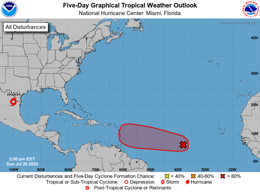
Invest 92L currently has a high chance of formation overall, with a 60% chance of such events in the next 48 hours and a higher 90% chance to form in the next 5-days. Current model consensus is split as to whether or not 92L travels into the Caribbean Sea or goes north of the Greater Antilles. This will become more clear throughout the next couple days and is heavily dependent on when and where 92L’s center fix forms when/if it is found a tropical cyclone.
No reconnaissance flights are scheduled and no real immediate danger is presented from the system at current, but that could change going forward. Interests in both of the Antilles as well as the Leeward Islands should likely monitor the progress of 92L.
For further information, refer to your local meteorological office. Force Thirteen is also providing further updates on 92L and other storms around the world through their facebook, twitter and youtube platforms.
