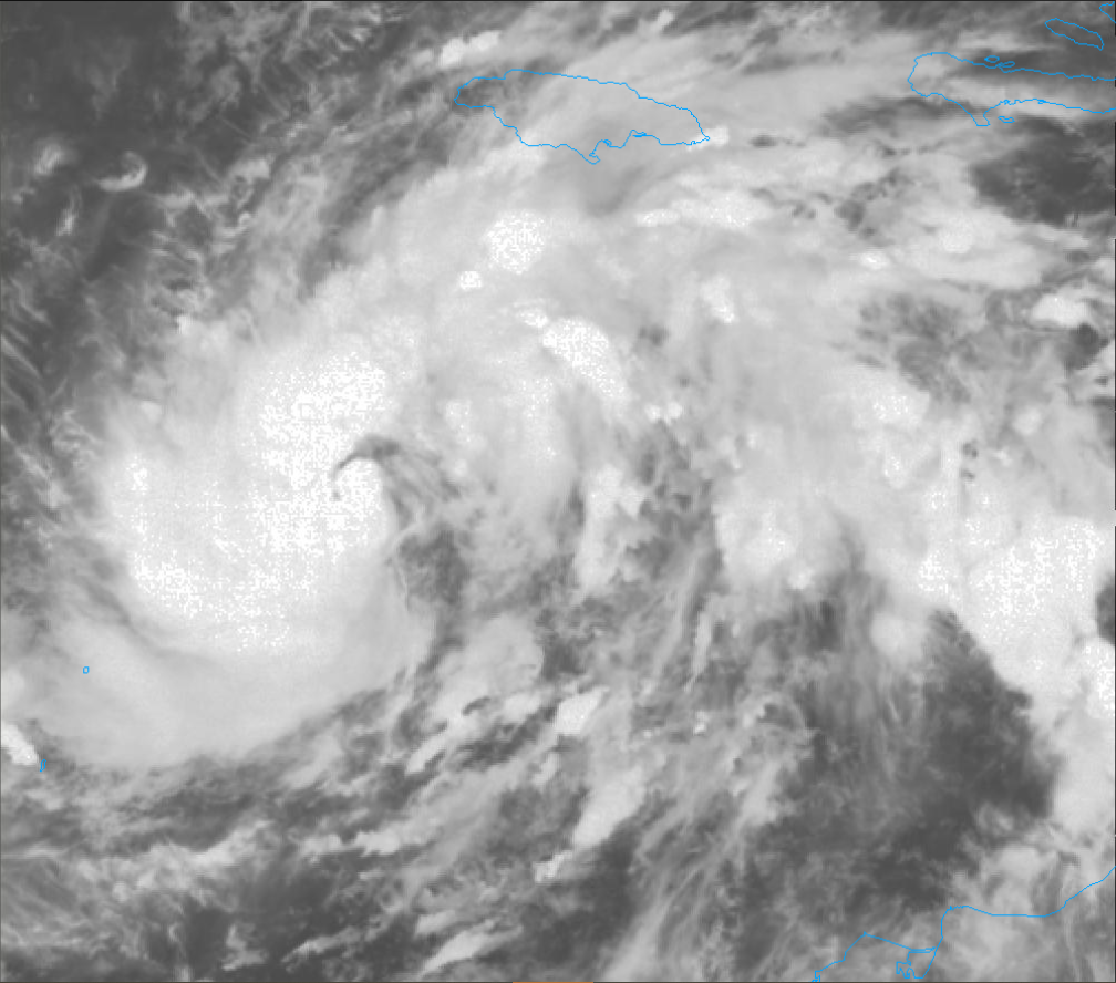
Newly Formed Tropical Storm Eta Rapidly Strengthens in the Caribbean, sets Eyes on Honduras and Nicaragua

Tropical Storm Eta is currently rapidly intensifying in the Caribbean and confidence is high that it will make a major landfall in Nicaragua Tuesday Morning. Preparations in this area should be rushed to completion in this area as catastrophic impacts are likely from this storm.
Current Information

The storm is currently located at 14.7 North 78.9 West or about 285 miles (460km) East of Cabo Gracias A Dios on the Nicaragua/Honduras border or about 305 miles East-Northeast of Puerto Cabezas, Nicaragua moving West at 15mph (24kph). Maximum Sustained winds are at 65mph (100kph) and the pressure is rapidly falling and now down to 992 millibars (29.30in. Hg). A Hurricane Warning remains in effect for the Honduras/Nicaragua border to Sandy Bay Sirpi, Nicaragua while a Tropical Storm Warning and Hurricane Watch remain in effect for Punta Patuca, Honduras to the Honduras/Nicaragua border. Meanwhile a Tropical Storm Watch has been issued for Punta Patuca to Punta Castilla, Honduras.
Current Forecast

Tropical Storm Eta is steadily moving across the warm waters of the Caribbean and is continuing to get better organized while doing so. With this in mind the environment favors a rapid intensification up until landfall with the National Hurricane Center (NHC) calling for a 110mph Category 2 peak but a major Category 3 landfall can’t be ruled out. After this the storm is expected to stall over the area for the next 72 hours and weaken significantly. Past the 3 day mark there is low model congruency with some taking the storm into the Eastern Pacific while some send it back into the Western Caribbean and intensify it again. The NHC has gone in the middle of this and calls for the storm to continue to slowly move over the area for the 4 & 5 day forecast.
Overall Threat to Land
Tropical Storm Eta will be accompanied by devastating impacts including life threatening storm surge, flooding rains and hurricane winds. When the storm makes landfall, an incredible 10-15ft. storm surge is expected which will create a large amount of coastal flooding which will spread well inland from the coast. Persons in this area should take the necessary precautions and should prepare to evacuate when told to do so as this surge will be very destructive when it arrives. This is on top of major hurricane winds which will cause severe wind damage to homes and buildings. Windows will blow out, siding will be peeled off and severe roof damage will occur. Rainfall, however, will be by far the main threat. A life-threatening 35in. (890mm) of rain is expected from this storm over Nicaragua and Honduras with 20in. (510mm) of rain expected in Costa Rica and Panama and 25in. (635mm) expected in Guatemala and Belize. This will create prime conditions for significant flash flooding in urban areas, large amounts of river flooding and landslides in the mountainous region which will cause catastrophic impacts to communities impacted by the storm. Here this warning now: Persons in this region should immediately begin taking the necessary precautions ahead of the storm as this storm will be severe and will be intense at landfall. Relief will not be able to arrive for several days-potentially weeks-after the storm as roads and bridges will be washed out by the heavy rain and mudslides. Do not try to ride out the storm, unless you are prepared with the necessities needed to ride out a storms aftermath for several days with no foreign relief, that is if you make it out of the storm alive.
