Cyclone Biparjoy set to become a Major Cyclone; No threat at present
Cyclone Biparjoy, the 2nd named storm of the 2023 North Indian Ocean Cyclone Season, continues to move northwards in the Arabian Sea with no initial threat of landfall at present and the remainder of the week.
Current Information –
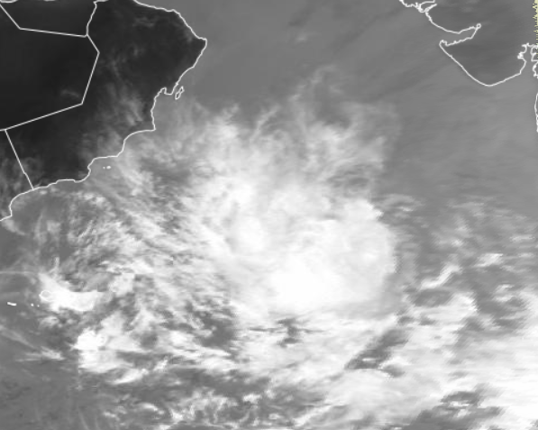
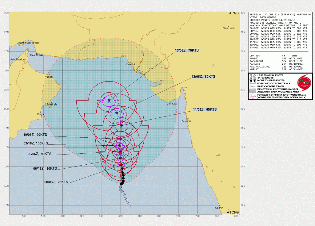
According to the Indian Meteorological Department’s (IMD) 11:30 AM IST (6AM UTC) update, Very Severe Cyclonic Storm “Biparjoy” is located at 14.1°N, 66°E. The storm continues to move at a very safe distance from the Indian Coast and is approximately 800 km from Honnavar, Karnataka state of India. Very Severe Cyclone Biparjoy has 3 minutes sustained winds equivalent to 90 mph (75 Kts/140 Kph) gusting up to 100 mph (85 Kts/160 Kph) and a minimal center pressure of 978 millibars. The system is currently moving Northward with a speed of 3 mph (2 Kts/4 Kph.) The Force Thirteen Cyclone Analyst team has analyzed the system a bit higher with 1 minute sustained winds equivalent to 95 mph (80 Kts/150 Kph) and a minimal central pressure of 973 mb based on the satellite appearance.
In Depth Look –
Cyclone Biparjoy is currently located in a marginal favorable region for intensification as the easterly shear continues to erode the system, exposing the LLC partially. Analysis of model soundings shows Biparjoy will continue to remain in moderate easterly shear imparted due to the presence of a weak ULAC to its NE. But in 24 hours as it moves northwards it will align with the shear vector, opening a short window for a brief intensification in about a day combined with very warm SST.
At the time of this article posting, the Indian Meteorological Department (IMD) had forecast a peak of 95 mph (80 Kts/150 Kph) while Joint Typhoon Warning Center forecasted a peak of 115 mph (100 Kts/185 Kph.) After the peak, Biparjoy is expected to encounter unfavorable conditions. A sea of dry air, moderate to high shear, relatively colder SST, and decreased outflow will weaken the system steadily. There’s a large diversity of its future track by models making a big cone of uncertainty from Gujarat to Oman. However, the possibility remains that Biparjoy will move Northwest under the influence of the Subtropical Ridge to its east, heading toward Oman, Iran or the Makaran Coast although unlikely.
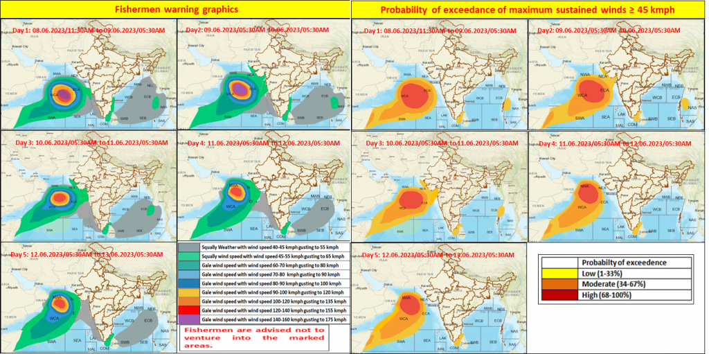
Fishermen & Port Warning –
As the Cyclone will intensify further into the deep sea, it’ll produce high swells into the sea with hurricane force winds. In wake of that The India Meteorological Department advised fishermen not to venture out into the Sea and terminate fishing activities in the deep sea.