Cyclone Darian a Strong Category 4 Storm – Tropical Weather Bulletin – December 21, 2022
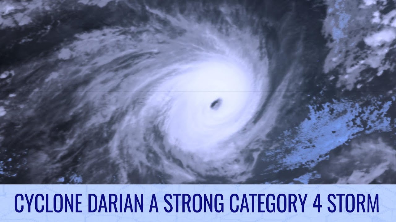
Cyclone Darian rapidly intensified beyond yesterday’s forecasts, and appears to have reached a peak intensity with winds of 150mph and a pressure estimate of 926mb, far out to sea over the Indian Ocean. Further strengthening is possible as it turns westwards this morning, and is set to continue on a near due west path for at least the next 48 hours. Already a Category 5 on the Australian scale, the storm’s winds render it a Category 4 on the Saffir Simpson Scale, and there is a chance that the storm could become a Category 5 on this scale too in the next few days.
Eventually, the storm will start to steer southwards and should remain a safe distance away from the Mascarene islands as it passes around Christmas, continuing southwestwards and then recurving by New Years, where it will turn extratropical.
Elsewhere, an area of interest is gathering momentum near East Timor, and has a 40% chance of development. Whilst the GFS is rather keen on development, other models remain cautious, however all of them show a disturbance that could potentially become a tropical cyclone. The system is expected to make landfall on Christmas Eve near Wadeye, in the Northern Territory.
In the Bay of Bengal, an area of interest that we were monitoring for most of last week has re-emerged, and has a 30% chance of development as it meanders around the region and eventually reaches Sri Lanka next week.
Watch our full Tropical Weather Bulletin using this link: https://www.youtube.com/watch?v=IkFVjN_2J1E
