Cyclone Gabrielle continues intensifying as it heads towards New Zealand; watches issued
Tropical Cyclone Gabrielle is continuing to intensify as it moves southeast, and is becoming another rainfall threat for New Zealand’s North Island, which already experienced devastating effects from the remnants of Cyclone Hale and Tropical Depression 06F.
Current Information
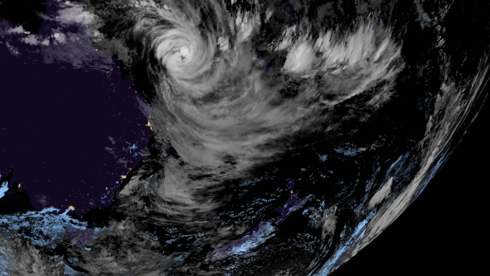
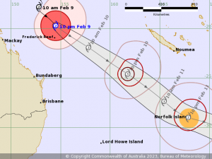
As of 10:00 pm AEST, Tropical Cyclone Gabrielle is located near 19.7 degrees south, 154.5 degrees east, or 140 kilometers (76 nautical miles) north of Frederick Reef. Force Thirteen currently has the storm as a Category 1 tropical cyclone in the Saffir-Simpson scale, with 1-minute winds of 130 km/h (80 mph) and a central pressure of 972 millibars. The Bureau of Meteorology has Gabrielle with 10-minute winds of 110 km/h (70 mph), with the pressure aligning to F13’s estimate. It is currently moving southeast, at 23 km/h (14 mph).
Current Warnings
The Bureau of Meteorology has issued a Tropical Cyclone Watch for:
- Norfolk Island.
The MetService of New Zealand has issued a Heavy Rain Watch for:
- Northland and Auckland north of Whangaparaoa; and
- the Coromandel Peninsula.
Additionally, the agency has also issued a Strong Wind Watch for:
- the aforementioned areas; and
- Auckland south of Whangaparaoa.
The MetService notes that these watches may be upgraded to orange or possibly red warnings as Gabrielle moves near the country.
What to Expect?
As the storm approaches Norfolk Island on Saturday local time, gale-force winds with higher gusts are expected to develop over the island, and the wind may become destructive as it moves over the region. Heavy rain is also expected, as well as abnormally high tides and very heavy surf which may lead to localised damage and coastal erosion.
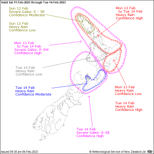
As it undergoes subtropical transition (as forecast by the JTWC), the cyclone’s gale-force wind radii should expand as it approaches New Zealand. The MetService expects 50mm or more rainfall to drop over Northland, Auckland, Coromandel Peninsula, northern and eastern Waikato, Bay of Plenty and northern Gisborne from Monday to Tuesday. Severe gale-force winds are expected to affect northern and central parts of the North Island, from Northland southwards to the central high country and Hawke’s Bay, along with very large waves and storm surge at the northern and eastern coastlines from Northland to Gisborne by Monday.
We hope you are preparing for the storm if you are in Norfolk Island or New Zealand, and listening to your local officials on what to do before the cyclone affects your area. We will keep you updated on the cyclone as it intensifies.
