Cyclone Jasper a looming threat to northeast Australia
Cyclone Jasper has weakened greatly from its peak intensity of a Category 4-equivalent cyclone yesterday, but it still remains a threat to north Queensland and potentially the Northern Territory.
Current information
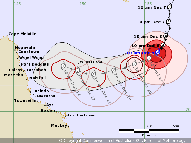
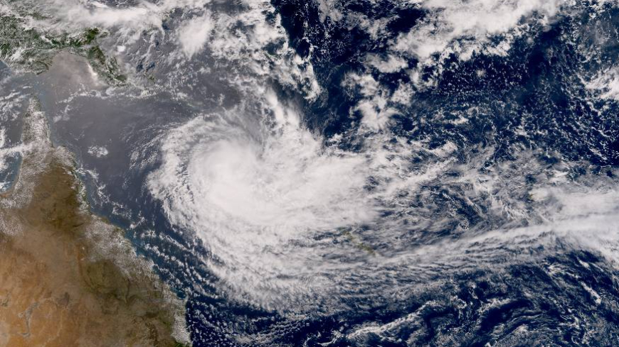
As of 10:00 AEST (00:00 UTC), Cyclone Jasper is located near 15.4 degrees south, 156.0 degrees east, or about 1,110 kilometres (690 mi) to the east of Cairns in Queensland, Australia. The Australian Bureau of Meteorology (BoM) estimated the system to have 10-minute sustained winds of 175 km/h (110 mph), thus a category 4 severe tropical cyclone, with gusts up to 250 km/h (155 mph), and a central pressure of 950 millibars. Meanwhile, the Joint Typhoon Warning Center (JTWC) has Jasper with 1-minute sustained winds of 165 km/h (105 mph), being a Category 2-equivalent cyclone on the Saffir-Simpson scale, with a central pressure of 964 millibars. Both wind estimates are supported by current Dvorak estimates. Jasper is currently moving fairly slow to the southwest at 6 km/h (4 mph).
Current warnings
There are no current warnings for the system. However, this may change as Jasper continues to move towards Queensland.
Current forecast

With Jasper having dry air mixed within itself, causing its eye that was present yesterday to collapse, in combination with increasing wind shear, the system is forecast by both the BoM and JTWC to continue weaken as it continues south under the influence of a weak mid-level ridge to the east and southeast. By late Saturday leading to Sunday, a stronger ridge is expected to take command of Jasper’s movement and go west towards Queensland. On Tuesday, the wind shear is forecast to ease, leading to a potential reintensification to a strong tropical cyclone, before making landfall between Cape Melville and Townsville on Wednesday or Thursday. In the much longer term, some model guidance has Jasper surviving the landfall and redeveloping in the Gulf of Carpentaria, near the Northern Territory.
Jasper is the first tropical cyclone to reach Category 4+ severe tropical cyclone status in the month of December since Cyclone Laurence of 2009, which went on to affect western Australia. However, the extent of its future impacts remain uncertain, so be sure to check out your local meteorological office for the latest forecasts for the system. Also, tune in to our 24/7 automated stream and our regional channel in Australia for the latest updates as this storm progresses.

