Cyclone Mocha continues intensification, threatens Myanmar and Bangladesh
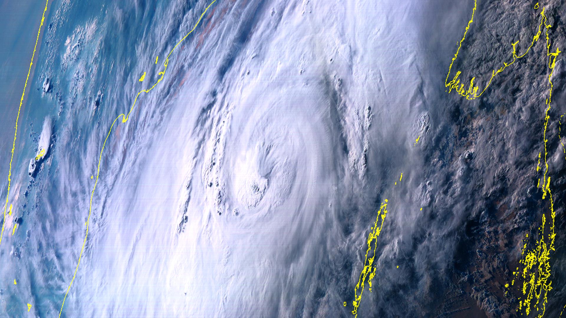
Cyclone Mocha has continued intensifying and is now a Category 2-equivalent cyclone, as Myanmar and Bangladesh prepare for the storm, with landfall expected in a few days.
Current Information

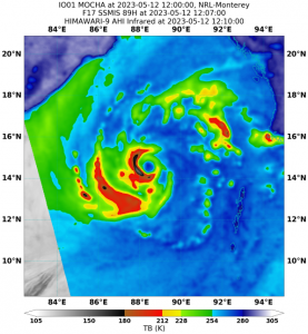
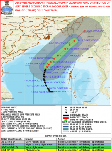
As of 12:00 UTC (5:30 pm IST), Mocha is currently located near 14.6 degrees north, 88.6 degrees east, or about 550 km northwest of Port Blair, or about 760 km southwest of Sittwe, Myanmar. The Indian Meteorological Department (IMD) has Mocha with 3-minute sustained winds of 150 kph (90 mph) with gusts up to 165 kph (100 mph), and a central pressure of 972 millibars. The Joint Typhoon Warning Center (JTWC) estimated Mocha to have 1-minute sustained winds of 105 mph (170 kph) with a central pressure of 966 millibars. The storm is currently moving north-northeastwards at 8 mph (13 kph).
Force Thirteen has analyzed Mocha to have 1-minute winds of 110 mph (180 kph) given its improving structure in microwave and infrared imagery.
Current Forecast

Mocha is forecast to continue its rapid intensification while moving northeast under a subtropical ridge, before landing near the Bangladesh-Myanmar border by Sunday noon. The IMD expects Mocha to peak as an Extremely Severe Cyclonic Storm tomorrow, with 3-minute sustained winds of 185 kph (115 mph), while the JTWC has the system peaking as a Category 4-equivalent cyclone in the Saffir-Simpson scale, with 1-minute winds of 220 kph (140 mph). The exact strength of the cyclone at landfall remains undetermined, with IMD forecasting a 160 kph (100 mph) landfall, whilst the JTWC has a 195 kph (120 mph) landfall.
Current Warnings
The Department of Meteorology and Hydrology in Myanmar warned that maximum winds may reach 100-110 mph in Rakhine State and 40-60 mph in Naypyitaw, Lower Sagaing, Mandalay, Magway, Bago, Yangon, Ayeyarwady Regions and Chin State during tonight to Monday.
The Bangladesh Meteorological Department has hoisted Local Warning Signal No. 4 at maritime ports in Chattogram, Cox’s Bazar, Mongla and Payra.
The IMD has issued wind warnings to Tripura, Mizoram & South Manipur, with winds of 60 kph and gusts up to 70 kph prevailing over the area until Sunday. Rainfall warnings are also in effect for the areas including Nagaland, Manipur & south Assam, with heavy rainfall expected until Sunday.
Storm surge of 2-2.5 meters above astronomical tide are likely to inundate low-lying coastal areas of Myanmar and adjoining southeast Bangladesh by Sunday’s expected landfall.
Fishermen, ships, boats and trawlers are advised not to venture into the northeast Bay of Bengal until Sunday when the storm makes landfall.
Preparations
According to the United Nations (UN) Refugee Agency in Bangladesh, emergency preparations in the camps & on Bhasan Char are undergoing as Mocha approaches the country. It also stated that the Government has hosted coordination meetings with humanitarian partners to respond efficiently with the aftermath of the cyclone.
In Myanmar, humanitarian organizations, especially in Rakhine, have ramped up their preparedness efforts and have been pre-positioning personnel and supplies wherever possible, with preparedness being stepped up in the Northwest, according to the UN Office for the Coordination of Human Affairs (OCHA). With the Myanmar humanitarian Emergency Response Preparedness Plan already being activated nationwide since the start of the week, evacuation advice has also been issued by local authorities in Rakhine for low-lying and coastal areas in Sittwe, Pauktaw, Myebon, Maungdaw and Buthidaung with many people already starting to move ahead of the storm.
“Across Rakhine and the Northwest, there are already about six million people in need of humanitarian assistance and 1.2 million people displaced, even before the cyclone hits,” the office said.
This region hasn’t experienced a major cyclone landfall since Cyclone Giri in 2010. With the system continuing its intensification on its way to land, it is advised to keep updated with your local officials and evacuate if ordered to. Stay tuned to us at Force Thirteen as we continue to cover this storm.

