Warnings issued as Cyclone Jasper nears Queensland
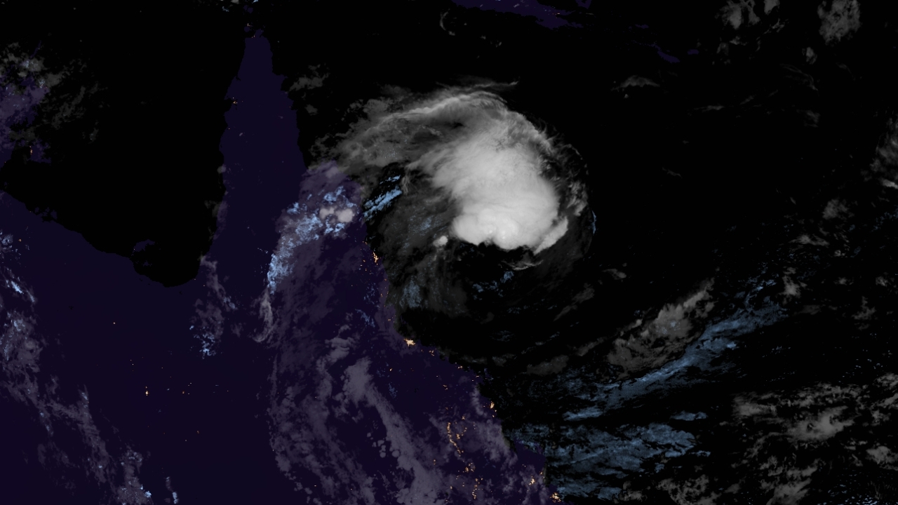
Cyclone Jasper has started to develop convection after getting exposed by a combination of dry air and strong wind shear, as it nears the Australian state of Queensland, where cyclone watches and warnings are in effect.
Current information
As of 22:00 AEST (12:00 UTC), Cyclone Jasper is located near 17.0 degrees south, and 148.9 degrees east, or about 335 kilometres to the east of Cairns and northeast of Townsville, in Queensland. It is currently moving west-southwest at 17 kph (10 mph).
The Australian Bureau of Meteorology (BoM) have estimated Jasper to have 10-minute sustained winds of 85 kph (50 mph), thus a Category 1 on the Australian scale, with gusts up to 120 kph (65 mph), and a central pressure of 992 millibars. The Joint Typhoon Warning Center (JTWC) has Jasper with 1-minute sustained winds of 85 kph (50 mph), with a central pressure of 994 millibars. Both estimates are based on surface observations, since Dvorak estimates have been low due to the system lacking deep convection.
Jasper continues to be entrained by dry air, hence the lack of convection to most of its structure. However, it is moving to an area of lower wind shear, and remains over warm sea surface temperatures.
Current warnings
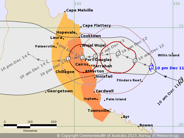
According to the BoM’s Tropical Cyclone Advice, a Cyclone Warning is in effect for Cooktown to Townsville (but not including Townsville), including Cairns, Innisfail, and Palm Island. A Cyclone Watch is also in effect for Cape Melville to Cooktown, extending inland to include Palmerville and Chillagoe.
A Flood Watch is also in effect for the North Tropical Coast, parts of the Cape York Peninsula and Gulf Country, along with a Severe Weather Warning for damaging gusts associated to the cyclone to parts of Herbert and Lower Burdekin and Central Coast and Whitsundays Forecast Districts.
Current forecast
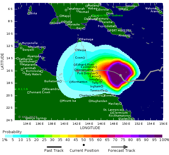
With Jasper moving over more favorable conditions, both the BoM and JTWC forecast some reintensification, as it continues west-northwest under the influence of a ridge to its south, before it crosses the Cape York Peninsula by Wednesday, between Cooktown and Innisfail. The BoM is expecting a Category 2 system at landfall, but pointed out that if it moves slower than forecast, there is a slim chance of a Category 3 severe tropical cyclone striking land. After that, the JTWC forecasts the system to dissipate inland by Thursday, although model guidance has the system emerging from land and into the Gulf of Carpentaria, where the BoM has said it is likely that the system will regenerate there.
Current hazards
Damaging wind gusts of over 90 km/h are expected to develop along the Queensland coast and adjacent ranges between Cooktown and Townsville, including Cairns, from Tuesday. These damaging wind gusts are expected to extend inland to Palmerville and Chillagoe after the cyclone has crossed the coast on Wednesday. Damaging wind gusts may extend as far north as Cape Melville on Wednesday, depending on the movement of Jasper.
- Heavy rainfall which may lead to flash flooding is forecast to develop from early Wednesday morning between Cape Flattery and Ingham. Six-hourly totals between 100–150mm are likely, with isolated falls of 250mm possible along the coast and adjacent ranges. 24-hourly rainfall totals between 150–250mm are likely, with isolated falls up to 350mm possible.
- As the cyclone approaches the coast, a storm tide is expected between Cooktown and Townsville on Tuesday and by Wednesday high tides. Large waves may produce minor flooding along the foreshore.
As the system continues towards Queensland, preparations should be completed as soon as possible. Listen to your local officials for the latest updates, and evacuate if necessary. Stay tuned to your local weather office and to us as the system progresses. Our Australian regional branch continues to make updates for this system, along with our main 24/7 automated stream which you can tune in here.
