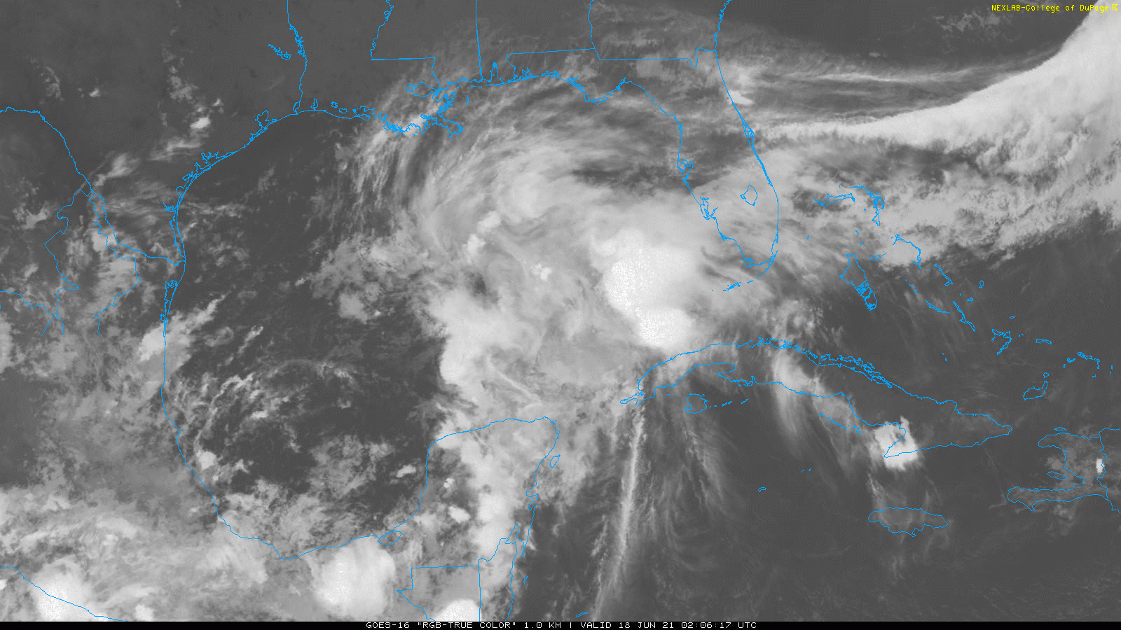
Potential Tropical Cyclone 3 Continues to Organize in the Gulf of Mexico, Expected to Deliver Heavy Rain to the Gulf Coast in the Coming Days

The National Hurricane Center has designated Potential Tropical Cyclone 3 in the Gulf of Mexico with a 90% chance of becoming a tropical or subtropical system in the next 2 days. Although it isn’t expected to be particularly strong as it heads for the Northern Gulf Coast, very heavy rain is expected which will cause life-threatening flash flooding in the area. Persons ahead of this storm should begin their preparations as this storm will be dangerous when it arrives.
Current Information
Potential Tropical Cyclone (PTC) 3 is currently located at 22.9N 92.4W which is about 479 miles (765km) south of Morgan City, Louisiana. According to satellite estimates the storm and a reconnaissance mission, it currently has 35mph (55kph) winds and a pressure of 1008mb (29.74inHg). The storms center is currently exposed and very broad with most of the showers and thunderstorms to the east of it stretching from the Mississippi Delta to Belize signaling this storm will likely be subtropical upon landfall. The storm is officially a tropical disturbance and labeled 03L but it does have a 90% chance of becoming a tropical or subtropical storm in the next 2 days so the National Hurricane Center has begun issuing advisories for this storm as it could make landfall in less than 2 days. It is currently moving north at 9mph (15kph) and is expected to come ashore in Louisiana in the early morning of Saturday. When it does make landfall, the storm will bring very heavy rain as it turns from due north to more northeast. It will then spread more rain to other southeast states before dissipating over North Carolina Sunday afternoon. With landfall about 36 hours away, Tropical Storm Warnings are also in effect for Intracoastal City, Louisiana to the Alabama/Florida Border including Lake Pontchartrain and Lake Maurepas.
Impacts![[Image of WPC QPF U.S. rainfall potential]](https://www.nhc.noaa.gov/storm_graphics/AT03/refresh/AL0321WPCQPF+gif/233901WPCQPF_sm.gif)
As all tropical systems go, there will be multiple hazards with this, although most will be pretty minimal. Winds are expected to be around 45mph (72kph) which can break branches of trees and also do light damage to roofs. Storm surge is expected to be up to 3ft. (0.9m) in areas from Intracoastal City, LA to the AL/FL border which will cause significant flooding in low lying areas during high tide. Isolated tornadoes will also be a threat with this storm along the coast on Friday and further inland on Saturday which could cause moderate damage to areas they effect. However, the main threat will be the rainfall. The Weather Prediction Center has put areas of Southeastern Louisiana, Southern Mississippi and Alabama, and Western Florida under a Moderate Risk for flooding meaning numerous flash floods are likely in the region. Widespread totals of 4-8″ are expected in this region, though totals could be as high as a foot in isolated areas. This will cause life-threatening flooding in urban areas and significant rises on creek and rivers which will cause flooding well after the storm has passed. Further northeast over Alabama and Georgia, totals up to 4″ can be expected which can also cause significant rises on small streams and also major flooding in flood prone areas. If flooding occurs, do not drive on flooded roads or go outside and instead move to a higher area immediately. It only takes a few inches of moving water to knock an adult off their feet and only 6″ of standing water for one to lose control of their vehicle. Remember: Turn around, don’t drown.
This is a very dangerous situation in the upcoming days. Stay up to date to your local weather authorities, National Weather Service and National Hurricane Center. Also make sure to Follow Force Thirteen on Facebook, Twitter and YouTube for the latest updates on this system. Be prepared for its arrival and most importantly, be safe.
