Major Hurricane Irene: A Decade Later

Today marks 10 years since Hurricane Irene struck Cape Lookout, North Carolina, causing 49 direct deaths and spawned several tornadoes prior to landfall.
Storm Synopsis
On August 15th, 2011 a tropical wave exited the west coast of Africa accompanied by a large area of clouds and thunderstorms.
The wave would soon become a tropical storm and eventually a hurricane, bringing severe impacts along the US East Coast.
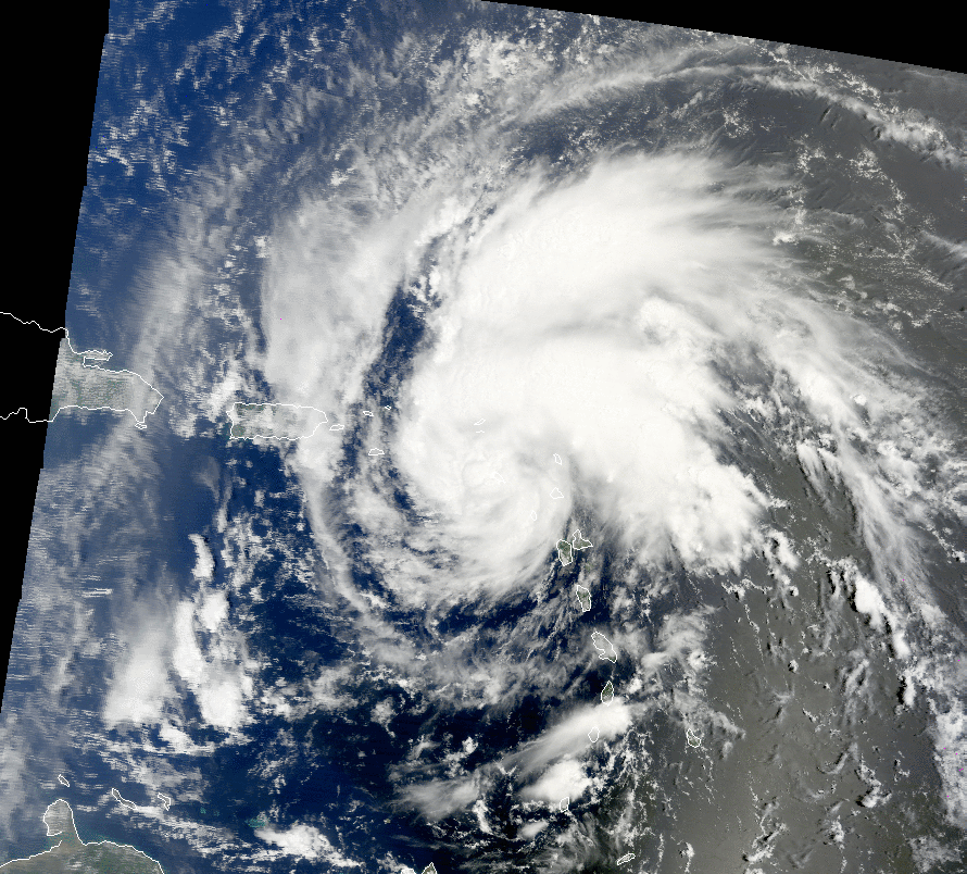
(Credit: NASA/MODIS)
The storm’s convection diminished passing south of the Cabo Verde Islands the next day, but it maintained its mid-level circulation.
Thunderstorm activity regenerated as it continued to move westward across the tropical Atlantic and became organized halfway between the Lesser Antilles and west coast of Africa.
A reconnaissance aircraft investigated the system on the 20th, finding surface winds of 45 to 50mph but without a well-defined low-level circulation.
Just before the conclusion of the mission, the aircraft was able to isolate a circulation in the southern edge of the convection, prompting the designation as Tropical Storm Irene in the evening of the 20th.
Throughout the 21st, as it moved west-northwest across the extreme northeast Caribbean Sea, it continued to gain strength as the circulation became larger.
It then made a landfall over St. Croix the evening of that day and over Punta Santiago, Puerto Rico early into the next day.
It became a hurricane shortly after the Puerto Rico landfall.
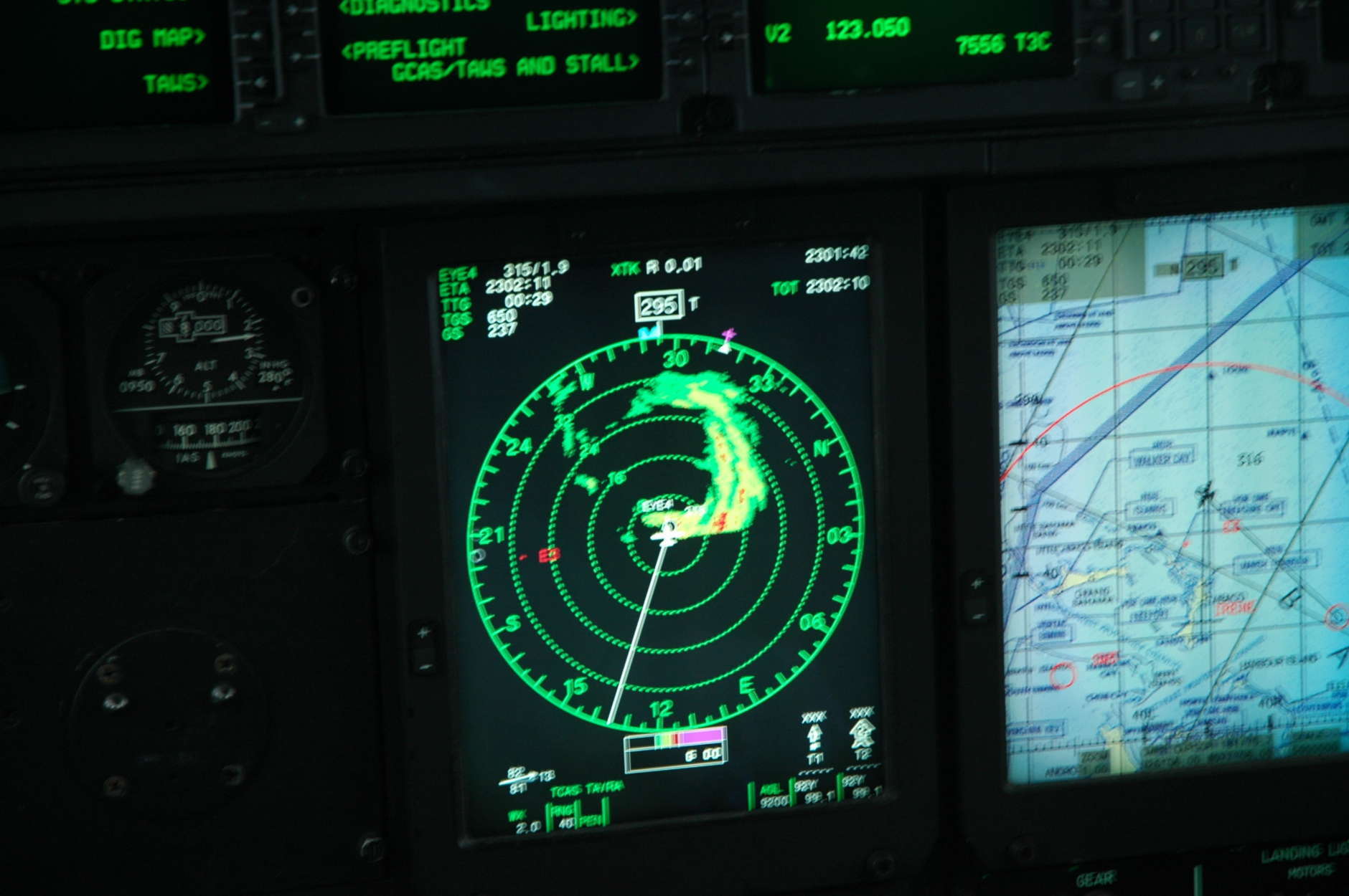
(Credit: NOAA/USAF/Dave Dildine)
It passed north of Hispaniola throughout the 23rd, and despite being over warm water and low wind shear, the interaction of Irene’s circulation with the mountains of the Island delayed further intensification.
As it moved away from Hispaniola, it quickly intensified and became a Category 3 Major Hurricane with peak intensity of 125mph and a minimum central pressure of 957mb within the 18 nautical mile diameter eye.
However, it wasn’t the lowest pressure observed from Irene as the pressure was observed while the closed eyewall structure became more fractured.
The dropsonde measured a minimum central pressure of 942mb with now decreasing winds of 105mph.
It then made four landfalls in The Bahamas throughout the 24th and 25th.
The hurricane then continued northward and passed far from the eastern coasts of Florida and Georgia.
And on the morning of the 27th, it made landfall near Cape Lookout, North Carolina with an intensity of 85mph with hurricane winds east of the North Carolina Sounds and Outer Banks.
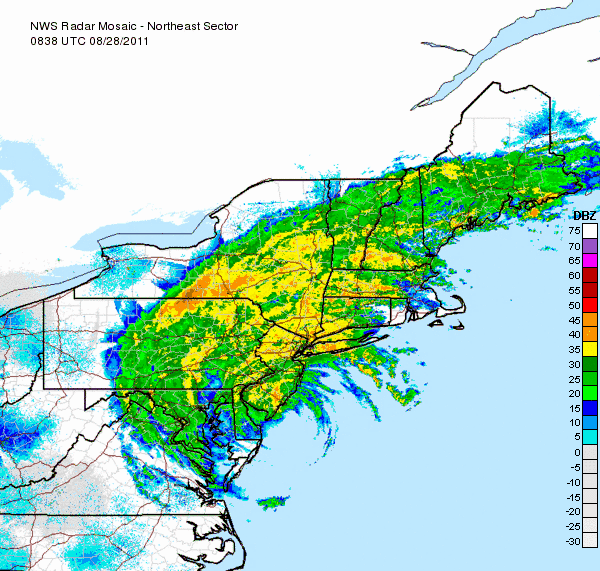
(Credit: NWS)
As it continued north-northeast movement just offshore of the Delmarva Peninsula and made landfall over Brigantine Island, New Jersey in the early morning of the 28th, still being a high-end tropical storm with winds of 70mph.
Later into the day, it made landfall over Coney Island, New York and it moved over Manhattan Island.
Swells over the Mid-Atlantic were observed for a couple of days between the North Carolina and New York landfalls.
It continued north-northeast over New England and became extratropical on the 29th near the New Hampshire-Vermont border.
The next day, it was absorbed by a frontal system in northeastern Canada.
Overview
The system was well observed with 19 Air Force Reserve reconnaissance missions and 16 NOAA reconnaissance missions.
Guzabo Abajo, Puerto Rico, recorded the heaviest rain from Irene at 22.05 inches enough to cause flooding.
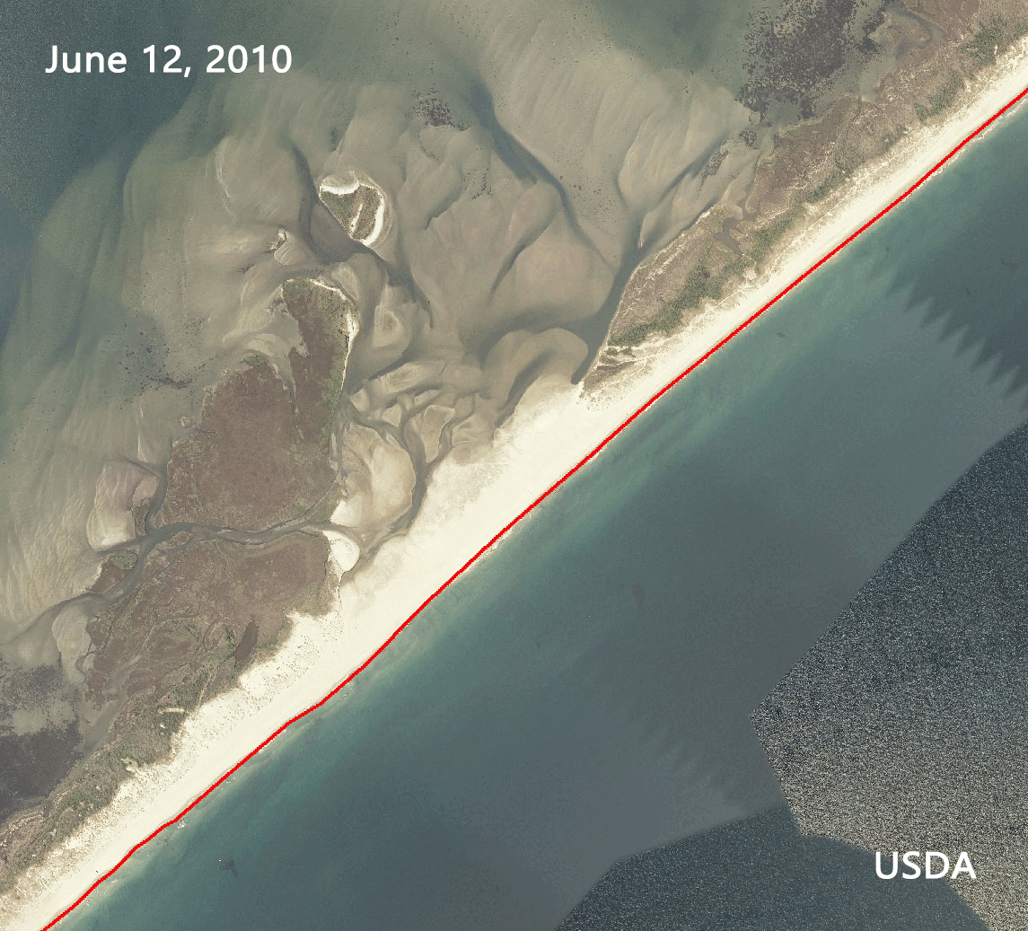
(Credit: USDA/NOAA/USGS)
There were unconfirmed reports of wind gusts of 115mph in Cat Island, The Bahamas.
A pressure reading of 950.4mb, during the afternoon of the 25th, was observed in Marsh Harbour, in the Island of Abacos, The Bahamas.
Large swaths of 5 to 10 inches of rain along the US east coast was recorded with Bayboro, North Carolina recording the highest amount at 15.74 inches.
Largest storm surge was 7 feet in Oregon Inlet, Marina, North Carolina in the late night of 27th.
It also spawned several tornadoes across the Mid-Atlantic with an EF2 tornado that landed in Columbia, North Carolina.
A total of 49 deaths and damages amounting to $14.2B (2011 value) were recorded.
The name was then retired and got replaced by Irma which suffered a similar fate.
Response and Aftermath
Many people underestimated Irene as a Category 1 hurricane, but the storm produced major damage.
Sustained high winds and major flooding together with storm surges caused more damage than anticipated.
Official forecasts were accurate but the populous was largely caught off guard.
“People just did not think that the impacts from a Category 1 would have been so substantial”
John Cole, meteorologist with the NWS in Newport/Morehead City.
To understand the public perception of the threats posed by Hurricane Irene and find out how people responded to the weather forecasts, the NWS held public meetings in some of the communities hardest hit by the storm.
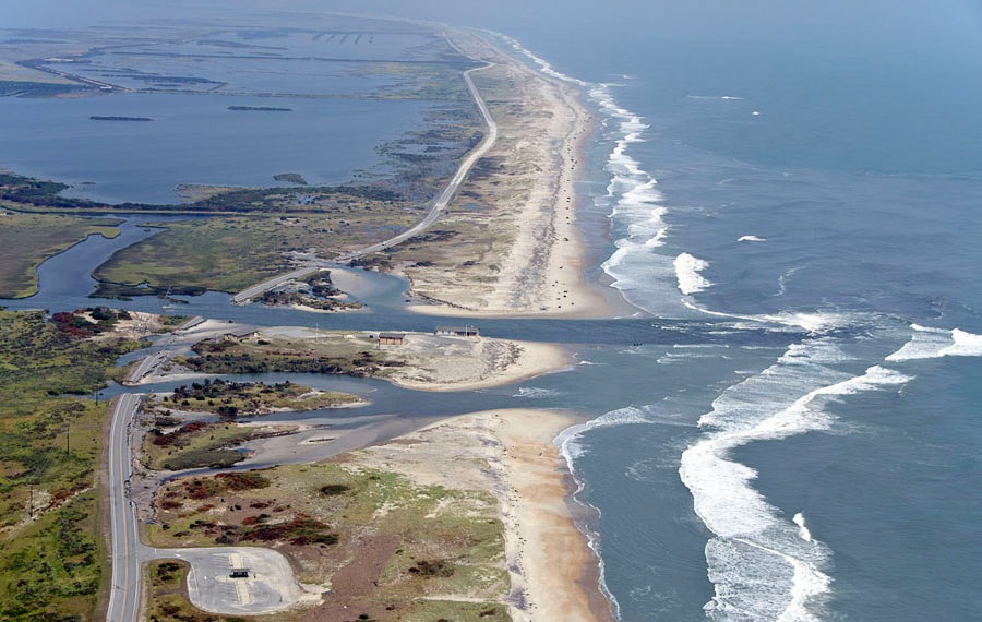
(Credit: Don Bowers, 2011)
Meetings during December were held in Dare, Pamlico, and Beaufort counties, where participants were surveyed about their experiences and perceptions.
In addition, Rich Bandy, lead meteorologist at the NWS Newport/Morehead City office, presented comparisons of the forecasts for wind, inland flooding and storm surge with observations during and after the storm.
Coastal flooding caused by storm surge was the main threat were people were not prepared enough for.
The NHC correctly forecasted storm surge will be between 6 to 8 feet as the highest storm surge was recorded at 7 feet.
And major flooding across parts of Carteret, Pamlico, Beaufort and Hyde counties and other areas including the entire barrier island chain north of Cape Lookout, and the Pamlico and Neuse river areas was observed.
Improvements
The NHC improved its warning system with better accuracy and longer lead time for preparation and information decimation.
However, making people evacuate remains a problem as people often don’t want to leave.
The NWS and local governments then used social media to reach more people in addition to the traditional TV news networks and newspapers.
“While social media is a way to reach people who do not rely on traditional media, adoption has been slow because many municipalities do not allow employees to access the sites on work computers. One of the lessons from Irene for emergency communicators has been that policies need to be developed about the use of social media, including how it will be staffed when a crisis occurs.”
Roberta Thuman, Town of Nags Head’s public information office.
Conclusion
While Irene was certainly not the strongest storm of the 2010s, it certainly resulted in significant changes in forecasting and forecasting platforms.
The impacts of Irene will likely be remembered for many years to come, even with the more powerful Hurricane Sandy that occurred one year later.
