Tropical Cyclone Belna Expected to Strengthen As it Threatens Madagascar

Force Thirteen's official cone for Tropical Cyclone Belna
Luke Katz
As Very Intense Cyclone Ambali is rapidly intensifying into a powerful major cyclone, there is another system in the South West Indian Ocean due to the strong MJO over the Indian Ocean right now. Since the system is a Cat 1 according to Meteo France, they named it Belna. Belna, unlike Ambali, is likely going to hit Madagascar as at least a Cat 4, 130mph according to the Force Thirteen, but other questions still linger. Will it be a Cat 2 at landfall? What impacts will it bring? What are the Models saying? And what will it do after? If you have those questions this article will answer them all up to date.
Satellite Imagery
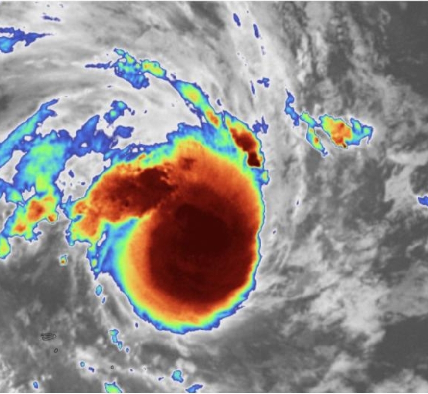
The satellite imagery is showing a Dvorak pattern that usually indicates a developing eyewall and eye. This not good news for Madagascar at all because Belna might be more intense than originally thought. One thing to note about the intensity is that the small size of these systems is making them stronger than expected, which is shown in the case of Ambali. The reason why is because small tropical cyclones can intensify faster, but also weaken quickly. For example, a recent case of this would be Ambali (2019) and one in the Atlantic would Beryl (2018).

Belna is developing an eyewall right now which could develop an eye and lead to rapid intensification. This will bring the wind speeds up and might make Belna an intense cyclone soon, so people Madagascar in the path of the cyclone should get prepared.
Rainfall
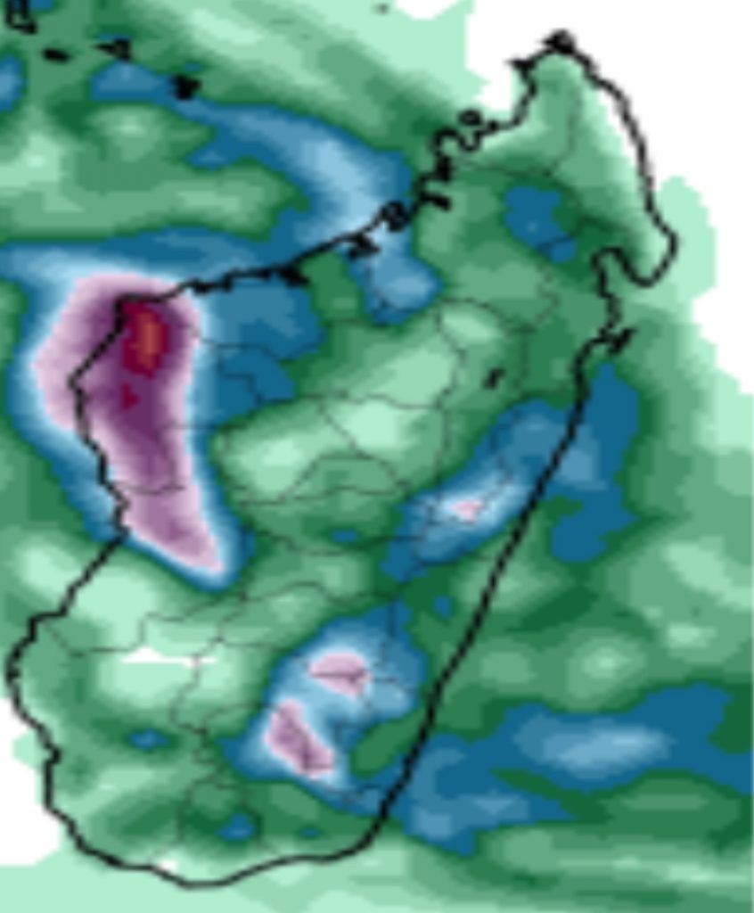
Rainfall is going to be a huge threat from this storm for people living across the coast, and flash flooding is also going to major problem for the people who are going to get a direct landfall from Belna. Because of the hazardous situations that Belna will bring to Madagascar, if you have friends or family there you should contact them to tell them about the system heading their way.
Force Thirteen Forecast
The track has shifted west a bit, but still does not limit the impacts for Madagascar. Force Thirteen says it will peak at 145mph but will weaken a bit before it makes landfall or when it is closest to the coast. Interests in Madagascar should watch this system closely. As of 6am EAT Dec 6, 2019 Force Thirteen has Belna at 75 mph 987 mb and located 7.9S and 49.2E.
Ads by 
Works Cited
1. @LukeKatz2 “Image” Twitter, https://twitter.com/LukeKatz2/status/1202713146928041990 Accessed 5. Dec.
2. www.tropic.ssec.wisc.edu “Microwave Imagery, Belna, latest 24hr loop GIF” http://tropic.ssec.wisc.edu/real-time/mimtc/2019_02S/web/basicGifDisplay.html Accessed 5. Dec.
3. www.tropicaltidbits.com “18z GFS, Southern Africa, Accumulated 24-hour Precipitation (mm), Forecast hour 120” https://tropicaltidbits.com/analysis/models/?model=gfs®ion=safr&pkg=apcpn24&runtime=2019120518&fh=120 Accessed 5. Dec.