Tropical Storm Iota a Major Hurricane Threat to Honduras

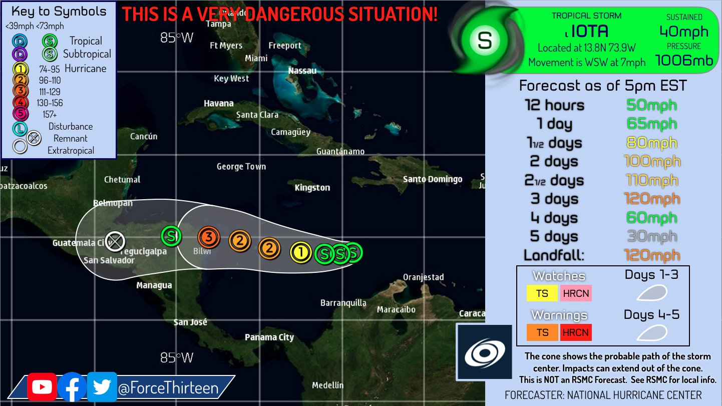
Tropical storm Iota the 30th named system in the super active atlantic hurricane season is now making a run for category 3 status in the saffir-simpson hurricane wind scale.
It is forcasted to make landfall exactly where major hurricane Eta made landfalled, catstrophic damages is expected.Landfall is still 3-4 days out, if you are in the cone please prepare for this storm as this will be a very dangerous one.Conditions are pretty conducive for the system to rapidly intesify.
Its currently 490 miles away from San Andres, 600 miles away from Puerto Cabezas, and 645 miles away from Puerto Lempira.
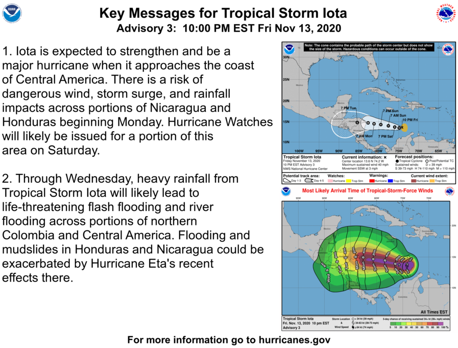
Current Information: (As of 10:00PM EST Fri, November 13th)
13.6°North 74.2°West
Maximum Sustained Winds of 40mph
Minimum Pressure of 1006mbar
Movement: South-Southwest at 3mph
No Tropical Storm, Hurricane Warnings or watches are currently in effect.

This will be very bad for Honduras since they were already affected by Eta
IS THERE A WAY IOTA COULD TURN UPWARD? I LIVE IN CANCUN AND HAVE MAJOR CONCERN. THANKS IN ADVANCE
As of now there is a small chance that Iota will turn upward, but i recommend you to keep updated on this storm if you are concerned.