Tropical Storm Laura Forms In the Atlantic

Overview
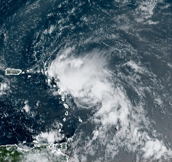
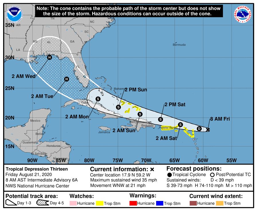
Tropical Storm Laura became the twelfth named storm of the Atlantic hurricane season this morning out of Tropical Depression Thirteen. At 9AM AST Laura was located at 17.0N and 59.8W, with winds of 40mph and a pressure of 1008mb. The storm was moving to the West at a brisk 21mph. Laura is expected to become a hurricane this weekend on approach to the Florida Strait. Laura formed out of the semi-struggling TD Thirteen, which formed slightly later than anticipated. The areas of greatest concern at this time are areas in the Greater Antilles which may receive tropical storm conditions in the next 24 to 48hrs, including winds possibly up to 60mph and flooding rainfall. However, residents in Florida and the US Gulf States should be monitoring the forecast for Laura, as the storm may provide impacts to those regions early next week. Laura may also be a historic storm, as it is forecast to move in the Gulf of Mexico as a hurricane – with Tropical Depression Fourteen, which may be a hurricane at that point in the Gulf at the same time. If these storms were both hurricanes, it would be the first time this has occurred in the basin in recorded history.
Current Warnings/Advisories
Tropical Storm Watches for:
- The southeastern Bahamas and the Turks and Caicos Islands
- Puerto Rico, Vieques and Culebra
- U.S. Virgin Islands
- British Virgin Islands
- Saba and St. Eustatius
- St. Maarten
- St. Martin and St. Barthelemy
- Antigua, Barbuda, St. Kitts, Nevis, and Anguilla
Future Forecast
Laura will likely continue to move to the west, likely bringing tropical storm conditions to areas of the Caribbean, including the Bahamas and Puerto Rico. Winds up to 50mph and heavy rainfall will be the main threats with the system as it moves past the islands. The storm will likely cross the Florida Strait after moving north of the Greater Antilles, and may cross into the Gulf as a hurricane. After a close shave between the strait, a landfall on the Florida panhandle is expected, however this may move either east or west depending on where the storm ultimately goes. The forecast track could shift, so any interests in the Greater Antilles, Southeastern US and US Gulf States need to keep a very close eye on Laura as the storm will likely provide impacts to those regions. Earlier model guidance was showing that Laura may move slightly farther to the north placing a landfall in Florida, however this trend has gone away in recent runs.
Future updates on Tropical Storm Laura and future systems in the Atlantic basin can be found on the Force Thirteen Youtube channel, as well as our various social mediums on Twitter and Facebook.
