Tropical Storm Nuri forms in the South China Sea

Tropical Storm Nuri (PAGASA name Butchoy) has formed in the South China Sea and is likely to strike China within the next few days as a weak Tropical Storm. As of the latest advisory from the Joint Typhoon Warning Center (JTWC), Nuri is currently a Tropical Depression equivalent with 1-minute sustained winds of 35 mph (30 knots, 55 km/h) with gusts of 45 mph (40 knots, 75 km/h). Force Thirteen, however, has pegged Nuri at minimal Tropical Storm intensity with winds of 40 mph (35 knots, 65 km/h). It is located near 17.7N latitude and 116.8E.
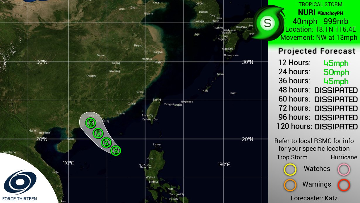
Forecast

Nuri is forecasted to gradually transition to a more uniform Northwestward movement while approaching the southern coast of China. The current forecast expects Nuri to peak as a low end Tropical Storm of 45 mph (40 knots, 75 km/h) tomorrow before making a weaker 40 mph (35 knots, 65 km/h) landfall a fair distance West of Hong Kong. Gusts could be up to 50 mph (45 knots, 85 km/h). Even outside of the forecasted landfall position, flooding rains and strong winds are likely/possible in the area in and around it.
For further information, refer to your local meteorological office. Force Thirteen is also providing more updates on Nuri and other storms around the world on their youtube channel, facebook and twitter accounts.
