Typhoon Rai (Odette) Approaches the Philippines
 Approaches the PhilippinesDecember 15th, 2021 at 16:41 PM • 4 years ago| 0")
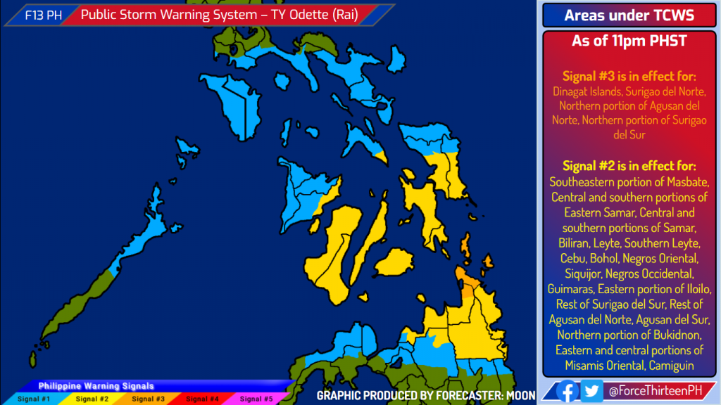
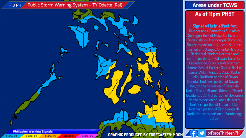
Typhoon Rai (PH Name: Odette) continues to intensify as it approaches the Philippines, clearing its eye. Storm signals hoisted across 11 regions.
The storm currently has1-minute sustained winds of 150 kph (90 mph) with minimum central pressure of 977 millibars, according to the latest advisory of the Joint Typhoon Warning Center. The storm is currently moving at speed of 19 kph (12 mph) towards the west-northwest.
Current Warnings:
What are the Risks?
- Heavy downpours caused by Rai (Odette) will be experienced across Southern Luzon, Visayas, and Northern and Northeastern Mindanao starting Thursday morning until Saturday morning; with the heaviest amounts concentrated near the storm’s path. Under these conditions, scattered to widespread flooding and rain-induced landslides are expected.
- Typhoon-force winds are expected within areas under TCWS #3. Strong winds (gale to storm force) will be experienced within any of the areas where TCWS #2 is in effect. Strong winds (strong breeze to near gale) with higher gusts will be experienced within any of the areas where TCWS #1 is currently in effect during the passage of the typhoon. This may generally bring up to various amounts of damage to structures and vegetation.
- Storm surge is possible along coastal areas in some areas six regions, possibility of coastal inundation is present.
Residents in areas under TCWS No. 3 and 2 should finish their preparation by Thursday morning. Evacuate if the Local Government Units (LGUs) asked you to do so. Residents in areas under TCWS No. 1 should also monitor the development of the storm.
