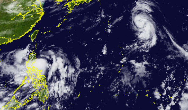
Western Pacific Wakes Up as Tropical Storm Ma-On Threatens Philippines, Tokage Forms

Activity in the Western Pacific has increased after a long period of dormancy, with Ma-On and Tokage named by the Japan Meteorological Agency (JMA,) as the total number of named storms in the basin in 2022 climbed to 10, still well behind the average.
Latest Information
As per the 11PM (15Z) Tropical Cyclone Bulletin of PAGASA, Ma-On (PH name Florita) was last located at 16.4°N 122.9°E or approximately 125 kilometers (60 miles) from Casiguran, Aurora. It strengthened to 10-minute sustained winds of 85 kph (55 mph) and gusts of 105 kph (65 mph,) with minimum central pressure of 994 millibars. The storm is moving westward slowly, likely making landfall on the island of Luzon.
Meanwhile, JTWC’s 15Z bulletin on Tokage located the center of the storm to be at 26.7°N 151.5°E, or roughly 1,533 kilometers southeast of Yokosuka, Japan. Tokage was drifting to the North at a rate of roughly 4kph (3.5mph.) The storm had winds of 85kph (55mph) with gusts to 105kph (65mph.)
 Latest Warnings:
Majority of Northern Luzon was under Warning Signal 2. The rest of Northern Luzon, the northeastern portion of Central and Southern Luzon was placed under Warning Signal 1. PAGASA notes that hoisting Warning Signal 3 is possible before its landfall tomorrow early morning.
No warnings are in effect for Tokage, as it meanders far away from land.
Future Forecast

Ma-On poses threat to the Philippines and Southern China, particularly to Northern Luzon and the Pearl River Delta respectively. Heavy to torrential rain is expected in the majority of Northern Luzon throughout Tuesday, with rainfall possibly exceeding a meter in isolated areas. Areas outside of the center can expect light to moderate rains due to the outer rainband of the storm and monsoonal influence being pulled by the storm’s circulation. PAGASA warns citizens on the possibility of flooding and landslides, with stricter precautions for areas affected by a Magnitude 7 earthquake last month. Local authorities may conduct evacuations in high-risk areas.
After it traverses the Northern Philippines, Ma-On will have time to reorganize in the South China Sea before hitting Southern China by Thursday, with heavy rain as the main concern for this storm. Current intensity guidance has the storm remaining as a tropical storm, however, model guidance does not rule out the potential of a typhoon as the storm strengthens in the South China Sea.
As for Tokage, it is expected to remain out of any landfall for its entire lifetime, likely intensifying to a strong tropical storm as it drifts North/Northwestward in the coming days. No impacts are expected for land, however local and international shipping could be minorly affected.
Continue to monitor both storms by staying tuned to Force Thirteen as well as national meteorological services. You can find more information in the Social Media and Cyclone Agencies section, respectively.
