Widespread Severe Weather and Flash Flooding Likely over Texas Today and Tonight

A very dangerous weather setup is currently in place over Western Texas. Thunderstorms are currently firing up across New Mexico and are expected to move into Texas where a Moderate Risk for severe weather is in place meaning widespread severe storms are likely. These will pose a risk for very large hail, potentially well over 2″ in diameter, as well as tornadoes. As the threat moves east it will organize into a damaging wind event potentially bringing gusts up to 80mph in some areas. Flash Flooding is also occurring in Louisiana and Eastern Texas and these areas will likely see widespread rain in the coming days. This is an extremely dangerous situation and persons in the way of this storm should prepare immediately for it.
Current Setup and Outlooks
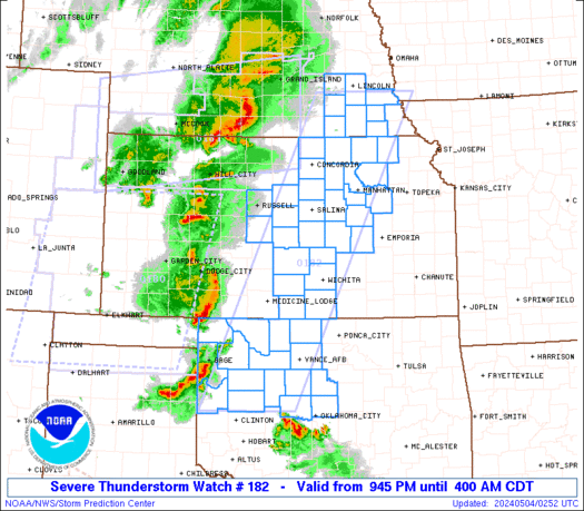
Over the past few days moisture has continue to surge into the state of Texas which has brought round after round of severe weather. Today this is once again the case as dewpoints have surged into the 50’s and 60’s over Western Texas while they are in the 70’s in the southeastern and eastern part of the state, but is very dry further up in the atmosphere. Meanwhile the atmosphere is increasingly unstable meaning it is very easy for air to rise and form thunderstorms as for an air parcel to rise it has to be warmer than its environment. The distance between the temperature and the temperature of a rising air parcel is called the Convective Available Potential Energy (CAPE) and is measured in joules per kilogram of air. Current values are about 1000-2000 in this region, but models predict it to skyrocket into the 3000 and even upwards of 4000. This combined with very strong updrafts (winds flowing upwards into the storm) will make a environment very suitable for large and very large hail, likely larger than 2″ in diameter. There is also weak, but rotation in the atmosphere which will support potential tornado development, though not very strong. Because of this a Severe Thunderstorm Watch has been issued for Northeastern New Mexico and Northeastern Oklahoma and Texas and a Tornado Watch has been issued for Eastern Texas.
The Storm Prediction Center has also issued a rare Moderate Risk for Western Texas, including the cities of Lubbock, Abilene and Plainview. This area has a 45% significant chance of hail, meaning that there is a 45% chance of there being a hailstorm within 25 miles of a given point inside the risk area as well as a 10%+ chance of there being a significant hailstorm within the same area. There is also a 10% tornado risk and 15% damaging wind risk. An Enhanced Risk, meaning numerous severe storms are possible, surrounds this risk region and includes areas of Central and Western Texas as well as Southwestern Oklahoma, including Ft. Worth, Amarillo and Midland, TX as well as Ft. Still, OK. Here there is a 30% significant risk for hail and a 15% damaging winds and these areas will also likely receive severe weather. Just east of this region, a 30% wind risk was issued for when this storm turns into a more linear system supporting a more damaging wind threat.
Severe Weather Event
Currently over New Mexico, there has been an increase in clouds and thunderstorms noted. This is signaling that supercells (thunderstorms with rotation) are likely to initiate sooner than expected. The current guidance suggests that over the next few hours, there will be a significant growth in coverage of this event. By 7pm there is expected to be a line of supercells from Del Rio to Dalhart in Texas posing a risk for mainly very large and even giant size hail, but also tornadoes and damaging winds. After this the southern ones will die down while the northern half (north of I-20) will begin to organize into a bow echo, still posing a risk for very large hail. By 11pm these will have fully organized into a line posing more of a risk for damaging winds but also may produce brief tornadoes. further south around this time new storms will have developed around the Del Rio-Laredo region which will move northeast staying just north of and along the I-35 corridor. These will pose a risk for large hail, damaging winds and a tornado or two as by 4am they will move through the San Antonio region. Further north the bow echo is expected to move through Northern Texas and Oklahoma but begin to dissipate around 4-5am just east of I-35.
Flooding Risk

Further east in Eastern Texas and Louisiana, extensive flooding is ongoing and is expected to occur these next few days. Today a Slight Risk for flooding was issued meaning scattered flash flooding events are possible for the far eastern Texas and Southern Louisiana today. Here stalling thunderstorms have produced heavy amounts of rain with widespread totals of 3″ with some areas getting over a foot of rain today. This has prompted two Flash Flood Emergencies for Lake Charles County, LA and Jefferson County, TX. This will make the ground extremely saturated ahead of 2 more waves of storms tomorrow which will bring another 2-4″ of rain across Eastern Texas and another 5″ over Southeastern Louisiana. On Wednesday, a strong complex of storms is expected to form and stall over the I-35 corridor bringing extreme rain with widespread values of 2-6″ with isolated amounts of a foot being predicted. Because of this Eastern Texas is under a Moderate Risk for flooding for both tomorrow and Thursday meaning numerous flash flooding events are likely. Southern Louisiana is also under a Moderate Risk for flooding tomorrow.
This is a very dangerous situation! Keep up to date with your local weather authorities as well as the National Weather Service for any storm information. Go to the Storm Prediction Center’s website for any information on severe weather and the Weather Prediction Center’s website for information on the current flooding risk. Also, subscribe to the Force13 US YouTube channel and follow us on Twitter for the latest video’s and updates on severe weather. Be prepared for these storms and most importantly, be safe.
