Windstorm Odette (23-26 September 2020)
")
On the 22nd of September a small depression formed in the North Sea, on the 24th it was officially named Odette by KMI (Belgian National Weather Institute). After this, Odette stalled in its place. The storm would not move for the coming day. On the 25th of September, the storm depression started to occlude even more. The structure would become much better overnight and eventually looked like a classic low pressure. On the 24th of December, a small depression was forecasted to form in the North Sea. This depression would reach heavy-storm and received the name, Odette. This windstorm caused mayhem on the northwest coast of Belgium and the province of Zeeland, Netherlands. With gusts over 100 km/h. It was the first autumn storm to affect the Netherlands and Belgium since 2017.
Cyclogenesis
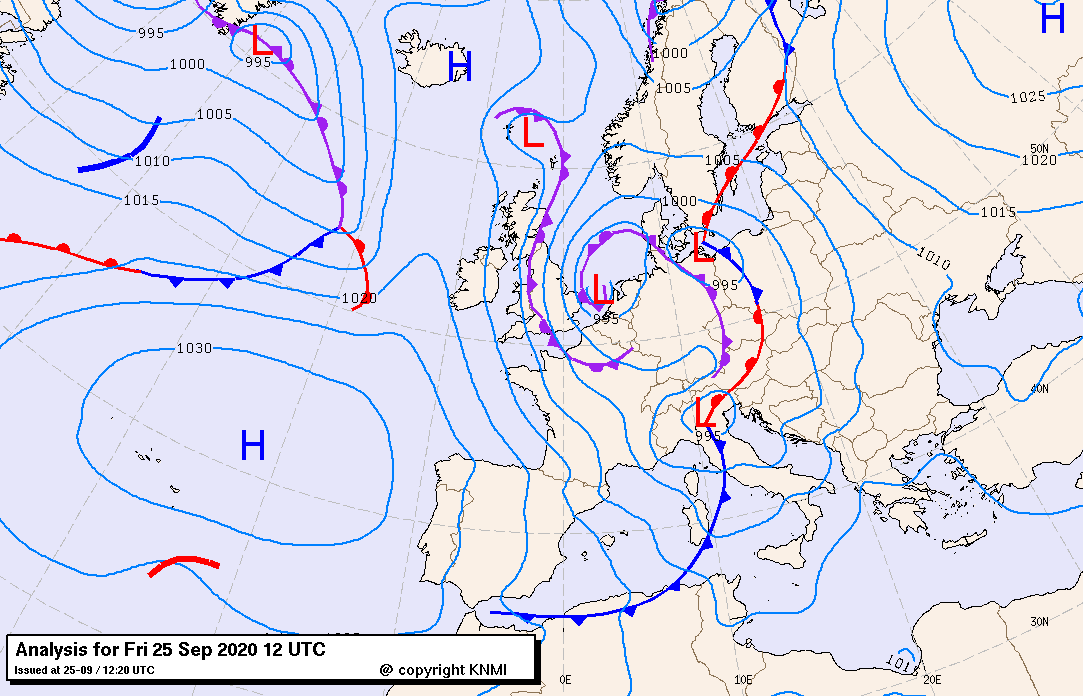
When Odette formed, the depression was still quite small and weak. Weathermodels were suggesting a potential heavy-storm forming from it. On the 25th of December, As the occluded front started spiraling very tightly, the winds got accelerated. Over the next seven hours, she deepened incredibly fast. Creating a strong, but local windfield. This would then aim at the NW of Belgium and the entire province of Zeeland. Cyclogenesis is the process of the formation of an extratropical cyclone and occurs when a warm and a cold front meet. These can start to occlude and form a low-pressure system. A select few of those actually become windstorms.
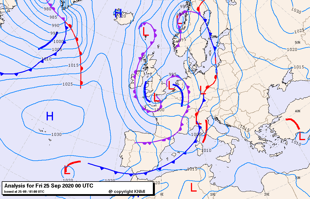
(Figure 1) A small storm-depression which has formed in the North Sea and has been given the name “Odette” by KMI Charts: @KNMI
Landfall of the storm
On the 26t-27th of September Odette made landfall in the Netherlands, with the full windfield on Zeeland and northwest Belgium. As Odette came ashore, gusts were reported of over 110 km/h. The winds blew on the coast with such a force, that the whole dune was blown on land and whole parts of beaches were slammed away. (See figure 3). KMI issued a code orange for the coast and West-Vlaanderen. With gales topping the 11 Beaufort, it made the storm earn the title of a very heavy storm. Whole parts of beaches were swept away by the sea. In Hoek van Holland (Netherlands), a wind gust of 114 km/h was reported. In Zeeland, the storm had sustained Beaufort 10 for two hours long. Making it a heavy storm for the Netherlands. The damage caused by Odette was massive because the incredibly strong winds at the low level forced them into a very small area. Due to the English Canal, the Venturi Effect took place. Because of the narrower space to move through, the air got crushed into itself and forced to flow faster. This caused stronger winds in the areas directly impacted. The total damage estimate is still unknown.
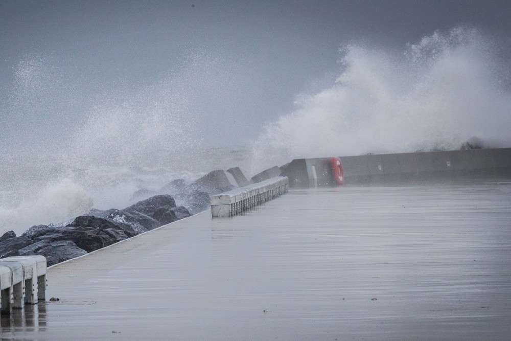
(Figure 2) Odette causing a huge swell of the Belgian coast. Photo: @Belga
The Damage
After Odette ravaged through northwestern Belgium and Zeeland, Netherlands, the true extent of the damage became clear. Whole parts of the beach swept away, small beach-houses destroyed. destroyed sailing yachts and small boats, sand blew off the beaches and onto roads of the cities and villages. Trams cannot move due to the sand and cars that are completely buried in the sand. The following set of photos depicts the damage Odette caused.
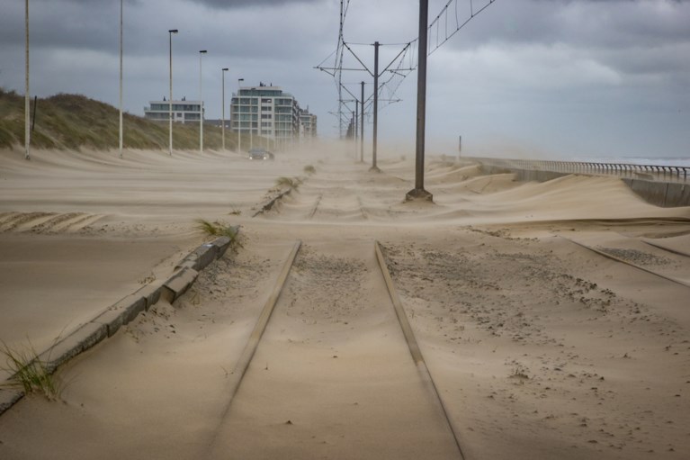
(Figure 3) Sand has blown all over the road and railway between Oostende and Westende (Belgium) photo: @Belga
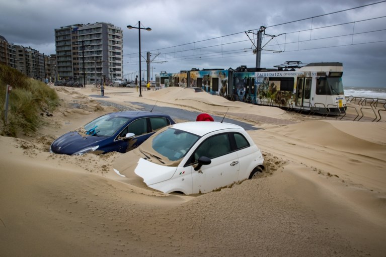
(Figure 4) Cars buried beside the tram line between Oostende and Westende (Belgium) photo: @Belga
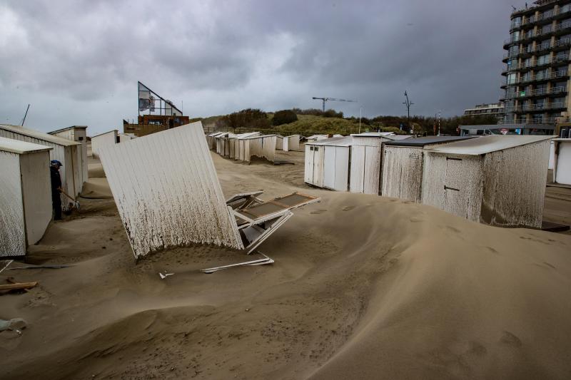 (Figure 5) Small beach houses destroyed by storm Odette Photo: @Belga
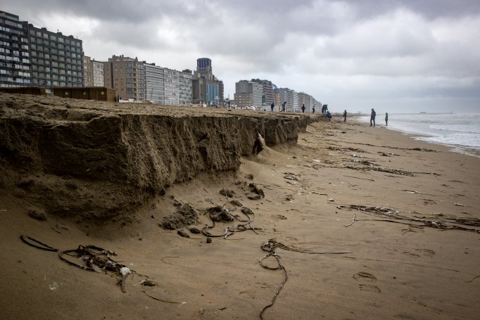
(Figure 6) Dike of Oostende after storm Odette Photo: @Belga
Author: Alex R (17 years old Climate Physics Enthusiast, future UU Physics and Climate Physics student)
Date of publishing: 26th of December 2020

Goed gedaan Alexander.
Wij zijn trots op je.
Heb je het allemaal zelf geschreven? Moeilijk engels hoor.
Dank Oma, sorry voor de late reactie.
Ja ik heb dit allemaal zelf geschreven. Goede oefening voor mijn Engels Eindexamen.