Zeta will strike Yucatan as a hurricane tomorrow. Louisiana and Mississippi are the next.

Tropical Storm Zeta becomes the 28th depression and the 27th named storm in 2020 season, tying with 2005 in terms of named systems. It is now just one more step to hurricane status, and it is expected to strike Yucatan Peninsula tomorrow, another one to strike there since Delta half month ago. After that, it is expected to move northward and smash Louisiana and Mississippi on Wednesday night.
Current Storm Information, Recon Observations
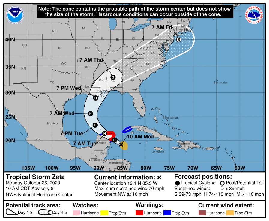
As of 10:00 Central Daylight Time, tropical storm Zeta is located at 19.1N 85.3W, with maximum 1-minute sustain winds of 70mph (110km/h) and gust of 85mph (140km/h), with minimum central pressure of 992mb, and moving northwest at 9mph (15km/h). The gale force winds radius is extend to 90-100 nautical miles away at the eastern side of Zeta.
Yesterday Zeta stalled due to lack of steering current, while it was accumulating energy in very high ocean heat content environment, accumulating energy, and made rather significant improvement in the last 24 hours. Notwithstanding good outflow and ocean environment, shear limits Zeta from more rapid intensification, as shown in satellite imagery it is being sheared off, with convection colder than -80C displaced to the southeastern side brought by upper level anticyclone (ULAC). It is now blowing convection at the center and attempt to cover the center again.
Reconnaissance plane (NOAA2 Mission #5) has found around 850mb flight level of 69 knots peak and stepped frequency microwave radiometer (SFMR) has found unflagged 66 knots peak at the southeastern side, with 992mb recorded by 10:35UTC center dropsonde, which backed up NHC’s analysis.
Current Warnings in Affect, Threats to Land and Forecast Track.
Hurricane Warning: Tulum to Dzilam, Mexico and Cozumel.
Tropical Storm Warning: Pinar Del Rio, Cuba; south of Tulum to Punta Allen and west of Dzilam to Progreso.
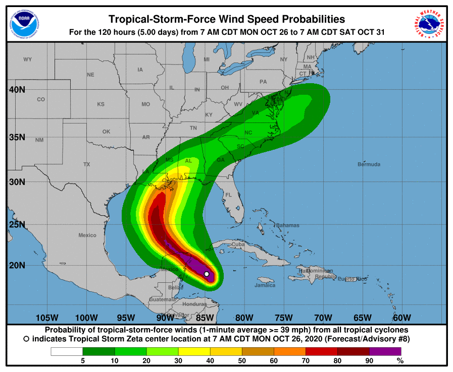
It is expected to produce a total of 2 to 4 feet surge to hurricane warning areas, as well as Rainfall totals of 4 to 8 inches with local amounts of 12 inches are possible tomorrow along and east-northeast of Zeta’s track across the Yucatan Peninsula of Mexico, the Cayman Islands, and central to western Cuba. This will probably cause significant flooding over those areas and should be cautioned about such risk.
After making landfall and weakens a bit, Zeta is expected to enter the Gulf of Mexico and slightly intensify and continue to move northwest, then curve to northeast or north-northeast, accelerating and go down from its probable second peak as the environment in the Gulf of Mexico is slipping in autumn, with lower ocean latent heat content and stronger wind shear brought by subtropical jet stream. Yet still, borderline hurricane landfall is still predicted over Louisiana, and bring torrential rainfall of central Gulf Coast Tuesday night, spreading inland across eastern Mississippi, Alabama, northern Georgia during Wednesday, through the southern Appalachians Wednesday night and into the Mid-Atlantic on Thursday. Rainfall totals of 2 to 4 inches with isolated amounts of 6 inches are expected across these areas, resulting in flash, urban, small stream, and minor river flooding. In addition, gale to storm force winds will also affect those areas and impose a notable threat overall.
