Large Tropical Storm Nicole Makes Landfall in the Bahamas, Sets Sights For Florida
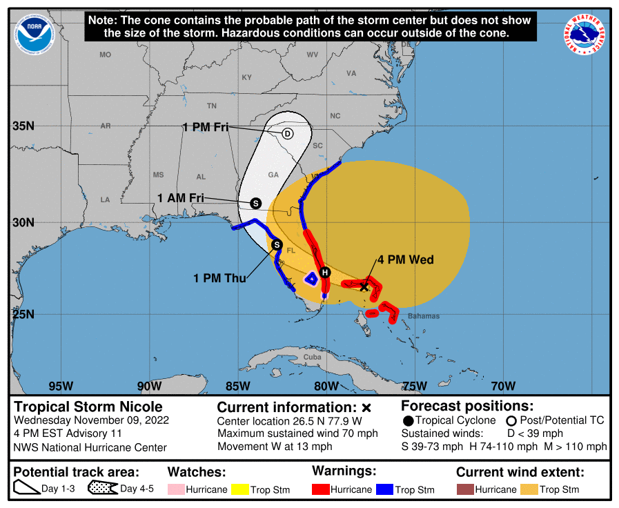
Tropical Storm Nicole has made landfall in the Bahamas this morning and s and now sets its sights on Florida. As of 10:00 PM UTC, Nicole was located at 26.5 degrees north and 77.9 degrees west, moving west at 13 mph. From the NHC’s analysis, the storm system has maximum winds of up to 70 mph and a pressure of up to 985 mbar. In terms of Nicole’s location, as of this update the storm was 55 miles East of Freeport in the Bahamas and 135 miles East of West Palm Beach in Florida. Numerous locations from Florida and the Bahamas are under hurricane warnings, tropical storm warnings, hurricane watches, and storm surge watches. Nicole’s anomalously large wind field poses a threat to locations as far as Georgia and South Carolina at this hour in addition to the threat to Florida. Tropical storm conditions are expected within the warning area. In addition, there is a danger of life-threatening inundation from rising water moving inland from the coastline in warnings, facilitating a potentially dangerous situation.
As for the local effects of this tropical storm system, there will be storm surge, tornado, wind, and rainfall risks for the northwestern area of the Bahamas and in some areas of Florida. For the storm surge risks, there will be a combination of a life-threatening storm surge, making the tide will cause normally dry areas near the coast to get flooded by rising waters moving inland from the shoreline. The water may reach the following heights above ground somewhere in the indicated areas if the peak surge occurs at the time of high tide. Furthermore, for the northwestern Bahamas area, storm surges may raise water levels by as much as 4 to 6 feet above normal tide levels, in which flooding is imminent. For the wind risks, the hurricane conditions are expected to extend westward in areas in hurricane warning area through this evening through South Carolina and Georgia. Moving on to rainfall risks, the rainfall emitted by Nicole is expected to produce the following rainfall amounts through Friday night: 3-5 inches of rain in the Northwestern Bahamas and the Florida peninsula, 2-4 inches in the southern and central Appalachians, and 1-4 inches in Northern Mid-Atlantic regions. Finally, for the tornado risk, a few tornadoes are possible this evening through Thursday across the Florida peninsula. Once again, this could be a life-threatening situation in affected regions of Florida and the Bahamas, monitoring products issued by your local meteorological service is important for storm updates.
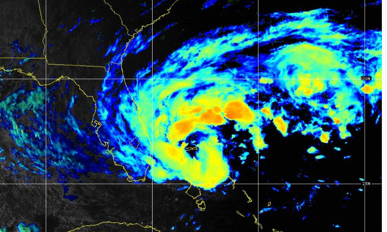
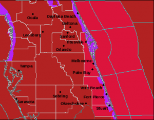
Proceeding to the track of Tropical Storm Nicole, it will expect to move to Florida and then curve into Georgia and the Carolinas. Nicole will become a category 1 hurricane making landfall on the east coast of the Florida peninsula, and thus expected to generate storm surges to the affected location of east Florida. Per the cities affected by Nicole’s storm path, Palm Bay and Port St. Lucie are one of the cities inbound into its path since they were issued a hurricane warning for possible damage. For the intensity guidance generated by models, Nicole will stay as a tropical storm for a while until it will be disintegrated after a little while. Finally, for the satellite imagery, we can see Nicole curving into Florida while making landfall in the Bahamas. Furthermore, we also barely see an eye of Nicole while it is approaching Florida. And as always, stay tuned for more updates about Tropical Storm Nicole.
Force Thirteen will be hosting live coverage on Tropical Storm Nicole at 23z, watch the stream using this link: https://www.youtube.com/watch?v=jTwyfoHnI98
