This Week in Weather (November 07 to November 13)
November 14th, 2021 at 15:04 PM • 4 years ago| 1")
Weather systems soak some US’ northern states rain, snow
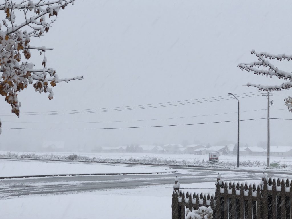
Two powerful storm systems walloped parts of the nation’s northern tier and caused serious disruptions and travel headaches on Friday. An atmospheric river brought bring heavy rains and strong winds to parts of Washington, Oregon, and Northern California. NWS Office in Seattle already warned people on “trees falling and general instability of soils. Heavy rain on top of snow, results in the snow melting quickly and rushing down the mountains, creating more flooding hazards. “Heavy rains and melting snow will cause rivers … to rise dramatically though Friday.” NWS Portland added that “rain amounts over a 48- to 54-hour period could exceed 4 to 7 inches in the hardest-hit areas of the north Coast Range and the south Washington/north Oregon Cascades and foothills,” This particular event is a category four of five on the atmospheric river scale.
A strengthening low in the Upper Midwest that originated from a cyclone offshore the Pacific Northwest early this week that flung heavy precipitation inland. The National Weather Service has issued winter weather advisories for much of western Minnesota, central and eastern North Dakota, and southeast South Dakota, and northwest Iowa. In most of these areas, inches of snow and wind gusts of at least 40 mph are likely. Most of the snow would be in extreme northern Minnesota. The system also brought accumulating snow to southern Wisconsin and Michigan on Sunday as it zipped eastward, coating areas of Wisconsin with a wide swath of three inches of snow, before the peak of winter season.
“Hurricane Season” of sunspots set to begin

Solar storms 93 million miles away from Earth occur with more frequency midway through an 11-year cycle in which the sun’s magnetic field polarity – meaning the northern lights occur more often. The 11-year solar cycle enters what’s known as “solar maximum,” as sunspot activity increases. Aurora experts say the busy season for sunspots should peak between 2023 and 2028. “The sun has negative and positive polarity, just like Earth. During this 11-year period, it does a reversal of the polarity. So negative becomes positive and positive becomes negative. During the middle of that process and transition, that’s when those sunspots emerge. So we go through a process when we are in the middle of this transition we get lots of sunspots and lots of space weather,” says Bill Murtagh, program coordinator for the National Oceanic and Atmospheric Administration’s Space Weather Prediction Center.
Increased solar activity has been noted throughout the last month as a powerful X-class flare occurred on October 28 that produced weak to moderate Borealis in the northern latitudes, which was followed by a weaker class flare with a more vibrant light show on November 4th. Although such storms are a sight for the eyes, it is important to remember that “Auroral storms can be as dangerous as they are gorgeous,” said Murtagh. Solar storms “can affect the technology we rely on here on Earth,” from satellite communications devices to consumer electronics. The storms can also cause voltage irregularities on high-latitude power grids.
Flooding kills dozens in Southern India, Sri Lanka
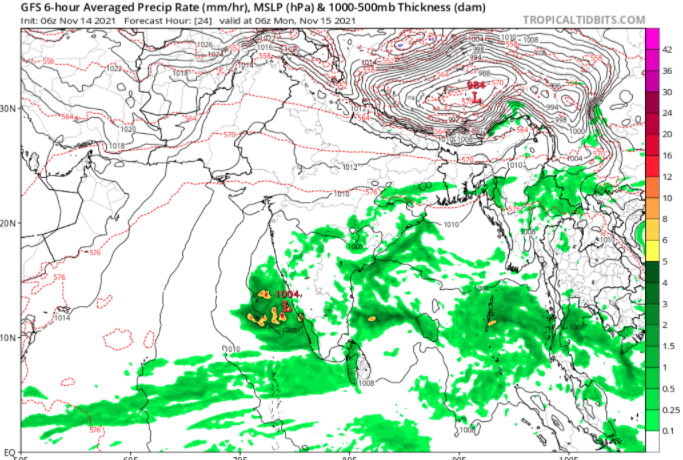
Heavy rains across southern India and Sri Lanka have killed at least 41 people, with 25 being killed in Sri Lanka, most of whom drowned. Five other people have been reported injured in a landslide, officials said. 16 people were killed in the Indian state of Tamil Nadu. 1,146 huts and 237 houses have been affected in rain related incidents across the state. Many parts of the state’s capital Chennai are flooded and thousands of people in low lying areas were moved to safety. Many schools and colleges in the state remained closed while some train services were still suspended. On Friday, the Indian Coast Guard deployed five teams and 75,000 police officers have been deployed to help citizens and carry out relief operations in Chennai as the water levels continue to subside. Heavy rainfall was caused by Tropical Depression BOB 05 accompanied by the monsoon.
.
Severe weather sweeps across Australia
The Australian Bureau of Meteorology Flood Watches and Warnings throughout six states and the capital territory as storms stretch throughout the country except the state of Western Australia. Wyangala Dam in the New South Wales Lachlan Valley where significant amounts of rain over the past 24 hours have refilled the reservoir and caused the dam to spill Friday afternoon. A spokesperson for Water New South Wales said that “with more rain possible and inflows likely to a peak of 65-70 gigaliters (65-70 billion liters) later today. Water NSW is working with the Bureau of Meteorology and the NSW State Emergency Service to monitor the situation.” Burrendong Dam in the NSW Macquarie Valley has doubled overnight, causing the storage into the flood surcharge zone. “That’s more than a month’s worth of rainfall in the space of 24 hours, but crucially what spared the region a little bit is we didn’t see those totals as widespread as they could have been,” [1] Bureau of Meteorology’s Hugh McDowell said.
A number of people have been rescued from floodwaters, as heavy rain and strong winds continue to lash parts of New South Wales. The State Emergency Service received 145 calls for help in the state’s Central West overnight. Many of the call-outs were in response to property flooding, while houses at Perthville, near Bathurst, were evacuated during the night.
Snowstorm affects North, Northeast China
Snowstorms brought record snowfall in parts of northern and northeastern China causing traffic, disrupting train service, and causing fears of power supplies loss. Meteorological departments in Liaoning and Jilin have issued red alerts for snowstorms, the highest in a color-coded warning system. Temperatures in some areas in northeastern China have plunged by as much as 14 degrees Celsius by Tuesday. A maximum snow depth of 53 cm (21 inches) was recorded in the Liaoning city of Anshan on Tuesday, as reported by the China Meteorological Association. Beijing reported its first snow of the season 23 days earlier than normal as temperatures on Sunday night dropped to be the lowest in the past decade. Traffic in Liaoning province has been severely disrupted, with the majority of expressway toll stations shut as of Tuesday. Train and bus stations were also closed, except those in the cities of Dalian and Dandong.
[1] Ralph, Olivia, and Emma Siossian. “People Rescued from Floodwaters, Wyangala Dam Spills after Heavy Rain in Large Parts of NSW.” Australian Broadcasting Corporation, 11 Nov. 2021, https://www.abc.net.au/news/2021-11-12/nsw-wild-weather-continues-wyangala-dam-spills/100613954.

Simply want to say your article is as astonishing. The clearness in your post is just spectacular and i could assume you’re an expert on this subject. Fine with your permission allow me to grab your feed to keep updated with forthcoming post. Thanks a million and please carry on the enjoyable work.