Tropical Storm Lala was located near 36.2°N, 178.4°W, or about 555 miles (894 km) north of Midway Atoll. Lala has maximum sustained winds of 40 knots and a minimum central pressure of 999 millibars.
Tropical Depression Iselle was located near 22.8°N, 125.5°W, or about 761 miles (1225 km) west-northwest of Clarion Island, Mexico. Iselle has maximum sustained winds of 30 knots and a minimum central pressure of 1002 millibars.
Typhoon Saudel was located near 28.5°N, 124.9°E, or about 229 miles (369 km) northwest of Kadena, Okinawa. Saudel has maximum sustained winds of 75 knots and a minimum central pressure of 966 millibars.
The remnants of Narra was located near 22.7°N, 113.7°E, or about 40 miles (64 km) northwest of Hong Kong. Narra has maximum sustained winds of 15 knots and a minimum central pressure of 1003 millibars.
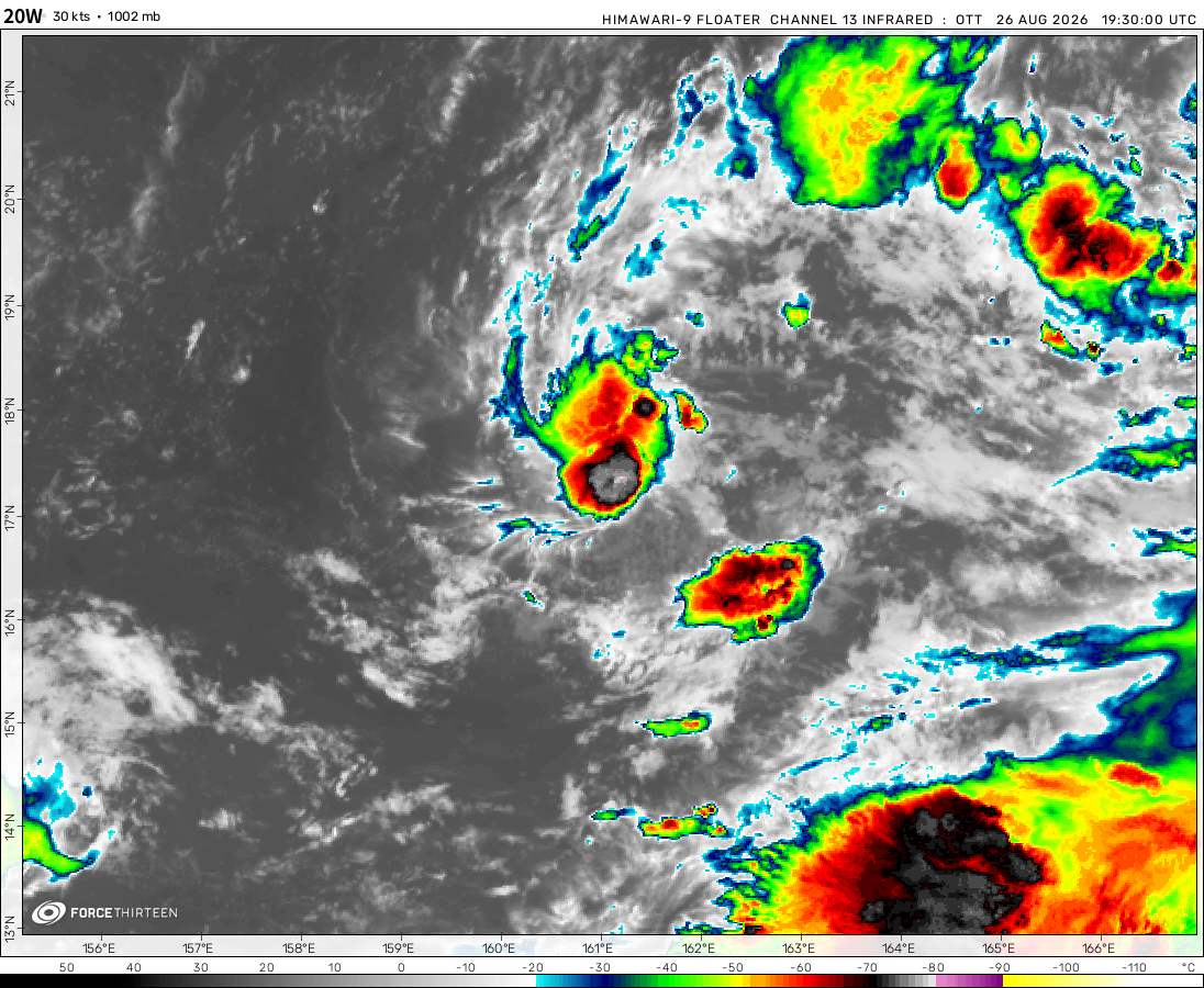
Tropical Depression 20W was located near 16.7°N, 161.4°E, or about 388 miles (625 km) west-southwest of Wake Island. 20W has maximum sustained winds of 30 knots and a minimum central pressure of 1002 millibars.
Tropical Depression 21W was located near 20.4°N, 167.7°E, or about 103 miles (166 km) northeast of Wake Island. 21W has maximum sustained winds of 30 knots and a minimum central pressure of 1000 millibars.
ATCF®
- Latest Information -
As of August 27th 2026 at 05:17 UTC
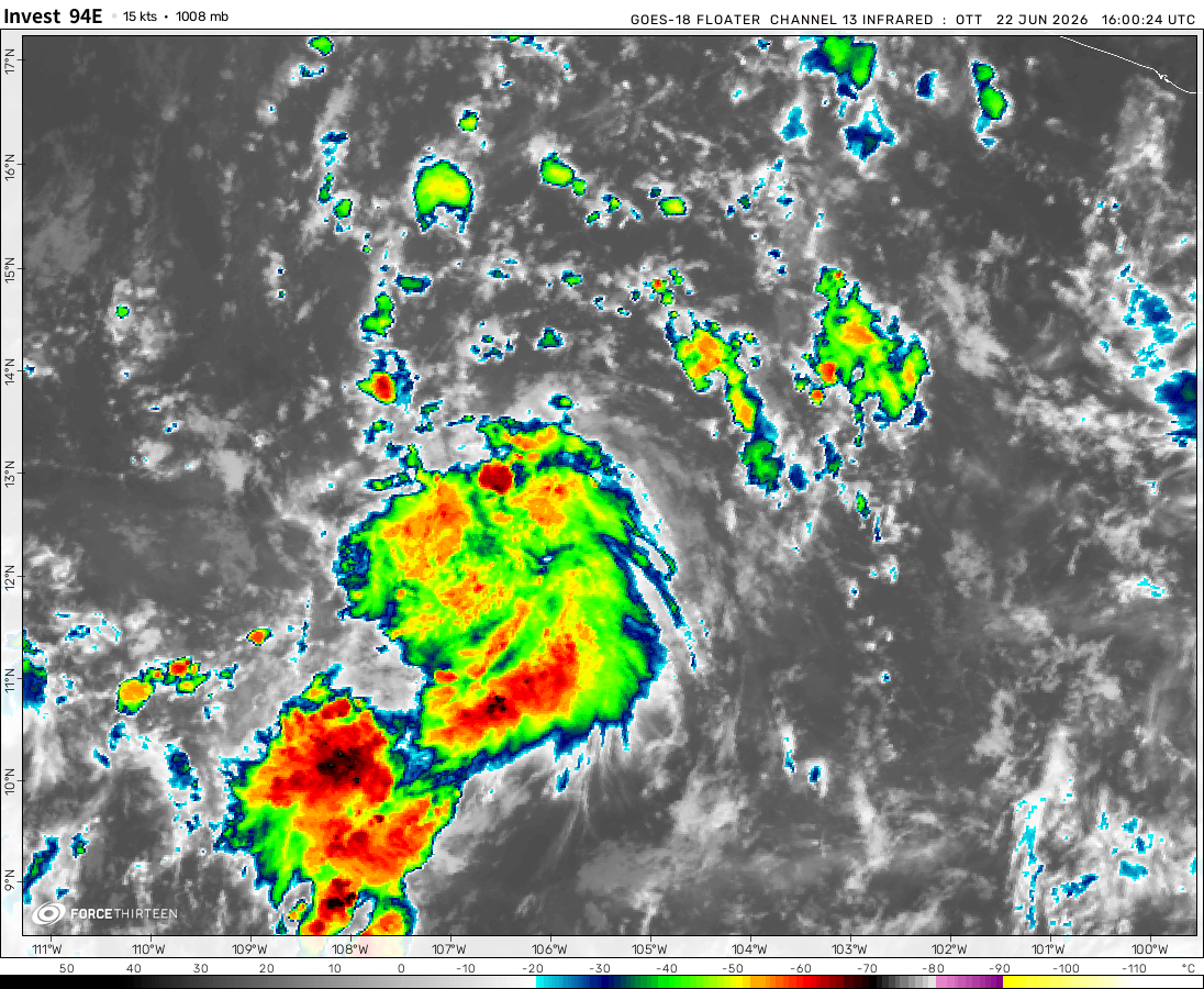
Invest 93E was located near 9.5°N, 107.5°W, or about 683 miles (1099 km) south-southeast of Socorro Island, Mexico. 93E has maximum sustained winds of 25 knots and a minimum central pressure of 1006 millibars.
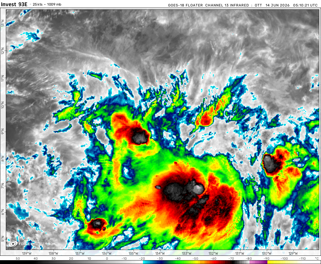
Invest 94E was located near 10.9°N, 135.0°W, or about 1448 miles (2331 km) west-southwest of Clarion Island, Mexico. 94E has maximum sustained winds of 20 knots and a minimum central pressure of 1009 millibars.
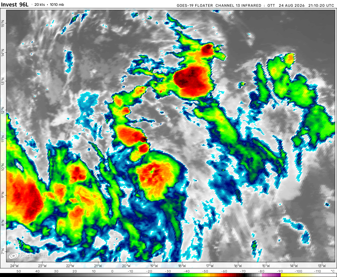
Invest 96L was located near 13.2°N, 33.1°W, or about 598 miles (963 km) west-southwest of Mindelo, Cabo Verde. 96L has maximum sustained winds of 30 knots and a minimum central pressure of 1007 millibars.
Invest 90W was located near 14.0°N, 154.5°E, or about 594 miles (956 km) north of Chuuk, Micronesia. 90W has maximum sustained winds of 15 knots and a minimum central pressure of 1009 millibars.
I think the problem is that the map is using the Asia-Australia-America format, and not the standard America-Asia-Australia format. If you don’t understand, that’s perfectly ok!
92L expected to become Isaias in the next few days
Douglas currently impacting Hawaii, may make it to WPAC, first since Olivia 2018 and second since Genevieve 2014
Khan
6 years ago
Why is it saying 0 systems active if there is Invest 92L,Hurricane Hanna,and Hurricane Douglas? Please kindly fix the Cyclone Tracker.
Gonzalo has officially been declared a sad storm (Chantal 2013 2.0?)
Hanna may reach hurricane status just before landfall in Texas
Douglas still forecast to impact Hawaii
Wave in Eastern Atlantic has a good chance of forming next week
The eye of hurricane Douglas is really starting to show now I’m predicting a peak of 130 mph and a pressure of 956 mbar
Stormy Sam
6 years ago
Gonzalo to reach hurricane strength
91L may become Hanna in the next few days
Douglas to strengthen to major status before a possible landfall in Hawaii as a TS
LB&H Hurricanes
6 years ago
oof 3 storms active, wonder if that ts invest will also become a hurricane
storm boii
6 years ago
Hurricane Douglas has formed, and it’s continuing to strengthen.
wazim
6 years ago
hurricane douglas in epac and tropical storm gonzalo strenghtening to hurricane status in the atlantic
tropical depression 7-e formed and potential tropical cyclone 8-e in the epac and invest 99-l might form into a tropical cyclone in the next few days in the atlantic
Cookies help us ensure our site works securely, continually make improvements, and personalize your browsing experience.
Click 'Accept All Cookies' to get the best browsing experience. You can change these settings at any time by clicking 'Manage My Cookies' below.
Functional
Always active
The technical storage or access is strictly necessary for the legitimate purpose of enabling the use of a specific service explicitly requested by the subscriber or user, or for the sole purpose of carrying out the transmission of a communication over an electronic communications network.
Preferences
The technical storage or access is necessary for the legitimate purpose of storing preferences that are not requested by the subscriber or user.
Statistics
The technical storage or access that is used exclusively for statistical purposes.The technical storage or access that is used exclusively for anonymous statistical purposes. Without a subpoena, voluntary compliance on the part of your Internet Service Provider, or additional records from a third party, information stored or retrieved for this purpose alone cannot usually be used to identify you.
Marketing
The technical storage or access is required to create user profiles to send advertising, or to track the user on a website or across several websites for similar marketing purposes.

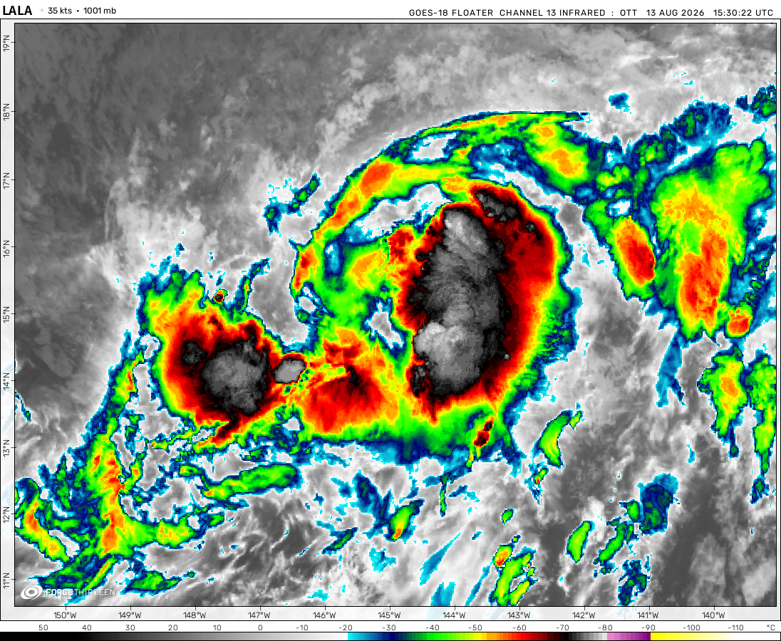 View more imageryAnimated GIF
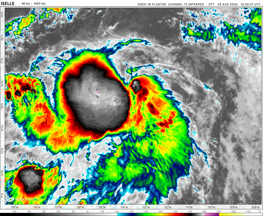 View more imageryAnimated GIF
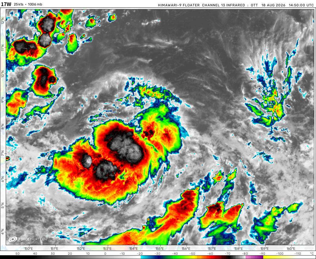 View more imageryAnimated GIF
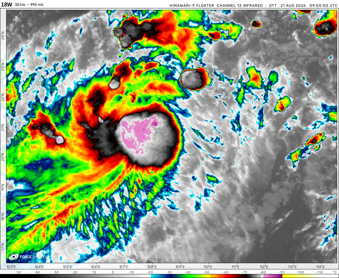 View more imageryAnimated GIF
 View more imageryAnimated GIF
 View more imageryAnimated GIF
 View more imagery
 View more imageryAnimated GIF
 View more imageryAnimated GIF
That’s bull how isn’t 09L Isaias
92-L is becoming a tropical depression
doesn’t show any storms, although there are.
The tracker is automated by the ATCF
https://www.nrlmry.navy.mil/tcdat/sectors/interp_sector_file
We have no control when the ATCF goes down.
I think the problem is that the map is using the Asia-Australia-America format, and not the standard America-Asia-Australia format. If you don’t understand, that’s perfectly ok!
And yes, I know it’s automated by that, just saying.
thats a lot of tropical storms.
92L expected to become Isaias in the next few days
Douglas currently impacting Hawaii, may make it to WPAC, first since Olivia 2018 and second since Genevieve 2014
Why is it saying 0 systems active if there is Invest 92L,Hurricane Hanna,and Hurricane Douglas? Please kindly fix the Cyclone Tracker.
The tracker is automated by the ATCF
https://www.nrlmry.navy.mil/tcdat/sectors/interp_sector_file
We have no control when the ATCF goes down.
Hurricane hanna reach a cat 1
Gonzalo has officially been declared a sad storm (Chantal 2013 2.0?)
Hanna may reach hurricane status just before landfall in Texas
Douglas still forecast to impact Hawaii
Wave in Eastern Atlantic has a good chance of forming next week
0haishen is noq a category 5
Ohmygod
The map doesn’t show Hurricane Douglas, Tropical Depression Eight, and Tropical Storm Douglas
The tracker is automated by the ATCF
https://www.nrlmry.navy.mil/tcdat/sectors/interp_sector_file
We have no control when the ATCF goes down.
The eye of hurricane Douglas is really starting to show now I’m predicting a peak of 130 mph and a pressure of 956 mbar
Gonzalo to reach hurricane strength
91L may become Hanna in the next few days
Douglas to strengthen to major status before a possible landfall in Hawaii as a TS
oof 3 storms active, wonder if that ts invest will also become a hurricane
Hurricane Douglas has formed, and it’s continuing to strengthen.
hurricane douglas in epac and tropical storm gonzalo strenghtening to hurricane status in the atlantic
Eloise is not dissipating quick and the update has it tha same way
As I can see Douglas is redeeming his energy from Steven-E while it shrinks and grow
tropical storm douglas is becoming a hurricane in the epac and 90L is dissipating over texas, 91L formed and 99L is becoming tropical depression 7L
To be honest, I think both storms in the Atlantic will become at least a tropical depression.
Predictions-
Gulf AOI (near cuba) – 60 Mph
Invest 99l – 85-100 Mph
Douglas – 95 Mph
90L will not develop
99L forecasted to develop over this week, may become Gonzalo
07E to dissipate eventually
08E forecast to become Hurricane Douglas
Gonzalo/07L to form later today
tropical depression 7-e formed and potential tropical cyclone 8-e in the epac and invest 99-l might form into a tropical cyclone in the next few days in the atlantic