Hurricane Fausto was located near 20.0°N, 143.0°W, or about 785 miles (1264 km) east of Hilo, Hawaii. Fausto has maximum sustained winds of 75 knots and a minimum central pressure of 984 millibars.
Hurricane Genevieve was located near 14.4°N, 110.8°W, or about 304 miles (489 km) south of Socorro Island, Mexico. Genevieve has maximum sustained winds of 130 knots and a minimum central pressure of 934 millibars.
The remnants of Noul was located near 25.7°N, 114.2°E, or about 234 miles (376 km) north of Hong Kong. Noul has maximum sustained winds of 20 knots and a minimum central pressure of 1000 millibars.
Invest 92C was located near 12.8°N, 178.4°E, or about 899 miles (1447 km) east-southeast of Wake Island. 92C has maximum sustained winds of 30 knots and a minimum central pressure of 1002 millibars.
Invest 93B was located near 21.2°N, 88.3°E, or about 95 miles (153 km) south of Kolkata, India. 93B has maximum sustained winds of 25 knots and a minimum central pressure of 993 millibars.
The ATCF still needs to be fixed… Anyway.
My prediction is that Invest 90B is not expected to develop as it moves over land.
90W could see some development once it moves over water.
i know. teddy is a 969mb storm, 2 invests west of africa, a tropical depression south east of corpus christi, tx, remnants of rene, paulette, vicky, and subtropical storm alpha in portugal.
Cookies help us ensure our site works securely, continually make improvements, and personalize your browsing experience.
Click 'Accept All Cookies' to get the best browsing experience. You can change these settings at any time by clicking 'Manage My Cookies' below.
Functional
Always active
The technical storage or access is strictly necessary for the legitimate purpose of enabling the use of a specific service explicitly requested by the subscriber or user, or for the sole purpose of carrying out the transmission of a communication over an electronic communications network.
Preferences
The technical storage or access is necessary for the legitimate purpose of storing preferences that are not requested by the subscriber or user.
Statistics
The technical storage or access that is used exclusively for statistical purposes.The technical storage or access that is used exclusively for anonymous statistical purposes. Without a subpoena, voluntary compliance on the part of your Internet Service Provider, or additional records from a third party, information stored or retrieved for this purpose alone cannot usually be used to identify you.
Marketing
The technical storage or access is required to create user profiles to send advertising, or to track the user on a website or across several websites for similar marketing purposes.

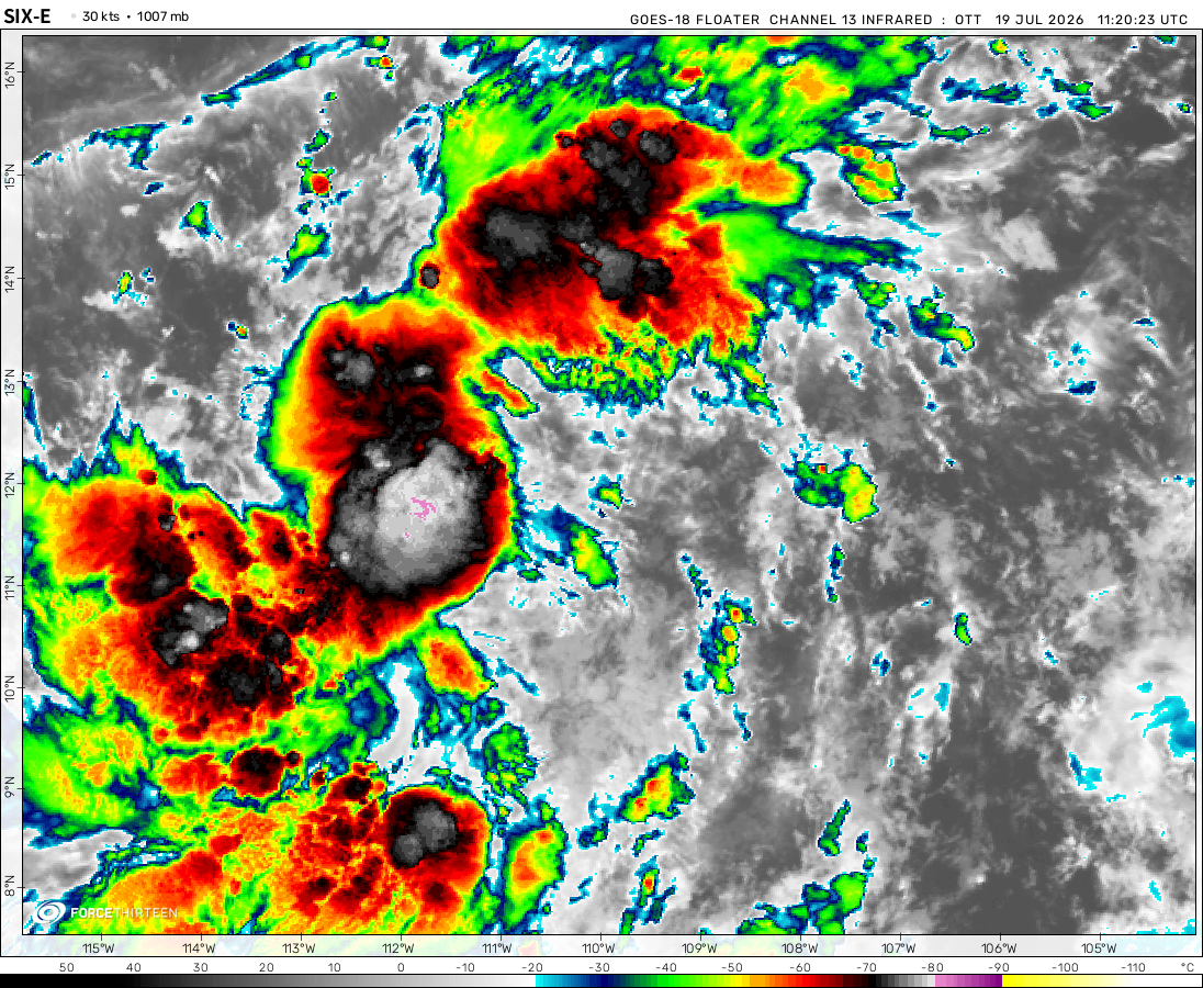 View more imageryAnimated GIF
 View more imageryAnimated GIF
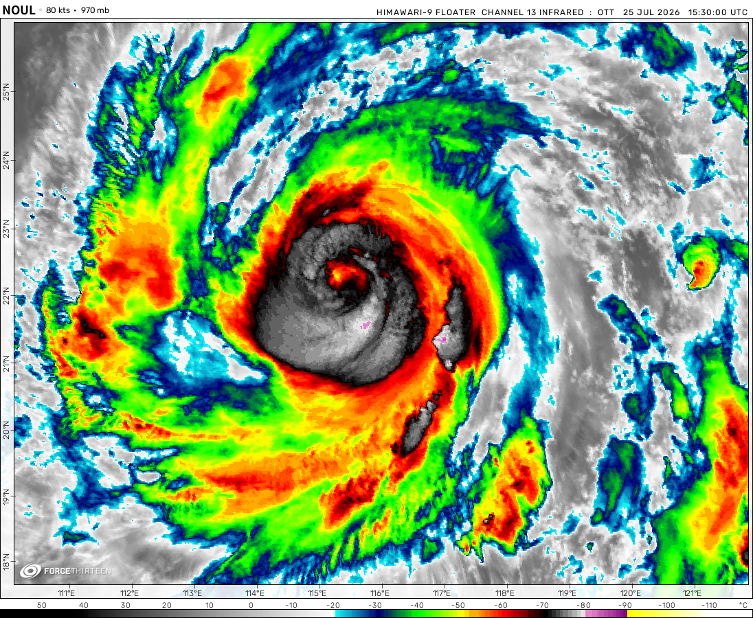 View more imageryAnimated GIF
 View more imageryAnimated GIF
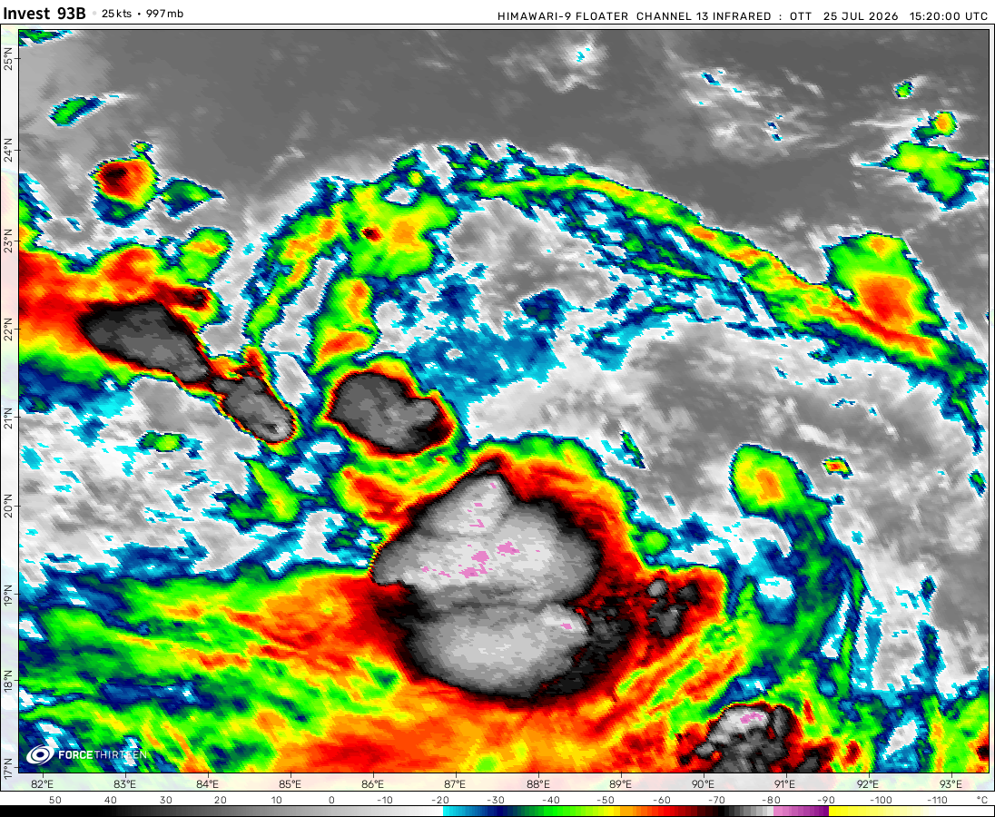 View more imageryAnimated GIF
nice job
This is a disappointment i dont see any storms in the atlantic
it dont shows ts beta huricane teddy and ts wilfred
ATCF died…..
According to this cyclone tracker, Invest 91W has is a 0 millibar low-pressure system, moving -9999.99 degrees at -10000 mph.
A tropical depression formed in the Mediterranean (01M)
moving
-9999.99°
at -10000mph
?????
This database is really messed up.
The ATCF still needs to be fixed… Anyway.
My prediction is that Invest 90B is not expected to develop as it moves over land.
90W could see some development once it moves over water.
Actually 5 now
lol this is hurricane war
It’s back yay ?
atlantic is super active with 4 cyclones
i know. teddy is a 969mb storm, 2 invests west of africa, a tropical depression south east of corpus christi, tx, remnants of rene, paulette, vicky, and subtropical storm alpha in portugal.
Why are the comments being held back lol
Doesn’t show TS Sally, TS Paulette, TD Rene, or TD 20L.
the website isn’t working very well but it does show up every once in a while
same
Hey
no its BACK!
it broke?
Yeah it kinda is
yeah :[
really is no system?
Have Haishen,Julio and ex-Omar
0haishen is noq a category 5
My estimates for Haishen are 175 mph 904 mbar
I ALMOST GOT HIT BY SUPER TYPHOON GONI
some one hurricane nana, get cross
Warning!!!
Hsishen intensified to a category 5 super typhoon!!!
Haishen is now a exremely powerful, dangerous and deadly super typhoon!!