As of 15:45 UTC on May 16th, Cyclone Ialy was located near 9.4°S, 52.3°E, or approximately 635 miles (1022 km) east-northeast of Moroni, Comoros. Ialy has maximum sustained winds of 38 knots and a minimum central pressure of 1000 millibars.
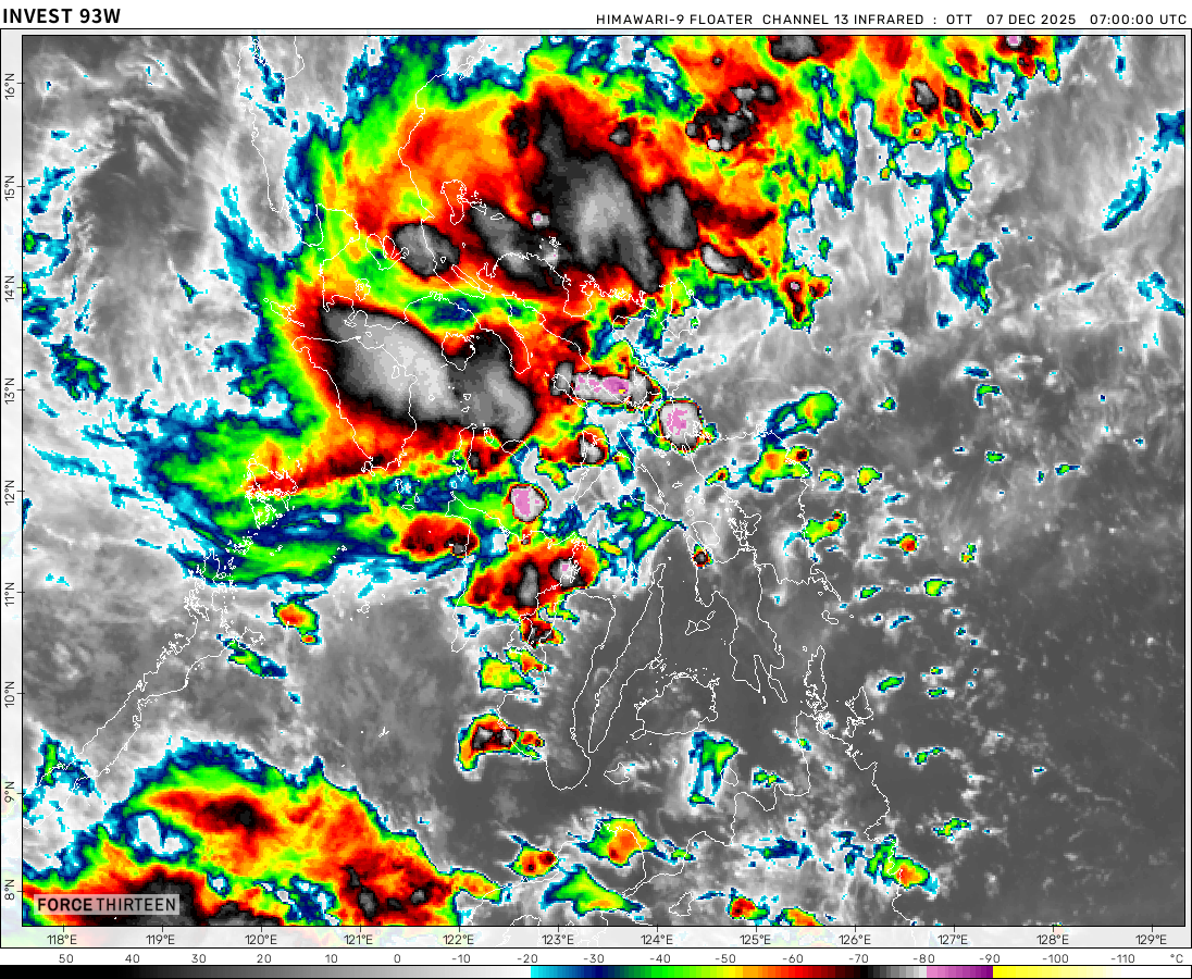
As of 15:45 UTC on May 16th, Invest 93W was located near 5.5°N, 142.7°E, or approximately 420 miles (675 km) southeast of Yap, Micronesia. 93W has maximum sustained winds of 15 knots and a minimum central pressure of 1005 millibars.
Now he says “And in the central pacific, we are still waiting for Hone. It’s been 5 years!”
F13 Fan
1 month ago
Also 95S has formed
F13 Fan
1 month ago
This is actually turning into 2023-24 Hypothetical Litia Von Lucernea season!
CyclonicUpdates
1 month ago
Mar 20, 2024: Currently, the storm on the right is what’s left of Cyclone Megan, which peaked on Mar 17 at about
105 mph and a pressure of 957 mb according to zoom earth.On the left is Cyclone Neville, which is peaking at about 80 mph and a pressure of 983 mb according to zoom earth and is forecasted to move west while continuing to strengthen.
acay
1 month ago
if u come across this post, dislike it
justmeranti
1 month ago
Babe wake up, Neville just got named.
acay
1 month ago
mine is RIPE
acay
1 month ago
tell me a word that best describes the environmental conditions where Megan is located just few days ago?
According to OW/HS, they are expecting that this storm is expected to make a tropical storm landfall in Mozambique early tomorrow. This storm is already producing about 7 inches of rain on the coast. After that, they expect that it will slowly move away in the cold Indian Ocean, affecting none.
Current Wind: 70 MPH
Pressure: 997 MB
Moving 7 MPH NW


Potential Gamane: MaUrItIoUs Im CoMiN fOr U
Mauritius: NOOOOOOOOOOO! I’m still recovering from Freddie and I have scars from Belal
Force thirteen when will you make the 2023 NIO season?
….
i hope one day there will be a wind shear analysis map in this website
The most popular thing F13 has said is… “And in the central pacific, we are still waiting for Hone.”
Now he says “And in the central pacific, we are still waiting for Hone. It’s been 5 years!”
Also 95S has formed
This is actually turning into 2023-24 Hypothetical Litia Von Lucernea season!
Mar 20, 2024: Currently, the storm on the right is what’s left of Cyclone Megan, which peaked on Mar 17 at about
105 mph and a pressure of 957 mb according to zoom earth.On the left is Cyclone Neville, which is peaking at about 80 mph and a pressure of 983 mb according to zoom earth and is forecasted to move west while continuing to strengthen.
if u come across this post, dislike it
Babe wake up, Neville just got named.
mine is RIPE
tell me a word that best describes the environmental conditions where Megan is located just few days ago?
megan’s trying to open an eye
POV: MEGAN HENDERSON TRIES TO BECOME A CYCLONE
Megan reached category 3 on Zoom earth
Is that a HURRICANE in the extreame north Atlantic?
Nope, its an extratropical cyclone with a tropical storm force winds. Just telling lol
That is spinning!!!!!!!!!!!!!
What
Tip’s record has been broken!
Ahah
According to OW/HS, they are expecting that this storm is expected to make a tropical storm landfall in Mozambique early tomorrow. This storm is already producing about 7 inches of rain on the coast. After that, they expect that it will slowly move away in the cold Indian Ocean, affecting none.
Current Wind: 70 MPH
Pressure: 997 MB
Moving 7 MPH NW
Things are active again!
Hi I’m back again.