The remnants of Saudel was located near 27.5°N, 116.6°E, or about 352 miles (566 km) west-northwest of Taipei City, Taiwan. Saudel has maximum sustained winds of 20 knots and a minimum central pressure of 994 millibars.
Tropical Storm Dolly was located near 14.8°N, 45.8°W, or about 813 miles (1309 km) north-northeast of Cayenne, French Guiana. Dolly has maximum sustained winds of 35 knots and a minimum central pressure of 1008 millibars.
Tropical Storm Karina was located near 12.9°N, 114.7°W, or about 377 miles (607 km) south of Clarion Island, Mexico. Karina has maximum sustained winds of 45 knots and a minimum central pressure of 999 millibars.
Tropical Storm Lowell was located near 12.3°N, 132.7°W, or about 1268 miles (2040 km) west-southwest of Clarion Island, Mexico. Lowell has maximum sustained winds of 40 knots and a minimum central pressure of 1003 millibars.
Typhoon Bang-lang was located near 19.5°N, 166.5°E, or about 18 miles (29 km) north-northwest of Wake Island. Bang-lang has maximum sustained winds of 65 knots and a minimum central pressure of 984 millibars.
Tropical Storm Etau was located near 25.2°N, 166.5°E, or about 409 miles (658 km) north of Wake Island. Etau has maximum sustained winds of 45 knots and a minimum central pressure of 990 millibars.
Invest 92W was located near 24.9°N, 125.5°E, or about 14 miles (23 km) northeast of Miyako Island, Japan. 92W has maximum sustained winds of 15 knots and a minimum central pressure of 1002 millibars.
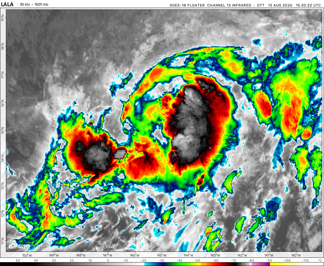
The remnants of Lala was located near 38.1°N, 179.1°W, or about 691 miles (1112 km) north of Midway Atoll. Lala has maximum sustained winds of 35 knots and a minimum central pressure of 1003 millibars.
Latest update on 2024 Atlantic Hurricane Season!!
Recently, a system has been monitered near to Gulf, but thankfully it died! It was the first system of the atlantic!
Hidaya is looking like its rain might be a threat to the southern coast of tanzania the icon model shows very little if any rain from Hidaya while the gfs predicts a landfall and the emcwf looks like it predicts a wind gusts on the coast are gonna be 40 mph to 50mph without a land fall and heavy rain very interesting…
Is that photo using radar that indicates wind? I just can’t wait for the 2024 Atlantic hurricane season to start. I heard it would be crazy, plenty of cities have a much larger chance of being hit.
Cookies help us ensure our site works securely, continually make improvements, and personalize your browsing experience.
Click 'Accept All Cookies' to get the best browsing experience. You can change these settings at any time by clicking 'Manage My Cookies' below.
Functional
Always active
The technical storage or access is strictly necessary for the legitimate purpose of enabling the use of a specific service explicitly requested by the subscriber or user, or for the sole purpose of carrying out the transmission of a communication over an electronic communications network.
Preferences
The technical storage or access is necessary for the legitimate purpose of storing preferences that are not requested by the subscriber or user.
Statistics
The technical storage or access that is used exclusively for statistical purposes.The technical storage or access that is used exclusively for anonymous statistical purposes. Without a subpoena, voluntary compliance on the part of your Internet Service Provider, or additional records from a third party, information stored or retrieved for this purpose alone cannot usually be used to identify you.
Marketing
The technical storage or access is required to create user profiles to send advertising, or to track the user on a website or across several websites for similar marketing purposes.

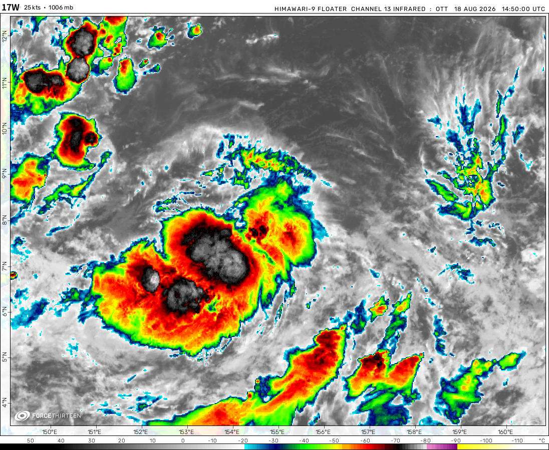 View more imagery
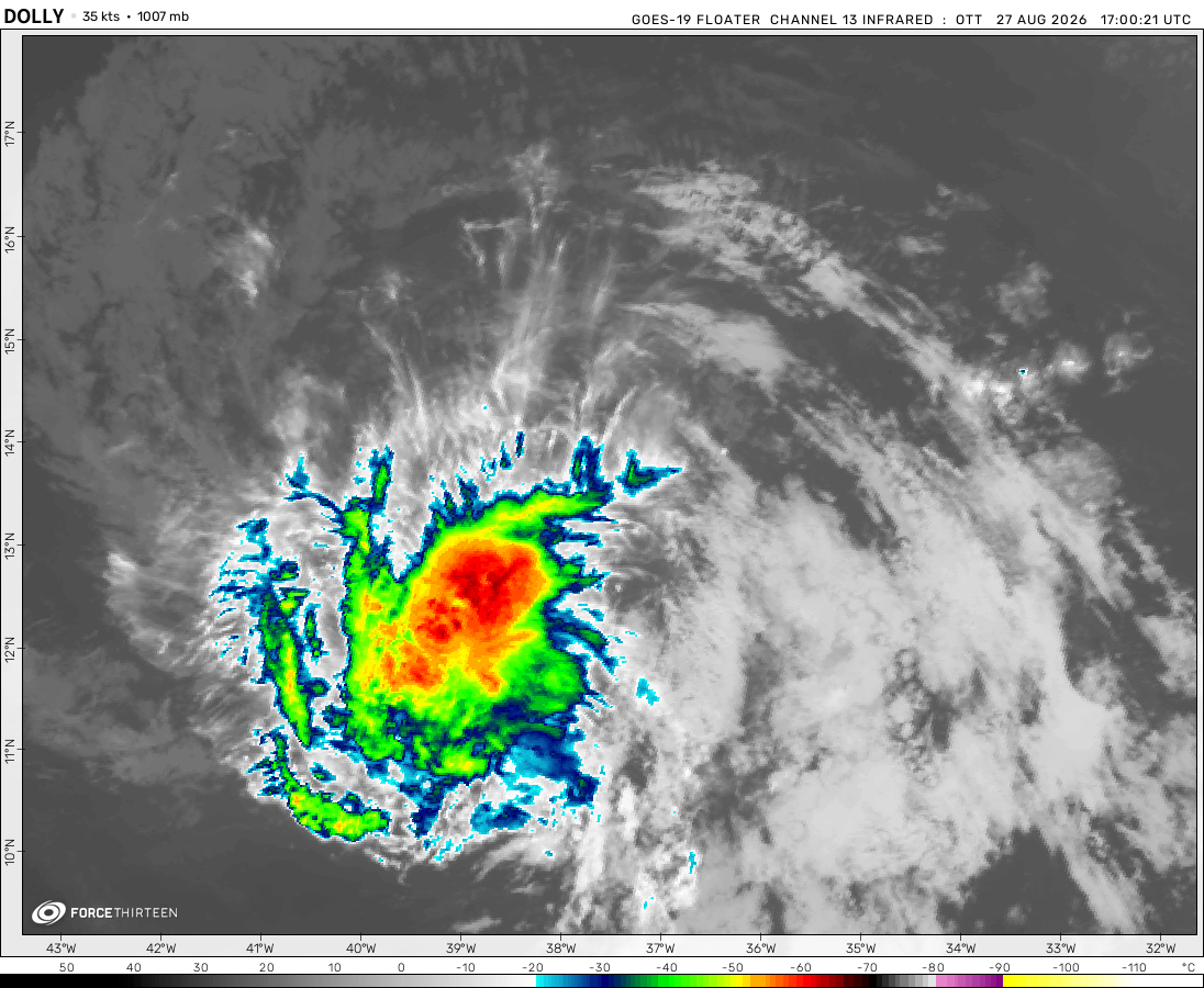 View more imageryAnimated GIF
 View more imageryAnimated GIF
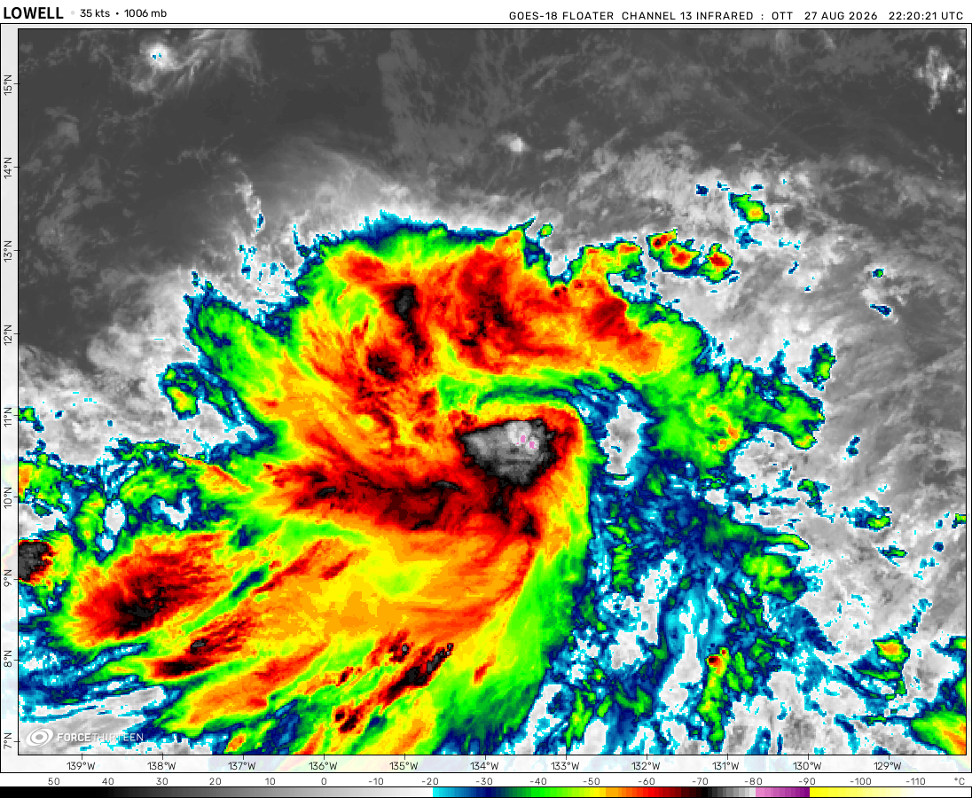 View more imageryAnimated GIF
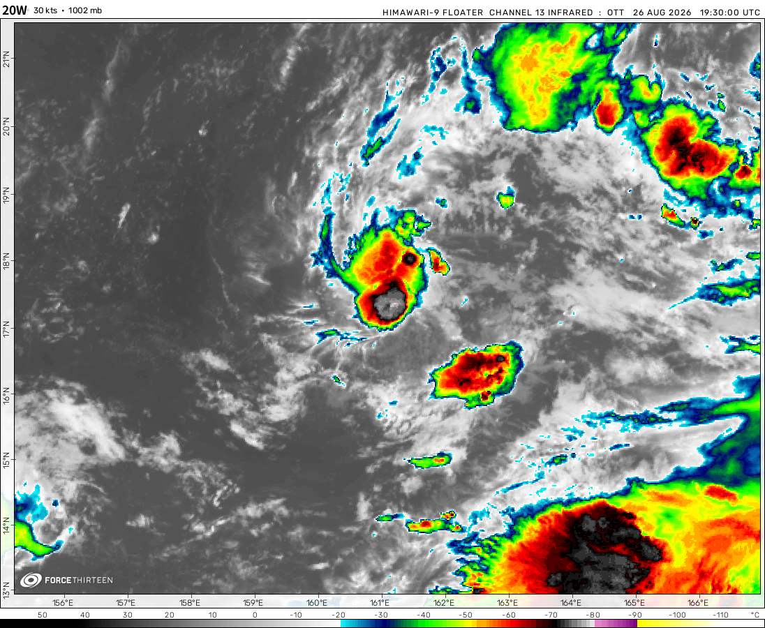 View more imageryAnimated GIF
 View more imageryAnimated GIF
 View more imagery
 View more imageryAnimated GIF
i wish there were a wind shear analysis on this website, it would be a nice combo
There is a wind shear analysis now. Yay!
Latest update on 2024 Atlantic Hurricane Season!!
Recently, a system has been monitered near to Gulf, but thankfully it died! It was the first system of the atlantic!
Nooooooooooooooooooooooooooooooooooooooooooooooooooooooooooooooooooooooooooooooooooooooooooooooooooooooooooooooooooooooooo!
Time to do our spanish lessons!
No!
What are you doing? Advertising?
?ban = Duolingo(online)
how can ewiniar intensify despite the land interactions?
Idk
The warm waters around tayabas bay caused ewiniar to intensify slightly (even showing a rugged eye thereafter)
Sick, it’s trying to clear its eye. Land interaction can take down even the mightiest of a storm, but it can still thriving
Humidity?
How did I get dis much storms from 1 swio season
what are the factors that can boost a tropical storm’s outflow?
these systems dont have enough time to explode (literally)
anyways if you come across this post, dislike it (that also means u like it)
sad man, people aint liking it
A weak disturbance in the Atlantic? Perhaps the start of the long-awaited season.
Man, who’s waiting for Ewiniar
“Finally they made Ewiniars faster!”
Ialy somehow still surviving as a TS with high windshear & low Coriolis forces!
Remal could form & make landfall in Odisha as a cat 2
It looks impressive on satellite and we all know its gonna be a very interesting system
extreme thunderstorms for my area hurricane force windgusts
OH NO ITS CLONE RIGGY (Fabien)
what is going on with the sst?!?!?!?
AYO!!!!!! Fabien 2.0?
yooooo the sequel better be good
Tracking 92W on Zoom Earth!
can tropical storms form inland and move out to the sea
Yes.
Hurricane Barry 2019https://en.wikipedia.org/wiki/Hurricane_Barry_(2019)
This tornado touched down near my house yesterday.
It’s false, I know this photo. It is in a 2019 book.
I meant a tornado similar to this one did
Ok excuse me
Hidaya is looking like its rain might be a threat to the southern coast of tanzania the icon model shows very little if any rain from Hidaya while the gfs predicts a landfall and the emcwf looks like it predicts a wind gusts on the coast are gonna be 40 mph to 50mph without a land fall and heavy rain very interesting…
Is that photo using radar that indicates wind? I just can’t wait for the 2024 Atlantic hurricane season to start. I heard it would be crazy, plenty of cities have a much larger chance of being hit.
noooo