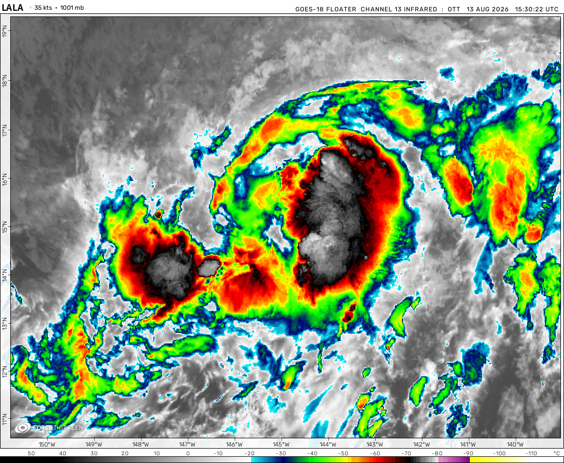
Tropical Storm Lala was located near 36.2°N, 178.4°W, or about 555 miles (894 km) north of Midway Atoll. Lala has maximum sustained winds of 40 knots and a minimum central pressure of 999 millibars.
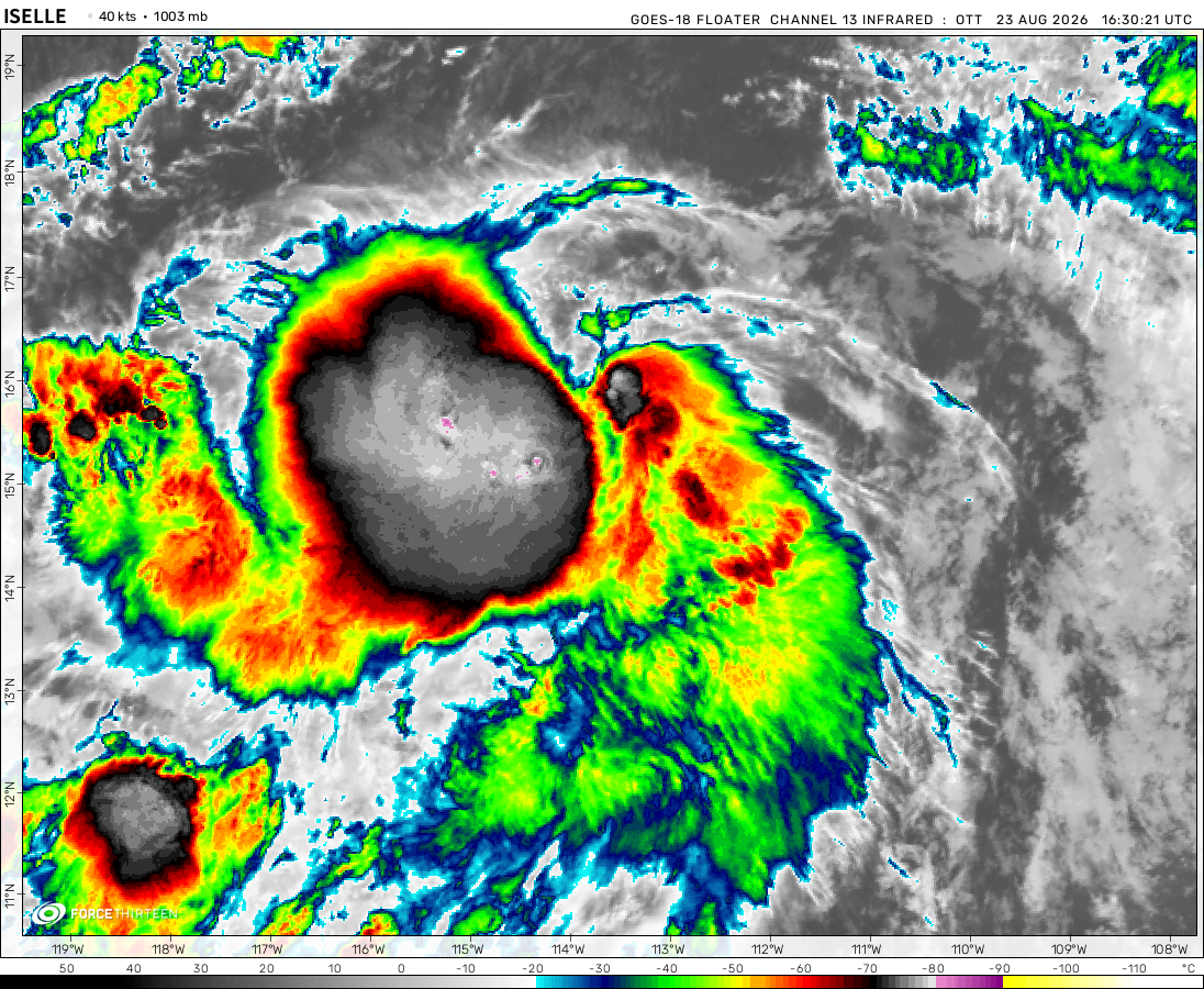
Tropical Depression Iselle was located near 22.8°N, 125.5°W, or about 761 miles (1225 km) west-northwest of Clarion Island, Mexico. Iselle has maximum sustained winds of 30 knots and a minimum central pressure of 1002 millibars.
Typhoon Saudel was located near 28.6°N, 124.9°E, or about 234 miles (376 km) northwest of Kadena, Okinawa. Saudel has maximum sustained winds of 75 knots and a minimum central pressure of 967 millibars.
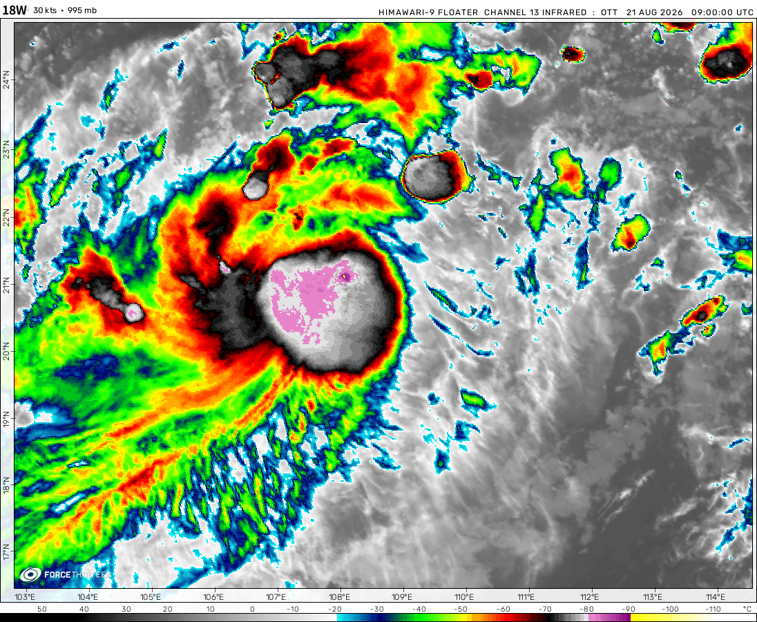
The remnants of Narra was located near 22.7°N, 113.7°E, or about 40 miles (64 km) northwest of Hong Kong. Narra has maximum sustained winds of 15 knots and a minimum central pressure of 1003 millibars.
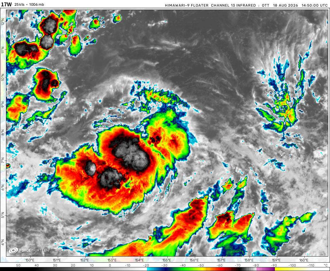
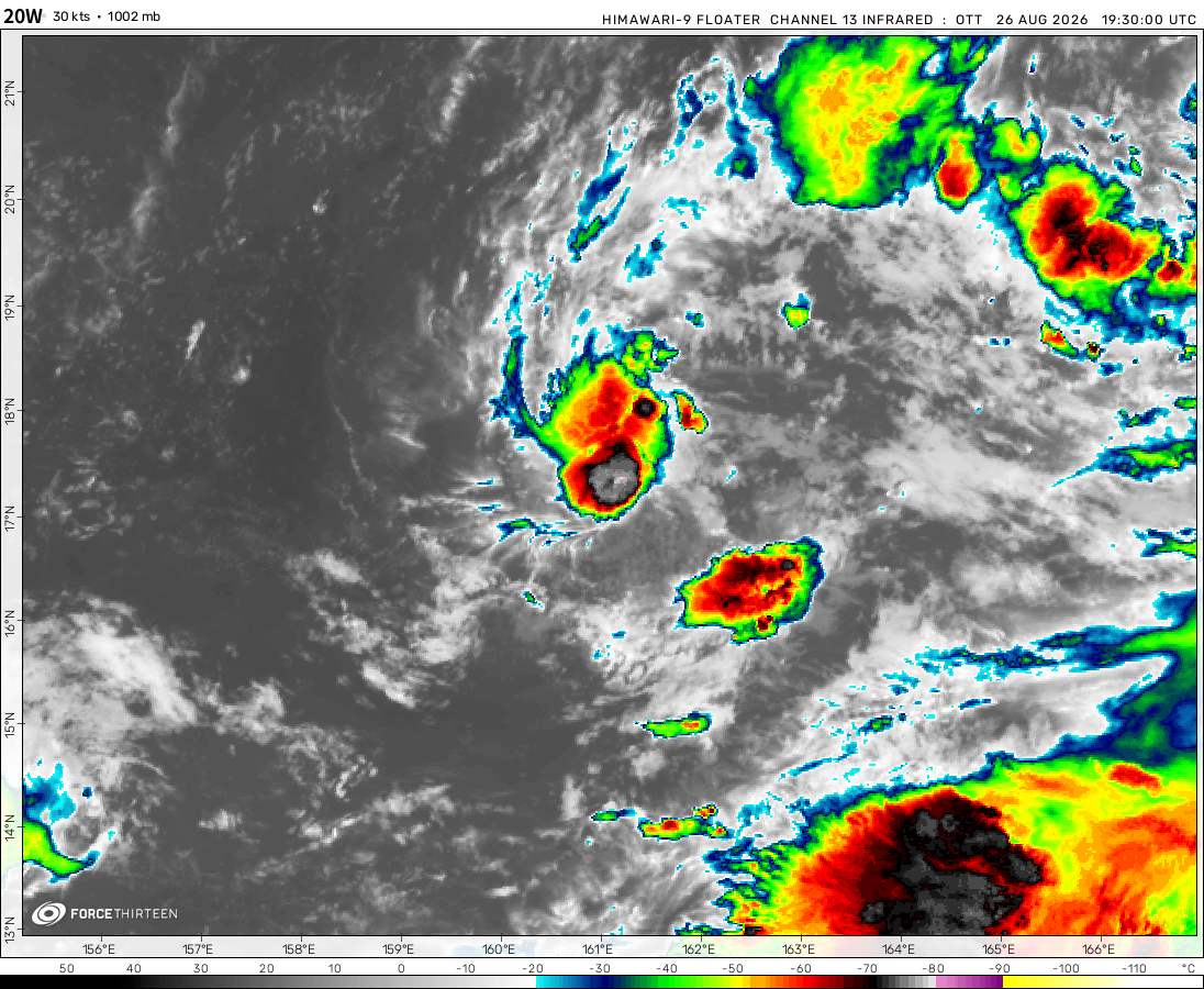
Tropical Depression 20W was located near 16.8°N, 161.4°E, or about 385 miles (620 km) west-southwest of Wake Island. 20W has maximum sustained winds of 30 knots and a minimum central pressure of 1002 millibars.
Tropical Storm 21W was located near 20.4°N, 167.7°E, or about 103 miles (166 km) northeast of Wake Island. 21W has maximum sustained winds of 35 knots and a minimum central pressure of 1000 millibars.
ATCF®
- Latest Information -
As of August 27th 2026 at 06:16 UTC
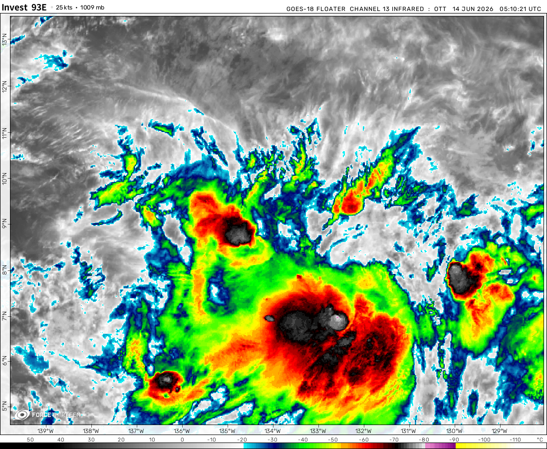
Invest 93E was located near 9.5°N, 107.5°W, or about 683 miles (1099 km) south-southeast of Socorro Island, Mexico. 93E has maximum sustained winds of 25 knots and a minimum central pressure of 1006 millibars.
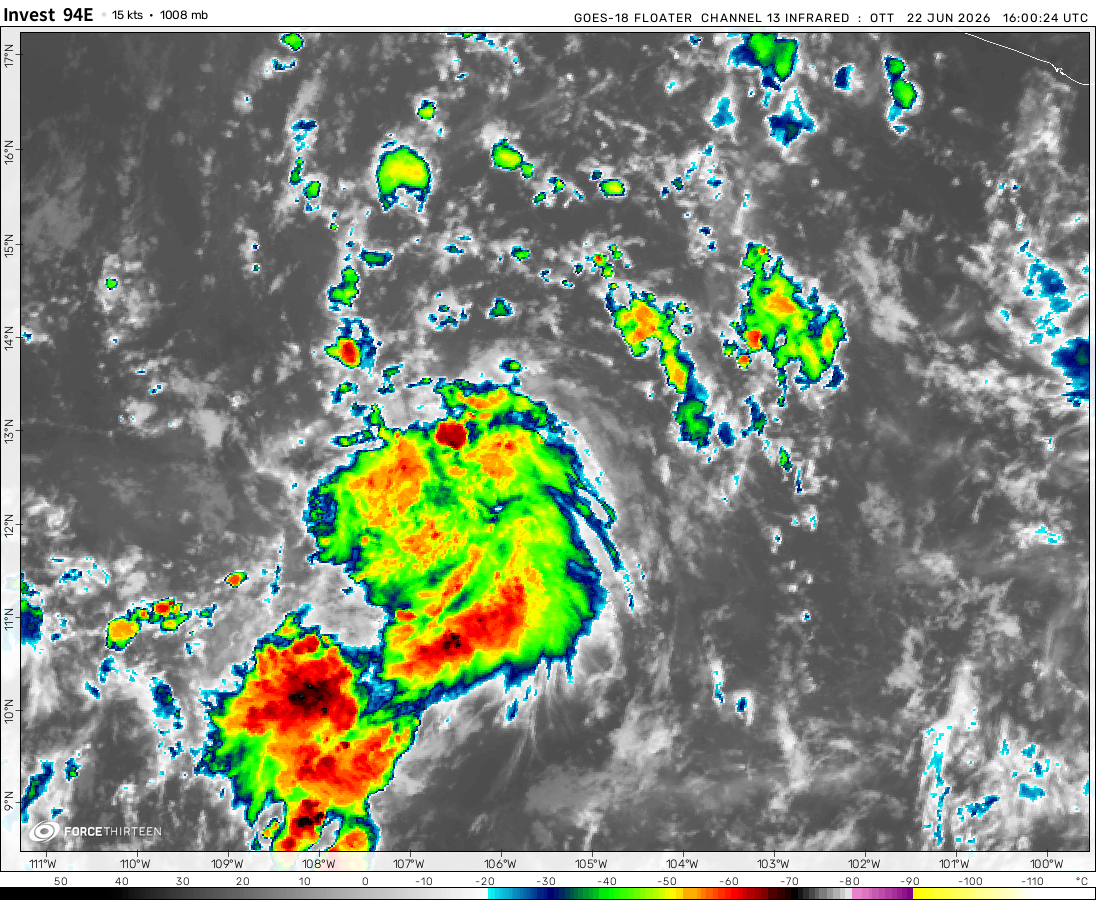
Invest 94E was located near 10.9°N, 135.0°W, or about 1448 miles (2331 km) west-southwest of Clarion Island, Mexico. 94E has maximum sustained winds of 20 knots and a minimum central pressure of 1009 millibars.
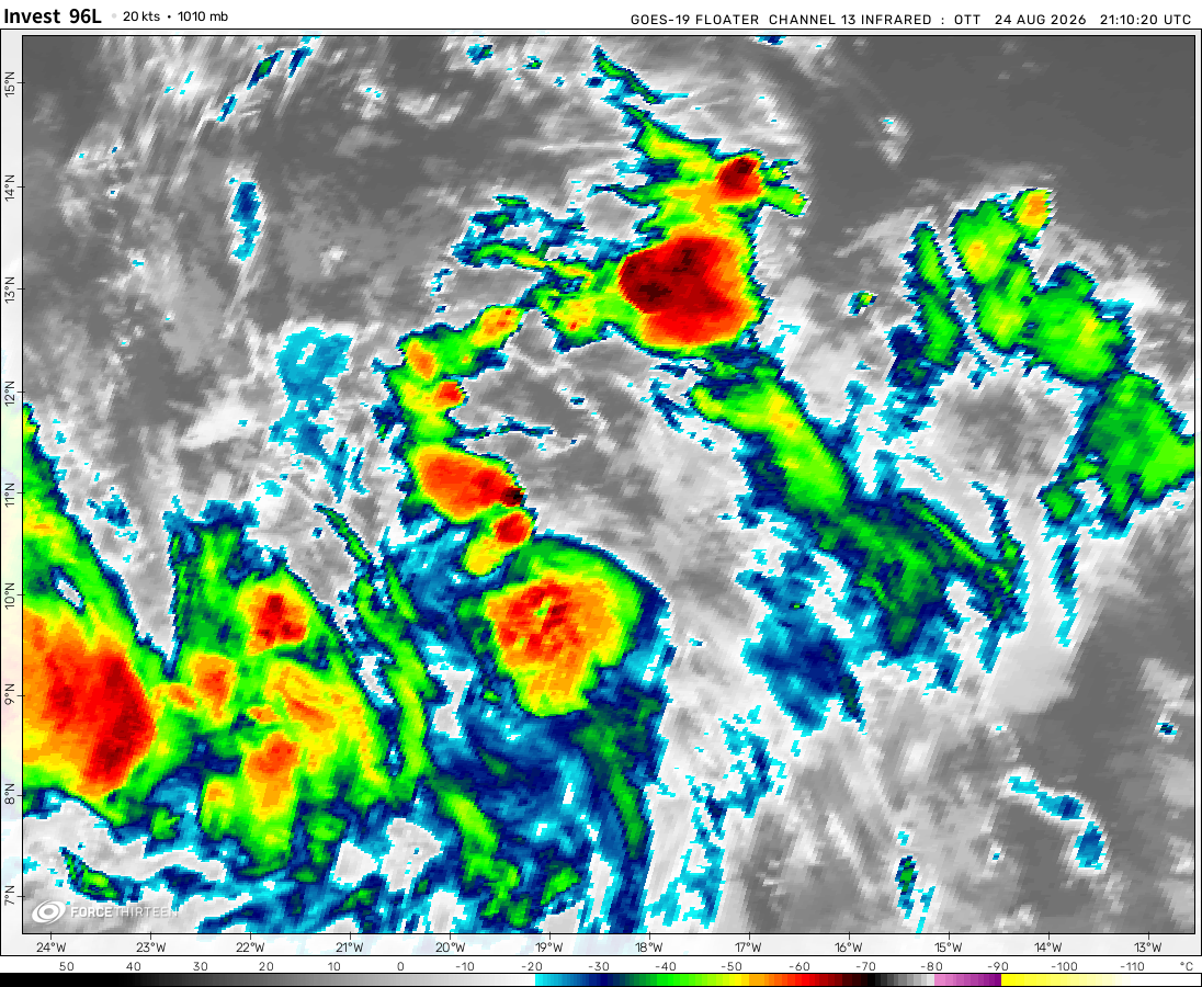
Invest 96L was located near 13.2°N, 33.1°W, or about 598 miles (963 km) west-southwest of Mindelo, Cabo Verde. 96L has maximum sustained winds of 30 knots and a minimum central pressure of 1007 millibars.
WHAT THE FLORENCE- the nhc combined the epac and cpac outlooks under the identity of the epac outlook
F0rce-23/FAN
1 year ago
Well that lasted…shorter than I expected.
Hurricane
1 year ago
40% in EPAC 7-day outlook on the NHC now.
casualcyclonetrackerguy
1 year ago
welp, alvin’s disorganized. we’ll have to wait for the next storm.
F0rce-23/FAN
1 year ago
NO NO NO NO NO NO NO NO NO NO NO NO NO NO NO NO NO NO NO NO NO NO NO NO NO NO NO NO NO NO NO NO NO NO NO NO NO NO NO NO NO NO NO NO NO NO NO NO NO NO NO NO NO NO NO NO NO NO NO NO NO NO NO NO NO NO NO NO NO NO NO NO NO NO NO NO NO NO NO NO NO NO NO NO NO NO NO NO NO NO NO NO NO NO NO NO NO NO NO NO NO NO NO NO NO NO NO NO NO NO NO NO NO NO NO NO NO NO NO NO NO NO NO NO NO NO NO NO NO NO NO NO NO NO NO NO NO NO NO NO NO NO NO NO NO NO NO NO NO NO NO NO NO NO NO NO NO NO NO NO NO NO NO NO NO NO NO NO NO NO NO NO NO NO NO NO NO NO NO NO NO NO NO NO NO NO NO NO NO NO NO NO NO NO NO NO NO NO NO NO NO NO NO NO NO NO NO NO NO NO NO NO NO NO NO NO NO NO NO NO NO NO NO NO NO NO NO NO NO NO NO NO NO NO NO NO NO NO NO NO NO NO NO NO NO NO NO NO NO NO NO NO NO NO NO NO NO NO NO NO NO NO NO NO NO NO NO NO NO NO NO NO NO NO NO NO NO NO NO NO NO NO NO NO NO NO NO NO NO NO NO NO NO NO NO NO NO NO NO NO NO NO NO NO NO NO NO NO NO NO NO NO NO NO NO NO NO NO NO NO NO NO NO NO NO NO NO NO NO NO NO NO NO NO NO NO NO NO NO NO NO NO NO NO NO NO NO NO NO NO NO NO NO NO NO NO NO NO NO NO NO NO NO NO NO NO NO NO NO NO NO NO NO NO NO NO NO NO NO NO NO NO NO NO NO NO NO NO NO NO NO NO NO NO NO NO NO NO NO NO NO NO NO NO NO NO NO NO NO NO NO NO NO NO NO NO NO NO NO NO NO NO NO NO NO NO NO NO NO NO NO NO NO NO NO NO NO NO NO NO NO NO NO NO NO NO NO NO
Ok, there are 21 total rows, and per row there is 59 emojis, now multiply that, 21×59=1239, but I didn’t forget about that last emoji row, which has 49, so, the formula is: 21×59+49= 1298 emojis.
The way that Tropical Tidbits creates images of the GFS model runs includes some features being layered above others, with some numbers erased to make space for such features.
Not lately, with all these active seasons we’ve been having. Remember 2020?
Force 13 Fanatic
1 year ago
HOLD YOUR HORSES EVERYONE!
A tropical depression has formed in the Eastern Pacific basin. Tagged as 01E by the National Hurricane Center, it is expected to move westward and strengthen into a tropical storm. Once it strengthens into a tropical storm, it will turn northward and affect the Baja California peninsula. If it were to strengthen into a tropical storm, it will be named Alvin.
THIS DOES NOT MEAN PARTY RIGHT NOW! ALVIN HAS NOT BEEN NAMED YET! ONCE IT IS NAMED WE ALL PARTY LIKE THERE IS NO TOMORROW!!!
confirmed tropical depression in east pacific by nhc!!
StormTracker2025
1 year ago
Looks like a PTC, not a depression or storm, however will likely develop into one.
F13F
1 year ago
Updates on the North Atlantic Hurricane Season: A storm has formed, or is beginning to form near Mexico, currently at a 100 percent chance of formation, although it hasn’t formed yet. It should be named.
I just now realize I didn’t mean to say ‘name’ (as a verb) but I don’t seem to have the option to edit my comment anymore. Whoops!
Nat
1 year ago
Wow
F13F
1 year ago
ZCZC MIATWOEP ALL
TTAA00 KNHC DDHHMM

Tropical Weather Outlook
NWS National Hurricane Center Miami FL
500 AM PDT Tue May 27 2025

For the eastern North Pacific...east of 140 degrees west longitude:

1. South of the Southern Coast of Mexico (EP90):
Showers and thunderstorms are gradually becoming better organized
near a broad area of low pressure located several hundred miles
south of the coast of southern Mexico.  While the system
currently lacks a well-defined circulation, environmental
conditions are favorable for further development, and a tropical
depression or tropical storm is expected to form during the next
day or two as the low moves generally west-northwestward at around
10 mph.
* Formation chance through 48 hours...high...90 percent.
* Formation chance through 7 days...high...90 percent.


Forecaster Blake/Mora
Cookies help us ensure our site works securely, continually make improvements, and personalize your browsing experience.
Click 'Accept All Cookies' to get the best browsing experience. You can change these settings at any time by clicking 'Manage My Cookies' below.
Functional
Always active
The technical storage or access is strictly necessary for the legitimate purpose of enabling the use of a specific service explicitly requested by the subscriber or user, or for the sole purpose of carrying out the transmission of a communication over an electronic communications network.
Preferences
The technical storage or access is necessary for the legitimate purpose of storing preferences that are not requested by the subscriber or user.
Statistics
The technical storage or access that is used exclusively for statistical purposes.The technical storage or access that is used exclusively for anonymous statistical purposes. Without a subpoena, voluntary compliance on the part of your Internet Service Provider, or additional records from a third party, information stored or retrieved for this purpose alone cannot usually be used to identify you.
Marketing
The technical storage or access is required to create user profiles to send advertising, or to track the user on a website or across several websites for similar marketing purposes.

 View more imageryAnimated GIF
 View more imageryAnimated GIF
 View more imageryAnimated GIF
 View more imageryAnimated GIF
 View more imageryAnimated GIF
 View more imageryAnimated GIF
 View more imagery
 View more imageryAnimated GIF
WHAT THE FLORENCE- the nhc combined the epac and cpac outlooks under the identity of the epac outlook
Well that lasted…shorter than I expected.
40% in EPAC 7-day outlook on the NHC now.
welp, alvin’s disorganized. we’ll have to wait for the next storm.
NO NO NO NO NO NO NO NO NO NO NO NO NO NO NO NO NO NO NO NO NO NO NO NO NO NO NO NO NO NO NO NO NO NO NO NO NO NO NO NO NO NO NO NO NO NO NO NO NO NO NO NO NO NO NO NO NO NO NO NO NO NO NO NO NO NO NO NO NO NO NO NO NO NO NO NO NO NO NO NO NO NO NO NO NO NO NO NO NO NO NO NO NO NO NO NO NO NO NO NO NO NO NO NO NO NO NO NO NO NO NO NO NO NO NO NO NO NO NO NO NO NO NO NO NO NO NO NO NO NO NO NO NO NO NO NO NO NO NO NO NO NO NO NO NO NO NO NO NO NO NO NO NO NO NO NO NO NO NO NO NO NO NO NO NO NO NO NO NO NO NO NO NO NO NO NO NO NO NO NO NO NO NO NO NO NO NO NO NO NO NO NO NO NO NO NO NO NO NO NO NO NO NO NO NO NO NO NO NO NO NO NO NO NO NO NO NO NO NO NO NO NO NO NO NO NO NO NO NO NO NO NO NO NO NO NO NO NO NO NO NO NO NO NO NO NO NO NO NO NO NO NO NO NO NO NO NO NO NO NO NO NO NO NO NO NO NO NO NO NO NO NO NO NO NO NO NO NO NO NO NO NO NO NO NO NO NO NO NO NO NO NO NO NO NO NO NO NO NO NO NO NO NO NO NO NO NO NO NO NO NO NO NO NO NO NO NO NO NO NO NO NO NO NO NO NO NO NO NO NO NO NO NO NO NO NO NO NO NO NO NO NO NO NO NO NO NO NO NO NO NO NO NO NO NO NO NO NO NO NO NO NO NO NO NO NO NO NO NO NO NO NO NO NO NO NO NO NO NO NO NO NO NO NO NO NO NO NO NO NO NO NO NO NO NO NO NO NO NO NO NO NO NO NO NO NO NO NO NO NO NO NO NO NO NO NO NO NO NO NO NO NO NO NO NO NO NO NO NO NO NO NO NO NO NO NO NO NO NO NO NO NO NO NO NO NO NO NO
yeah this is barbara (unused) on the gfs model. start running.
the name (unused) is a reference to the wikipedia tropical cyclone season articles btw.
Is that an eye on Alvin?
Alvin has 60 mph winds and 999 mbar pressure according to the latest NHC update on Alvin. Oh no bro.
LESSSSSSSSSSSSSSSSS GOOOOOOOOOOOOOOOOOOOOOOOOOO!!!
PARTY!!!
ALVIN WAS NAMED!!!
FIRST PACIFIC STORM AND NORTHERN HEMISPHERE 40+ MPH STORM!!!
🥳🥳🥳🥳🥳🥳🥳🥳🥳🥳🥳🥳🥳🥳🥳🥳🥳🥳🥳🥳🥳🥳🥳🥳🥳🥳🥳🥳🥳🥳🥳🥳🥳🥳🥳🥳🥳🥳🥳🥳🥳🥳🥳🥳🥳🥳🥳🥳🥳🥳🥳🥳🥳🥳🥳🥳🥳🥳🥳🥳🥳🥳🥳🥳🥳🥳🥳🥳🥳🥳🥳🥳🥳🥳🥳🥳🥳🥳🥳🥳🥳🥳🥳🥳🥳🥳🥳🥳🥳🥳🥳🥳🥳🥳🥳🥳🥳🥳🥳🥳🥳🥳🥳🥳🥳🥳🥳🥳🥳🥳🥳🥳🥳🥳🥳🥳🥳🥳🥳🥳🥳🥳🥳🥳🥳🥳🥳🥳🥳🥳🥳🥳🥳🥳🥳🥳🥳🥳🥳🥳🥳🥳🥳🥳🥳🥳🥳🥳🥳🥳🥳🥳🥳🥳🥳🥳🥳🥳🥳🥳🥳🥳🥳🥳🥳🥳🥳🥳🥳🥳🥳🥳🥳🥳🥳🥳🥳🥳🥳🥳🥳🥳🥳🥳🥳🥳🥳🥳🥳🥳🥳🥳🥳🥳🥳🥳🥳🥳🥳🥳🥳🥳🥳🥳🥳🥳🥳🥳🥳🥳🥳🥳🥳🥳🥳🥳🥳🥳🥳🥳🥳🥳🥳🥳🥳🥳🥳🥳🥳🥳🥳🥳🥳🥳🥳🥳🥳🥳🥳🥳🥳🥳🥳🥳🥳🥳🥳🥳🥳🥳🥳🥳🥳🥳🥳🥳🥳🥳🥳🥳🥳🥳🥳🥳🥳🥳🥳🥳🥳🥳🥳🥳🥳🥳🥳🥳🥳🥳🥳🥳🥳🥳🥳🥳🥳🥳🥳🥳🥳🥳🥳🥳🥳🥳🥳🥳🥳🥳🥳🥳🥳🥳🥳🥳🥳🥳🥳🥳🥳🥳🥳🥳🥳🥳🥳🥳🥳🥳🥳🥳🥳🥳🥳🥳🥳🥳🥳🥳🥳🥳🥳🥳🥳🥳🥳🥳🥳🥳🥳🥳🥳🥳🥳🥳🥳🥳🥳🥳🥳🥳🥳🥳🥳🥳🥳🥳🥳🥳🥳🥳🥳🥳🥳🥳🥳🥳🥳🥳🥳🥳🥳🥳🥳🥳🥳🥳🥳🥳🥳🥳🥳🥳🥳🥳🥳🥳🥳🥳🥳🥳🥳🥳🥳🥳🥳🥳🥳🥳🥳🥳🥳🥳🥳🥳🥳🥳🥳🥳🥳🥳🥳🥳🥳🥳🥳🥳🥳🥳🥳🥳🥳🥳🥳🥳🥳🥳🥳🥳🥳🥳🥳🥳🥳🥳🥳🥳🥳🥳🥳🥳🥳🥳🥳🥳🥳🥳🥳🥳🥳🥳🥳🥳🥳🥳🥳🥳🥳🥳🥳🥳🥳🥳🥳🥳🥳🥳🥳🥳🥳🥳🥳🥳🥳🥳🥳🥳🥳🥳🥳🥳🥳🥳🥳🥳🥳🥳🥳🥳🥳🥳🥳🥳🥳🥳🥳🥳🥳🥳🥳🥳🥳🥳🥳🥳🥳🥳🥳🥳🥳🥳🥳🥳🥳🥳🥳🥳🥳🥳🥳🥳🥳🥳🥳🥳🥳🥳🥳🥳🥳🥳🥳🥳🥳🥳🥳🥳🥳🥳🥳🥳🥳🥳🥳🥳🥳🥳🥳🥳🥳🥳🥳🥳🥳🥳🥳🥳🥳🥳🥳🥳🥳🥳🥳🥳🥳🥳🥳🥳🥳🥳🥳🥳🥳🥳🥳🥳🥳🥳🥳🥳🥳🥳🥳🥳🥳🥳🥳🥳🥳🥳🥳🥳🥳🥳🥳🥳🥳🥳🥳🥳🥳🥳🥳🥳🥳🥳🥳🥳🥳🥳🥳🥳🥳🥳🥳🥳🥳🥳🥳🥳🥳🥳🥳🥳🥳🥳🥳🥳🥳🥳🥳🥳🥳🥳🥳🥳🥳🥳🥳🥳🥳🥳🥳🥳🥳🥳🥳🥳🥳🥳🥳🥳🥳🥳🥳🥳🥳🥳🥳🥳🥳🥳🥳🥳🥳🥳🥳🥳🥳🥳🥳🥳🥳🥳🥳🥳🥳🥳🥳🥳🥳🥳🥳🥳🥳🥳🥳🥳🥳🥳🥳🥳🥳🥳🥳🥳🥳🥳🥳🥳🥳🥳🥳🥳🥳🥳🥳🥳🥳🥳🥳🥳🥳🥳🥳🥳🥳🥳🥳🥳🥳🥳🥳🥳🥳🥳🥳🥳🥳🥳🥳🥳🥳🥳🥳🥳🥳🥳🥳🥳🥳🥳🥳🥳🥳🥳🥳🥳🥳🥳🥳🥳🥳🥳🥳🥳🥳🥳🥳🥳🥳🥳🥳🥳🥳🥳🥳🥳🥳🥳🥳🥳🥳🥳🥳🥳🥳🥳🥳🥳🥳🥳🥳🥳🥳🥳🥳🥳🥳🥳🥳🥳🥳🥳🥳🥳🥳🥳🥳🥳🥳🥳🥳🥳🥳🥳🥳🥳🥳🥳🥳🥳🥳🥳🥳🥳🥳🥳🥳🥳🥳🥳🥳🥳🥳🥳🥳🥳🥳🥳🥳🥳🥳🥳🥳🥳🥳🥳🥳🥳🥳🥳🥳🥳🥳🥳🥳🥳🥳🥳🥳🥳🥳🥳🥳🥳🥳🥳🥳🥳🥳🥳🥳🥳🥳🥳🥳🥳🥳🥳🥳🥳🥳🥳🥳🥳🥳🥳🥳🥳🥳🥳🥳🥳🥳🥳🥳🥳🥳🥳🥳🥳🥳🥳🥳🥳🥳🥳🥳🥳🥳🥳🥳🥳🥳🥳🥳🥳🥳🥳🥳🥳🥳🥳🥳🥳🥳🥳🥳🥳🥳🥳🥳🥳🥳🥳🥳🥳🥳🥳🥳🥳🥳🥳🥳🥳🥳🥳🥳🥳🥳🥳🥳🥳🥳🥳🥳🥳🥳🥳🥳🥳🥳🥳🥳🥳🥳🥳🥳🥳🥳🥳🥳🥳🥳🥳🥳🥳🥳🥳🥳🥳🥳🥳🥳🥳🥳🥳🥳🥳🥳🥳🥳🥳🥳🥳🥳🥳🥳🥳🥳🥳🥳🥳🥳🥳🥳🥳🥳🥳🥳🥳🥳🥳🥳🥳🥳🥳🥳🥳🥳🥳🥳🥳🥳🥳🥳🥳🥳🥳🥳🥳🥳🥳🥳🥳🥳🥳🥳🥳🥳🥳🥳🥳🥳🥳🥳🥳🥳🥳🥳🥳🥳🥳🥳🥳🥳🥳🥳🥳🥳🥳🥳🥳🥳🥳🥳🥳🥳🥳🥳🥳🥳🥳🥳🥳🥳🥳🥳🥳🥳🥳🥳🥳🥳🥳🥳🥳🥳🥳🥳🥳🥳🥳🥳🥳🥳🥳🥳🥳🥳🥳🥳🥳🥳🥳🥳🥳🥳🥳🥳🥳🥳🥳🥳🥳🥳🥳🥳🥳🥳🥳🥳🥳🥳🥳🥳🥳🥳🥳🥳🥳🥳🥳🥳🥳🥳🥳🥳🥳🥳🥳🥳🥳🥳🥳🥳🥳🥳🥳🥳🥳🥳🥳🥳🥳🥳🥳🥳🥳🥳🥳🥳🥳🥳🥳🥳🥳🥳🥳🥳🥳🥳🥳🥳🥳🥳🥳🥳🥳🥳🥳🥳🥳🥳🥳🥳🥳🥳🥳🥳🥳🥳🥳🥳🥳🥳🥳🥳🥳🥳🥳🥳🥳🥳🥳🥳🥳🥳🥳🥳🥳🥳🥳🥳🥳🥳🥳🥳🥳🥳🥳🥳🥳🥳🥳🥳🥳🥳🥳🥳🥳🥳🥳🥳🥳🥳🥳🥳🥳🥳🥳🥳🥳🥳🥳🥳🥳🥳🥳🥳🥳🥳🥳🥳🥳🥳🥳🥳🥳🥳🥳🥳🥳🥳🥳🥳🥳🥳🥳🥳🥳🥳🥳🥳🥳🥳🥳🥳🥳🥳🥳🥳🥳🥳🥳🥳🥳🥳🥳🥳🥳🥳🥳🥳🥳🥳🥳
I dare someone to count every emoji and say how much there is.
Ok, there are 21 total rows, and per row there is 59 emojis, now multiply that, 21×59=1239, but I didn’t forget about that last emoji row, which has 49, so, the formula is: 21×59+49= 1298 emojis.
Why does this atlantic hurricane has 99 millibars
The way that Tropical Tidbits creates images of the GFS model runs includes some features being layered above others, with some numbers erased to make space for such features.
14mbs tropical wave 💀
Also so happy that we might get Atlantic storm soon
ALVIN IS NAMED LETS GOOOOOO!!!
If this pacific storm isn’t named tomorrow I am gonna be mad
*named by tomorrow*
Ain’t no way the Pacific getting started before Atlantic 💀💀💀
bro THAT IS NORMAL
Not lately, with all these active seasons we’ve been having. Remember 2020?
HOLD YOUR HORSES EVERYONE!
A tropical depression has formed in the Eastern Pacific basin. Tagged as 01E by the National Hurricane Center, it is expected to move westward and strengthen into a tropical storm. Once it strengthens into a tropical storm, it will turn northward and affect the Baja California peninsula. If it were to strengthen into a tropical storm, it will be named Alvin.
THIS DOES NOT MEAN PARTY RIGHT NOW! ALVIN HAS NOT BEEN NAMED YET!
ONCE IT IS NAMED WE ALL PARTY LIKE THERE IS NO TOMORROW!!!
Nah, party now!
track
confirmed tropical depression in east pacific by nhc!!
Looks like a PTC, not a depression or storm, however will likely develop into one.
Updates on the North Atlantic Hurricane Season: A storm has formed, or is beginning to form near Mexico, currently at a 100 percent chance of formation, although it hasn’t formed yet. It should be named.
HEY! STEALER OF NAMES! GIVE THAT BACK!
Okay, fine. But from now on I’m Force13Guy.
just name it already :sob:
I just now realize I didn’t mean to say ‘name’ (as a verb) but I don’t seem to have the option to edit my comment anymore. Whoops!
Wow
WHy is this japanese, I dont know what is Japanese.
It’s not in Japanese, silly
I know its japanese. I think
Invest 90E has formed
my long wait for a northern hemisphere storm is likely over soon.