Hurricane Fausto was located near 20.0°N, 143.0°W, or about 785 miles (1264 km) east of Hilo, Hawaii. Fausto has maximum sustained winds of 75 knots and a minimum central pressure of 984 millibars.
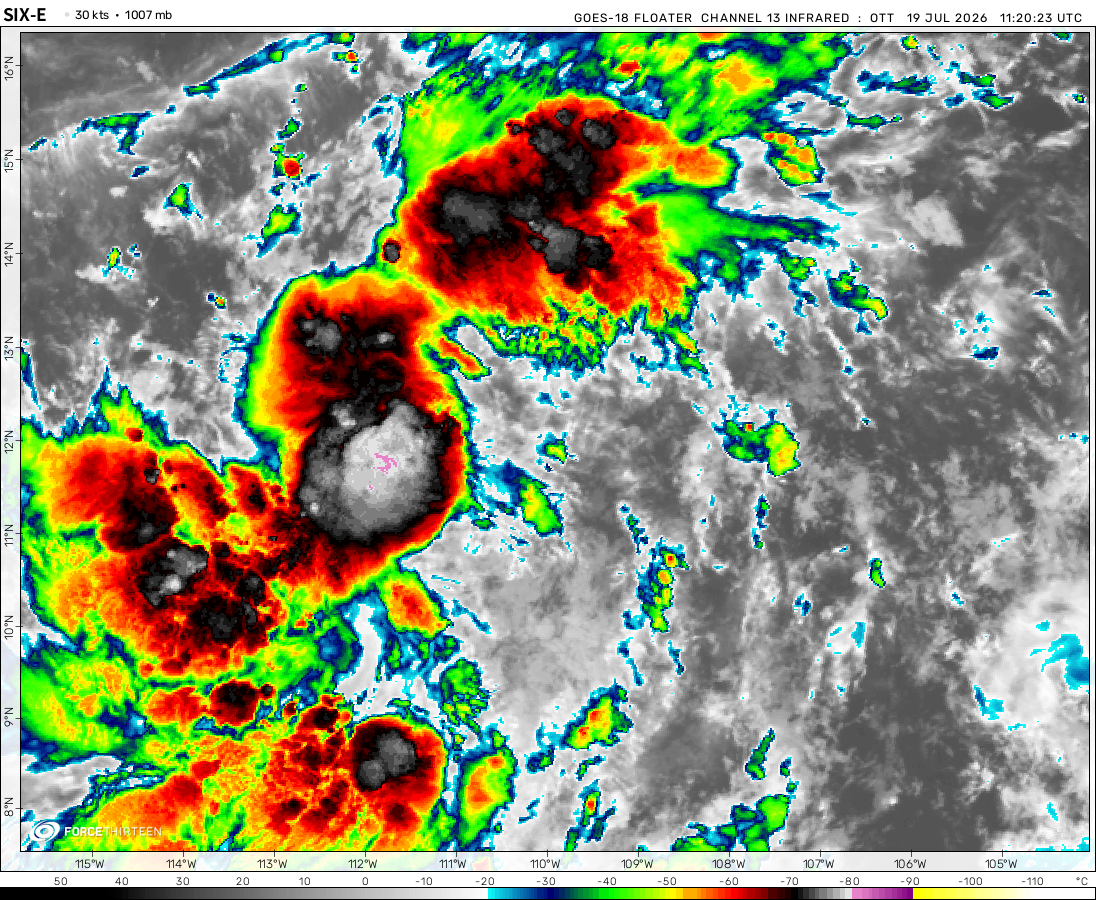
Hurricane Genevieve was located near 14.4°N, 110.8°W, or about 304 miles (489 km) south of Socorro Island, Mexico. Genevieve has maximum sustained winds of 130 knots and a minimum central pressure of 934 millibars.
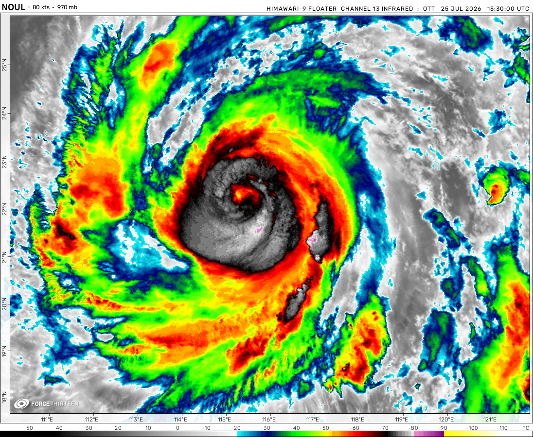
The remnants of Noul was located near 25.7°N, 114.2°E, or about 234 miles (376 km) north of Hong Kong. Noul has maximum sustained winds of 20 knots and a minimum central pressure of 1000 millibars.
Tropical Depression 12W was located near 12.8°N, 178.3°E, or about 893 miles (1438 km) east-southeast of Wake Island. 12W has maximum sustained winds of 30 knots and a minimum central pressure of 1002 millibars.
ATCF®
- Latest Information -
As of July 27th 2026 at 03:17 UTC
Invest 92C was located near 12.8°N, 178.3°E, or about 893 miles (1438 km) east-southeast of Wake Island. 92C has maximum sustained winds of 30 knots and a minimum central pressure of 1002 millibars.
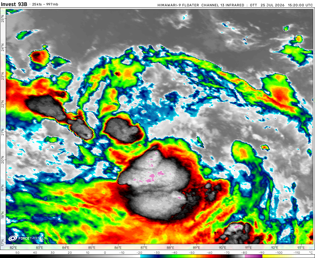
Invest 93B was located near 21.2°N, 88.3°E, or about 95 miles (153 km) south of Kolkata, India. 93B has maximum sustained winds of 25 knots and a minimum central pressure of 993 millibars.
This tracker uses information from the Automated Tropical Cyclone Forecast system (ATCF) system. So if it shows an absurd number, there is no forward speed or direction data for now. You’ll have to wait at least an hour or so before the data is provided.
Hi, have you noted a possible AOI in the Atlantic of the east coast? it seems pretty interesting, it also has a typical comma-shaped subtropical pattern.
What do you mean by the Area of interest is moving at NaN degrees and is moving at NaN miles per hour? Plus, shouldn’t the Invest be a depression because it has wind speed of 35 miles per hour?
Hi, we were not provided with the motion and speed information that would be sustainable for updates. A depression is only clasified when thete is a center of ciruclation with deep convection, and not when it reaches a certain wind speed. Thanks!
Cookies help us ensure our site works securely, continually make improvements, and personalize your browsing experience.
Click 'Accept All Cookies' to get the best browsing experience. You can change these settings at any time by clicking 'Manage My Cookies' below.
Functional
Always active
The technical storage or access is strictly necessary for the legitimate purpose of enabling the use of a specific service explicitly requested by the subscriber or user, or for the sole purpose of carrying out the transmission of a communication over an electronic communications network.
Preferences
The technical storage or access is necessary for the legitimate purpose of storing preferences that are not requested by the subscriber or user.
Statistics
The technical storage or access that is used exclusively for statistical purposes.The technical storage or access that is used exclusively for anonymous statistical purposes. Without a subpoena, voluntary compliance on the part of your Internet Service Provider, or additional records from a third party, information stored or retrieved for this purpose alone cannot usually be used to identify you.
Marketing
The technical storage or access is required to create user profiles to send advertising, or to track the user on a website or across several websites for similar marketing purposes.

 View more imageryAnimated GIF
 View more imageryAnimated GIF
 View more imageryAnimated GIF
 View more imageryAnimated GIF
 View more imageryAnimated GIF
I like this site but during the alantic season i never see anything there why exacly is that im just wondering if they could add that in the future?
Man it ramped up fast.We might even get Tauktae. Wasn’t there an AOI in the west pacfic?
What the frick two invests in NIO basin
When you post two comments, both disappear. Does this happen to anyone else?
The 97S AOI dissipated. It’s no longer on the ATCF.
WTF!!!! Invest 97S and 97S are colliding!!!
And btw, do you think that invest 95S is going to collide with the 2 invest?
What if we got Jobo and Kanga simultaneously?That would be fun, but it’s probably not going to happen
That would be nice though
yeah
If it says that Invest 97S is moving at -9999.99 Degrees and at -10000mph, does that means that INvest 97S is stationary?
This tracker uses information from the Automated Tropical Cyclone Forecast system (ATCF) system. So if it shows an absurd number, there is no forward speed or direction data for now. You’ll have to wait at least an hour or so before the data is provided.
Now it shows the data
Hi, have you noted a possible AOI in the Atlantic of the east coast? it seems pretty interesting, it also has a typical comma-shaped subtropical pattern.
Rest of March is probably going to be inactive
What happened to that area of interest near Peru?
It dissipated
idk well thank god it did
Do you think that 94S is going to be a tropical storm? I don’t think so.
Well, we didn’t
I feel like there is a small chance that we could get an Indonesian storm out of 94S
But probably not
It just dissipated
Thanks!
What do you mean by the Area of interest is moving at NaN degrees and is moving at NaN miles per hour? Plus, shouldn’t the Invest be a depression because it has wind speed of 35 miles per hour?
Hi, we were not provided with the motion and speed information that would be sustainable for updates. A depression is only clasified when thete is a center of ciruclation with deep convection, and not when it reaches a certain wind speed. Thanks!
R.I.P Habana
only habana is a SD
finally habana has gone
i agree
System near South America WTF?!?
Yes there is an area of interest currently being monitored by Force Thirteen. We are providing updates on the social media platforms as well
Thanks for the info!
ok
can you update it on youtube as well?
and YouTube?
These area of interests are only reflected on the daily Tropical Weather Outlooks (TWO) issued on the Twitter platform.
Okay.
DIE HABANA