Hurricane Lala was located near 30.3°N, 172.2°W, or about 344 miles (553 km) east-northeast of Midway Atoll. Lala has maximum sustained winds of 70 knots and a minimum central pressure of 979 millibars.
Tropical Storm Moke was located near 14.6°N, 149.7°W, or about 501 miles (807 km) southeast of Hilo, Hawaii. Moke has maximum sustained winds of 45 knots and a minimum central pressure of 994 millibars.
Typhoon Saudel was located near 19.6°N, 144.8°E, or about 422 miles (679 km) south-southeast of Iwō-Tō Island, Japan. Saudel has maximum sustained winds of 105 knots and a minimum central pressure of 956 millibars.
Tropical Depression Narra was located near 21.0°N, 108.0°E, or about 140 miles (225 km) east of Hanoi, Vietnam. Narra has maximum sustained winds of 30 knots and a minimum central pressure of 995 millibars.
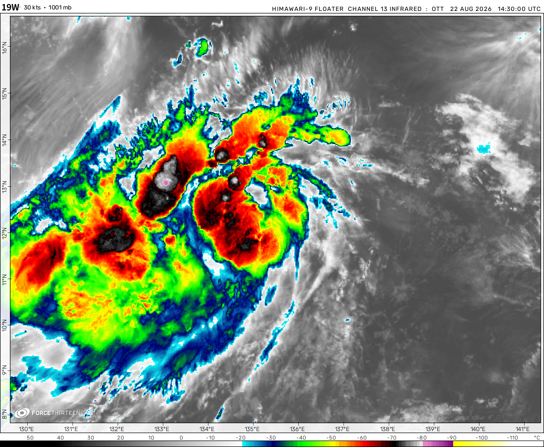
Tropical Depression 19W was located near 12.2°N, 135.4°E, or about 261 miles (419 km) northwest of Yap, Micronesia. 19W has maximum sustained winds of 30 knots and a minimum central pressure of 1001 millibars.
Invest 91E was located near 9.8°N, 117.5°W, or about 620 miles (997 km) south-southwest of Clarion Island, Mexico. 91E has maximum sustained winds of 20 knots and a minimum central pressure of 1009 millibars.
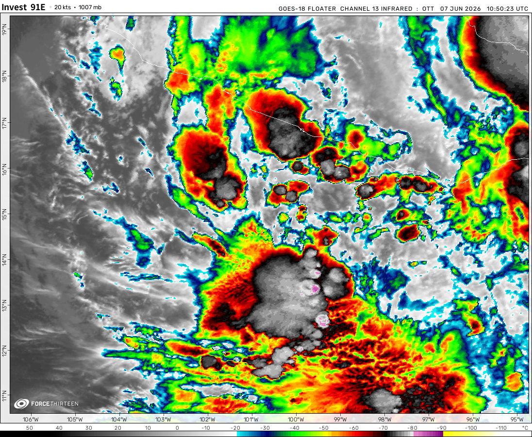
Invest 92E was located near 12.5°N, 109.8°W, or about 442 miles (711 km) south of Socorro Island, Mexico. 92E has maximum sustained winds of 25 knots and a minimum central pressure of 1009 millibars.
Invest 94W was located near 26.7°N, 122.6°E, or about 132 miles (212 km) north-northeast of Taipei City, Taiwan. 94W has maximum sustained winds of 30 knots and a minimum central pressure of 1000 millibars.
Invest 96W was located near 47.0°N, 166.1°E, or about 533 miles (858 km) southeast of Petropavlovsk-Kamchatsky, Russia. 96W has maximum sustained winds of 25 knots and a minimum central pressure of 1005 millibars.
Two areas of interest
1. An area of clouds in the Southwest Indian Ocean northeast of the Remnants of Herold.
2. Another area of clouds probably delivering somewhat rain on Fiji in the South Pacific (but seeing what happened during the 2018 – 19 season, it might not form.
The cyclone tracker is automated with the atcf data.
Force Thirteen has used SATIED data in the video updates.
Herold has just reached Category 3 (SSHWS) as of 06:00am UTC.
I think that maybe a tropical depression is forming in the north of Madagascar, the storm have winds of 20 miles per hour and a pressure of 1010 milibars.
Cookies help us ensure our site works securely, continually make improvements, and personalize your browsing experience.
Click 'Accept All Cookies' to get the best browsing experience. You can change these settings at any time by clicking 'Manage My Cookies' below.
Functional
Always active
The technical storage or access is strictly necessary for the legitimate purpose of enabling the use of a specific service explicitly requested by the subscriber or user, or for the sole purpose of carrying out the transmission of a communication over an electronic communications network.
Preferences
The technical storage or access is necessary for the legitimate purpose of storing preferences that are not requested by the subscriber or user.
Statistics
The technical storage or access that is used exclusively for statistical purposes.The technical storage or access that is used exclusively for anonymous statistical purposes. Without a subpoena, voluntary compliance on the part of your Internet Service Provider, or additional records from a third party, information stored or retrieved for this purpose alone cannot usually be used to identify you.
Marketing
The technical storage or access is required to create user profiles to send advertising, or to track the user on a website or across several websites for similar marketing purposes.

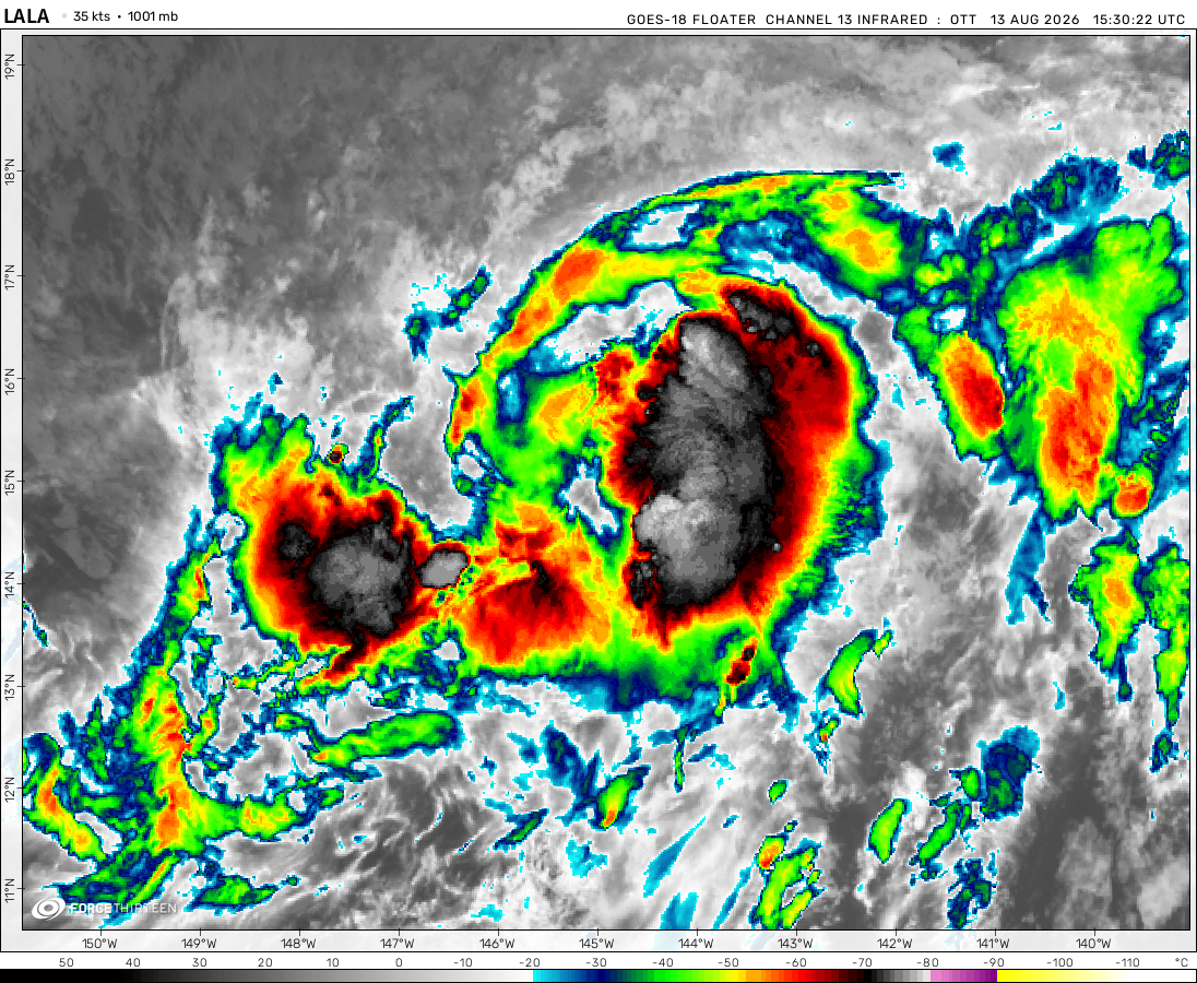 View more imageryAnimated GIF
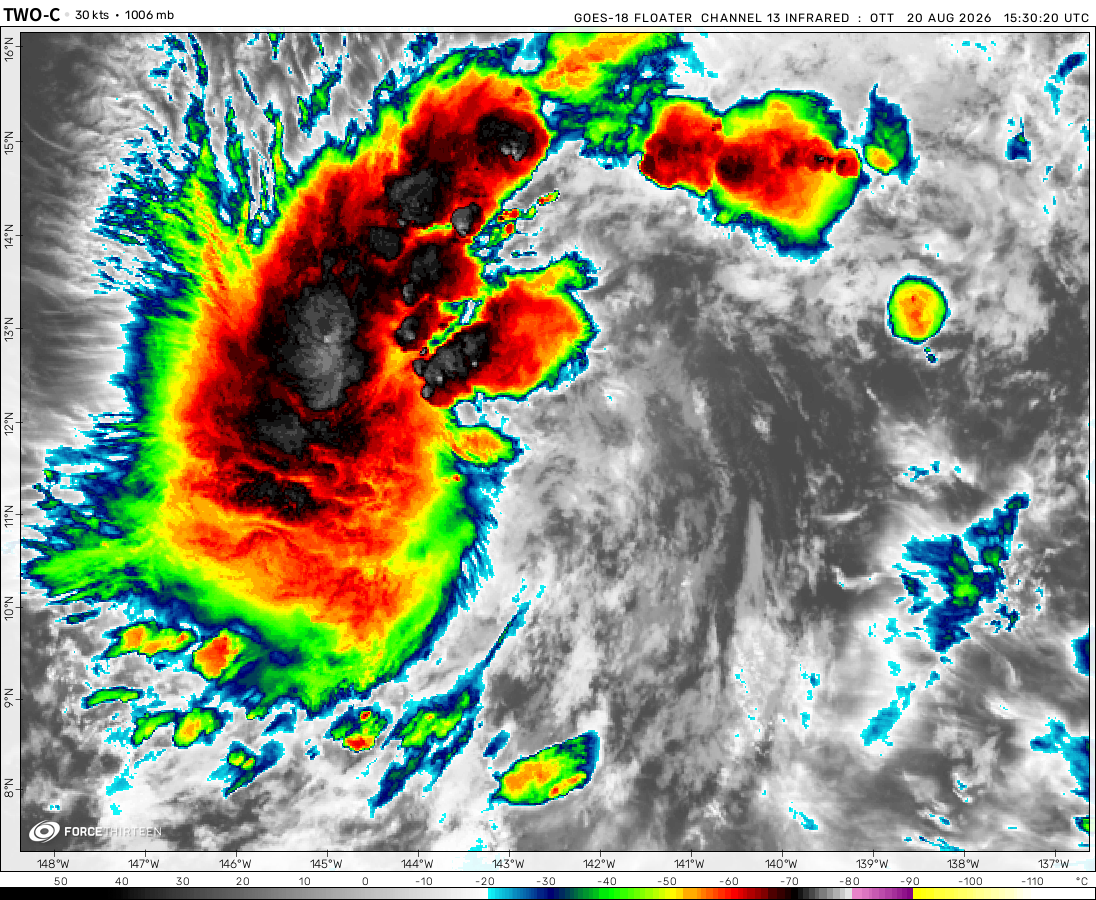 View more imageryAnimated GIF
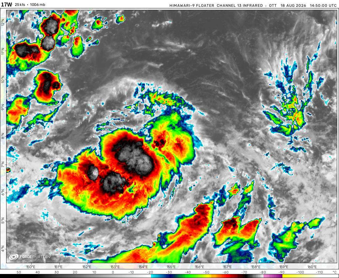 View more imageryAnimated GIF
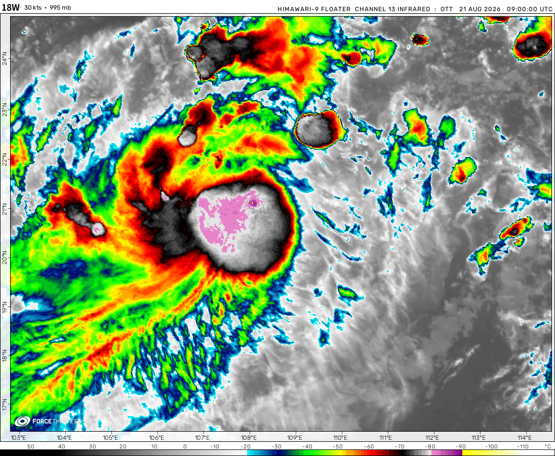 View more imageryAnimated GIF
 View more imageryAnimated GIF
 View more imageryAnimated GIF
 View more imageryAnimated GIF
 View more imageryAnimated GIF
 View more imageryAnimated GIF
Two areas of interest
1. An area of clouds in the Southwest Indian Ocean northeast of the Remnants of Herold.
2. Another area of clouds probably delivering somewhat rain on Fiji in the South Pacific (but seeing what happened during the 2018 – 19 season, it might not form.
why
why
why
why
ss
hhh
ss
ss
ss
ss
ss
ss
ss
ss
s
ss
ss
ss
ss
ss
ss
ss
ss
HPC
HPC
TPC
CPC
SPC
I think I found the first reply on this website. No one else is going to see this unless they click on the bottom of this page.
looks like herold decided to say goodbye
Weird. Just saw the video update that said Herold was a C3. But here is a C1. Huh
The cyclone tracker is automated with the atcf data.
Force Thirteen has used SATIED data in the video updates.
Herold has just reached Category 3 (SSHWS) as of 06:00am UTC.
And it still is Nathan
I think it’s probably because Harold was a cat 3 for a very short time
Are you talking about Tropical Storm Harold?
If u search the screen
Lol already cat2
Hypo is dead
On an iPhone it olny gives me the left side of the screen I can’t scroll to the right side of the page
Horizontal scrolling has been added to the cyclone tracker. 16/03/2020.
Should work on all mobile devices now.
I say 110 mph with a pressure of 957 mb
hi
hope Herold will bring much rain
It’s ded
Nope
Check the thing to Esther s on water now get it rightfu
viccy is quicccy
Hi, I think that a tropical depression is forming in the north of Australia.
The storm have a pressure of 1005 milibars and winds of 24-25 mph.
An S.A storm
Yeeeet
I started it All xd
I think that maybe a tropical depression is forming in the north of Madagascar, the storm have winds of 20 miles per hour and a pressure of 1010 milibars.
What happened here!!!!!!
Ahoyhoy
Hi , Will the Subtropical storm Kurumí make landfall in the future?
Kurumí will continue to move southeast away from Brazil and transition to an Extra-Tropical Cyclone.
nope
Hey 🙂
Hello and welcome to the Force Thirteen Cyclone Tracker 🙂
Thanks!
I’ll be replying to this every 3 years
You’d better be back soon buddy.
its been 3 years, payup.