Tropical Storm Lala was located near 36.7°N, 178.4°W, or about 590 miles (949 km) north of Midway Atoll. Lala has maximum sustained winds of 40 knots and a minimum central pressure of 999 millibars.
Typhoon Saudel was located near 28.4°N, 124.2°E, or about 255 miles (410 km) southeast of Shanghai, China. Saudel has maximum sustained winds of 80 knots and a minimum central pressure of 962 millibars.
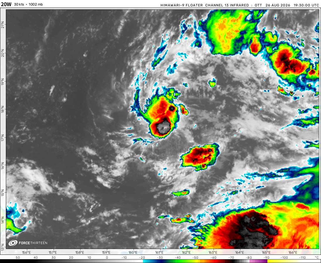
Tropical Storm 20W was located near 16.7°N, 162.3°E, or about 337 miles (542 km) west-southwest of Wake Island. 20W has maximum sustained winds of 35 knots and a minimum central pressure of 1000 millibars.
Tropical Storm 21W was located near 21.2°N, 168.0°E, or about 159 miles (256 km) north-northeast of Wake Island. 21W has maximum sustained winds of 40 knots and a minimum central pressure of 998 millibars.
ATCF®
- Latest Information -
As of August 27th 2026 at 10:17 UTC
Invest 93E was located near 9.5°N, 109.7°W, or about 648 miles (1043 km) south of Socorro Island, Mexico. 93E has maximum sustained winds of 30 knots and a minimum central pressure of 1006 millibars.
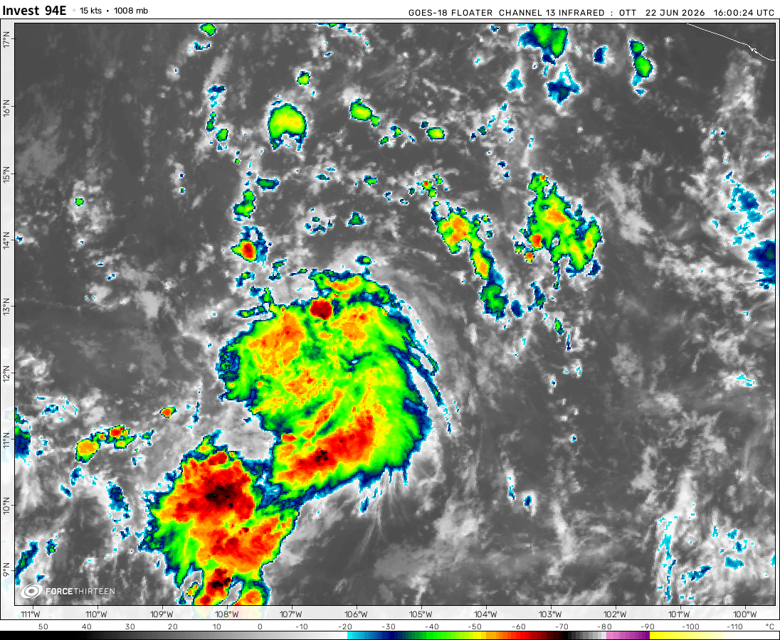
Invest 94E was located near 10.9°N, 134.8°W, or about 1436 miles (2311 km) west-southwest of Clarion Island, Mexico. 94E has maximum sustained winds of 25 knots and a minimum central pressure of 1008 millibars.
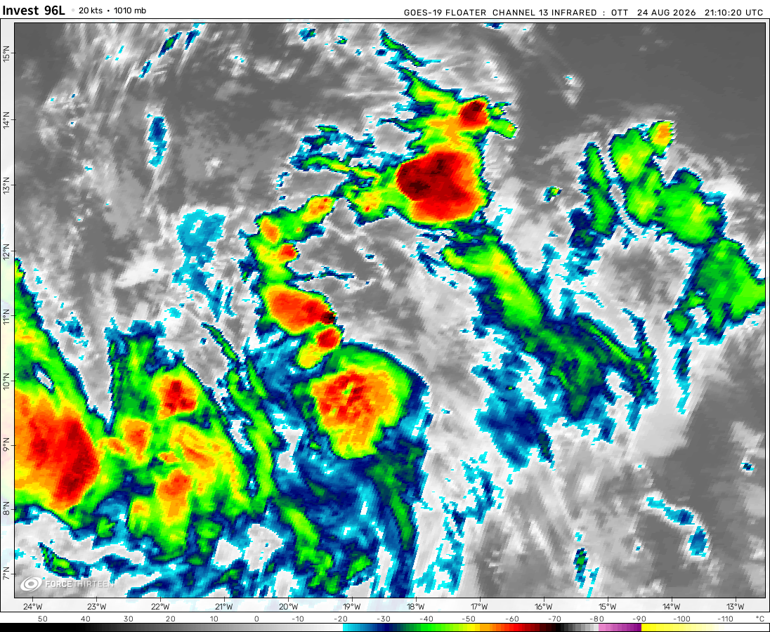
Invest 96L was located near 13.4°N, 35.3°W, or about 729 miles (1173 km) west-southwest of Mindelo, Cabo Verde. 96L has maximum sustained winds of 30 knots and a minimum central pressure of 1007 millibars.
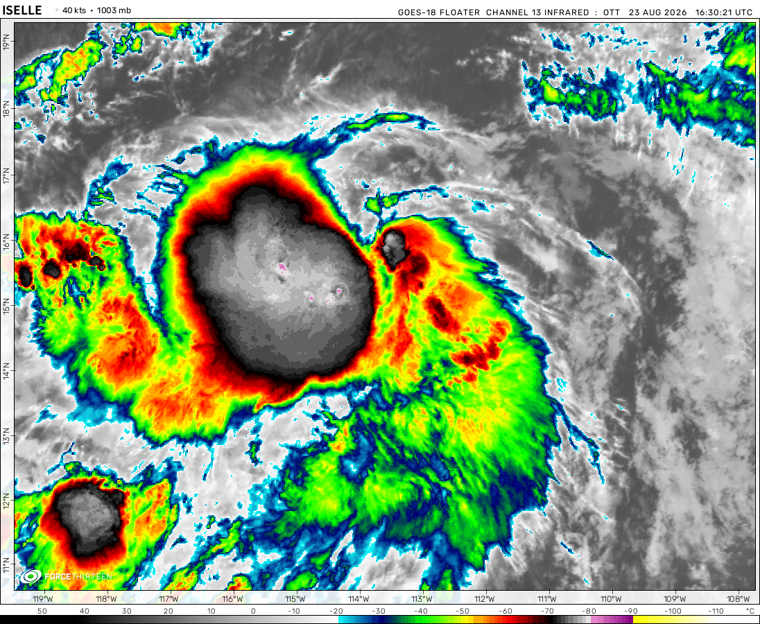
Tropical Depression Iselle was located near 22.8°N, 125.5°W, or about 761 miles (1225 km) west-northwest of Clarion Island, Mexico. Iselle has maximum sustained winds of 30 knots and a minimum central pressure of 1002 millibars.
The remnants of Narra was located near 22.7°N, 113.7°E, or about 40 miles (64 km) northwest of Hong Kong. Narra has maximum sustained winds of 15 knots and a minimum central pressure of 1003 millibars.
Ok so I have Surigae under going EWRC right now, but I thin it will peak at 150mph early next morning so better keep and “Eye” on this storm. But seriously, the Philippines should watch out.
Cookies help us ensure our site works securely, continually make improvements, and personalize your browsing experience.
Click 'Accept All Cookies' to get the best browsing experience. You can change these settings at any time by clicking 'Manage My Cookies' below.
Functional
Always active
The technical storage or access is strictly necessary for the legitimate purpose of enabling the use of a specific service explicitly requested by the subscriber or user, or for the sole purpose of carrying out the transmission of a communication over an electronic communications network.
Preferences
The technical storage or access is necessary for the legitimate purpose of storing preferences that are not requested by the subscriber or user.
Statistics
The technical storage or access that is used exclusively for statistical purposes.The technical storage or access that is used exclusively for anonymous statistical purposes. Without a subpoena, voluntary compliance on the part of your Internet Service Provider, or additional records from a third party, information stored or retrieved for this purpose alone cannot usually be used to identify you.
Marketing
The technical storage or access is required to create user profiles to send advertising, or to track the user on a website or across several websites for similar marketing purposes.

 View more imageryAnimated GIF
 View more imageryAnimated GIF
 View more imageryAnimated GIF
 View more imageryAnimated GIF
 View more imagery
 View more imageryAnimated GIF
 View more imageryAnimated GIF
 View more imageryAnimated GIF
Will 92A be strong to category 4?
i love how Andres is just U N D E F I N E D
Isn’t Andres a tropical despression?
Tropical storm Andres is active and it is the earliest Eastern Pacific storm on record. The last one in May 10th
Looks like Eastern Pacific is going to get tropical storm Andres!
omg good morning east pacific
Surigae 190 mph?!?!?!
For the whole time that Potira was active, it just says that the wind speed are the same and says that it is moving 90.00 degrees at NaN mph
Did Potira really dissipated?
Is it just the comments breaking or has no one typed in the chat since the 21st?
Comments are broken. They update every like 5-6 days.
I think its the comment breaking
Thats why
It just formed
did you even keep track on Potira cuz like the wind speed, direction, and the it just says NaN mph.
WTF WHAT IS EVEN THIS? Subtropical storm invest ??
Wait WHAT!!!!!!!!!!!! HOW DID POTIRA FORM IN THE SOUTH ATLANTIC OCEAN??????????
So, Surigae weakened to a category 4 storm and 95S have been here for at least 3 days and have not dissipate nor became a tropical storm
It was named Jobo today by Meteo-France ,doesn’t show it here though
95S
Raise your hand if Surigae beat your expectations.I mean,888 mb!Did’nt you guys go with 190 mph for Goni?
*raised hand*
*raised hand because I said it*
Never thought anyone was going to respond?
OMG SURIGAE 178 MPH
Maybe tomorow Surigae be a Cat5?
Ok so I have Surigae under going EWRC right now, but I thin it will peak at 150mph early next morning so better keep and “Eye” on this storm. But seriously, the Philippines should watch out.