Tropical Storm Lala was located near 34.9°N, 177.0°W, or about 463 miles (745 km) north of Midway Atoll. Lala has maximum sustained winds of 45 knots and a minimum central pressure of 994 millibars.
Tropical Storm Iselle was located near 20.9°N, 121.4°W, or about 468 miles (754 km) west-northwest of Clarion Island, Mexico. Iselle has maximum sustained winds of 50 knots and a minimum central pressure of 994 millibars.
The remnants of Julio was located near 19.5°N, 118.8°W, or about 278 miles (447 km) west-northwest of Clarion Island, Mexico. Julio has maximum sustained winds of 40 knots and a minimum central pressure of 1003 millibars.
Typhoon Saudel was located near 27.5°N, 128.1°E, or about 81 miles (131 km) north-northeast of Kadena, Okinawa. Saudel has maximum sustained winds of 80 knots and a minimum central pressure of 966 millibars.
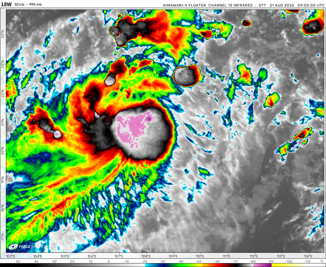
Tropical Depression Narra was located near 20.0°N, 109.6°E, or about 39 miles (63 km) west of Haikou, Hainan Island. Narra has maximum sustained winds of 25 knots and a minimum central pressure of 999 millibars.
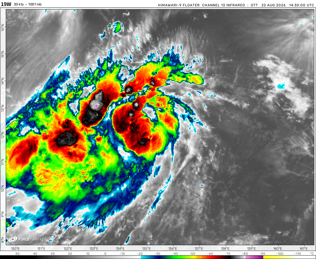
The remnants of Atsani was located near 22.8°N, 135.5°E, or about 340 miles (548 km) southeast of Minami-Daitō Island, Japan. Atsani has maximum sustained winds of 20 knots and a minimum central pressure of 1007 millibars.
Invest 90W was located near 13.8°N, 151.7°E, or about 467 miles (752 km) east of Hagåtña, Guam. 90W has maximum sustained winds of 20 knots and a minimum central pressure of 1008 millibars.
Invest 95L was located near 38.4°N, 58.2°W, or about 521 miles (838 km) southeast of Cape Sable Island, Nova Scotia. 95L has maximum sustained winds of 30 knots and a minimum central pressure of 1014 millibars.
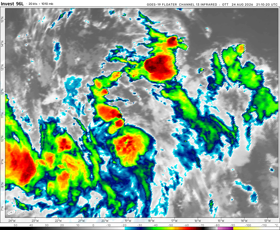
Invest 96L was located near 12.9°N, 23.6°W, or about 141 miles (226 km) south of Praia, Cabo Verde. 96L has maximum sustained winds of 25 knots and a minimum central pressure of 1009 millibars.
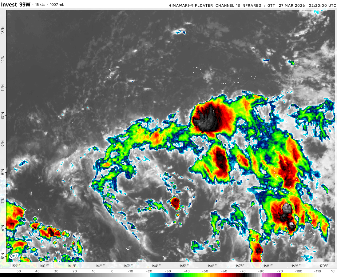
Invest 99W was located near 16.0°N, 162.0°E, or about 381 miles (613 km) southwest of Wake Island. 99W has maximum sustained winds of 20 knots and a minimum central pressure of 1007 millibars.
The latest few GFS runs show a marginal tropical storm forming at about 30N30W in approximately 36 hours from a surface trough currently located at about 30N40W. This is in the Eastern Atlantic
Cookies help us ensure our site works securely, continually make improvements, and personalize your browsing experience.
Click 'Accept All Cookies' to get the best browsing experience. You can change these settings at any time by clicking 'Manage My Cookies' below.
Functional
Always active
The technical storage or access is strictly necessary for the legitimate purpose of enabling the use of a specific service explicitly requested by the subscriber or user, or for the sole purpose of carrying out the transmission of a communication over an electronic communications network.
Preferences
The technical storage or access is necessary for the legitimate purpose of storing preferences that are not requested by the subscriber or user.
Statistics
The technical storage or access that is used exclusively for statistical purposes.The technical storage or access that is used exclusively for anonymous statistical purposes. Without a subpoena, voluntary compliance on the part of your Internet Service Provider, or additional records from a third party, information stored or retrieved for this purpose alone cannot usually be used to identify you.
Marketing
The technical storage or access is required to create user profiles to send advertising, or to track the user on a website or across several websites for similar marketing purposes.

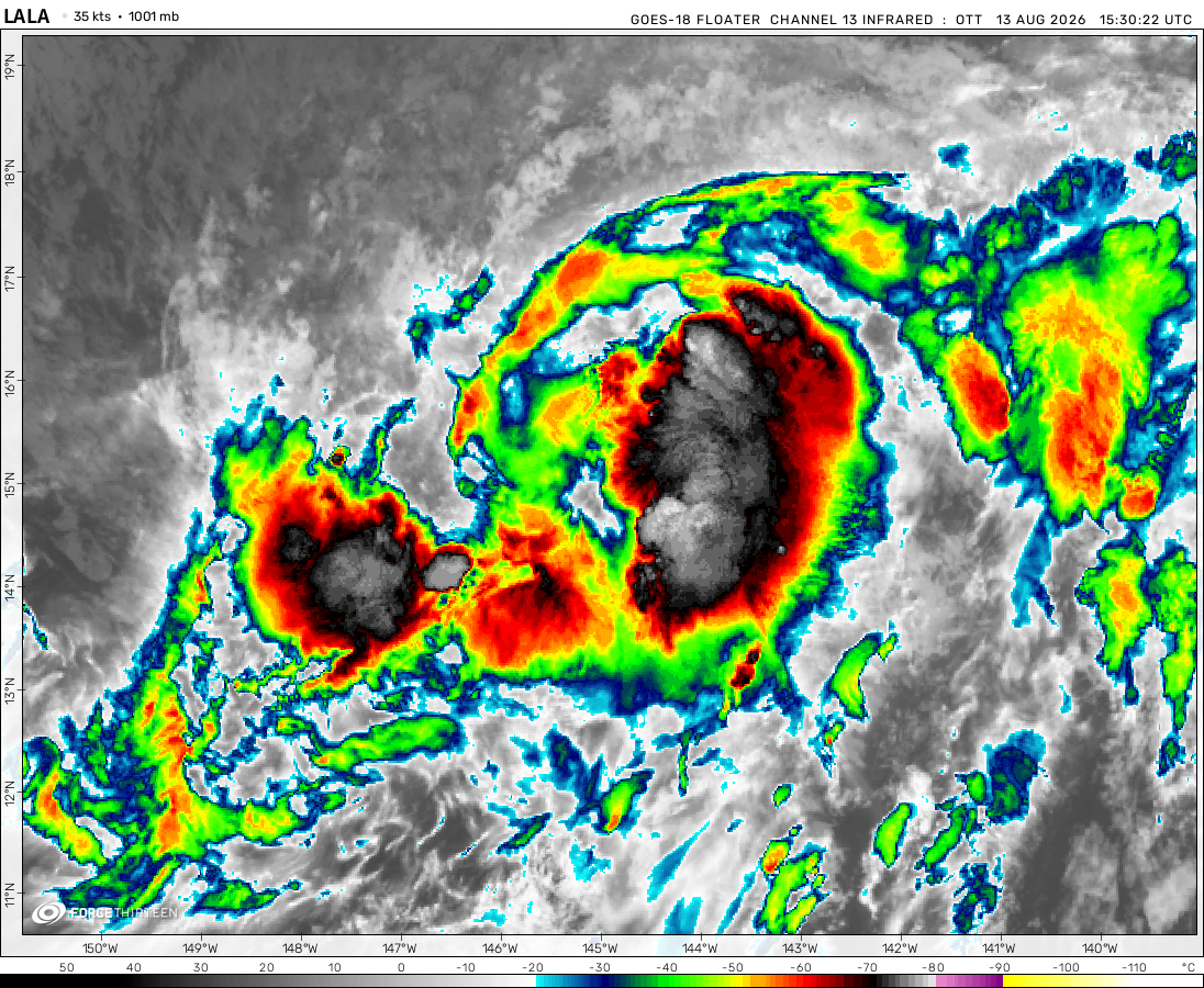 View more imageryAnimated GIF
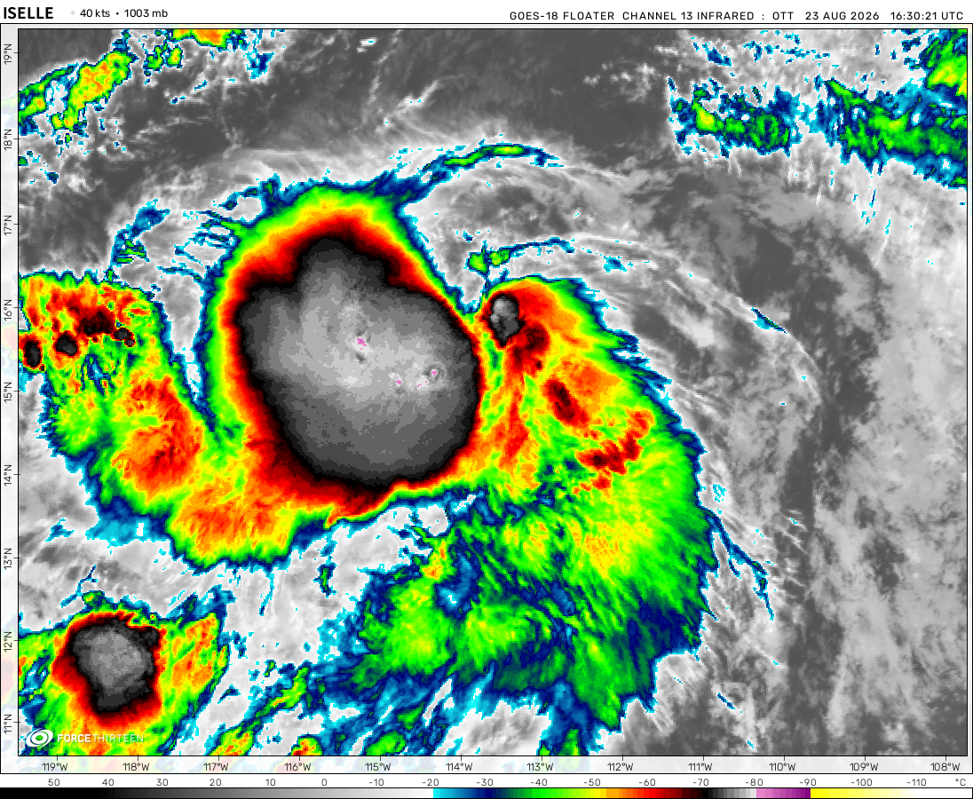 View more imageryAnimated GIF
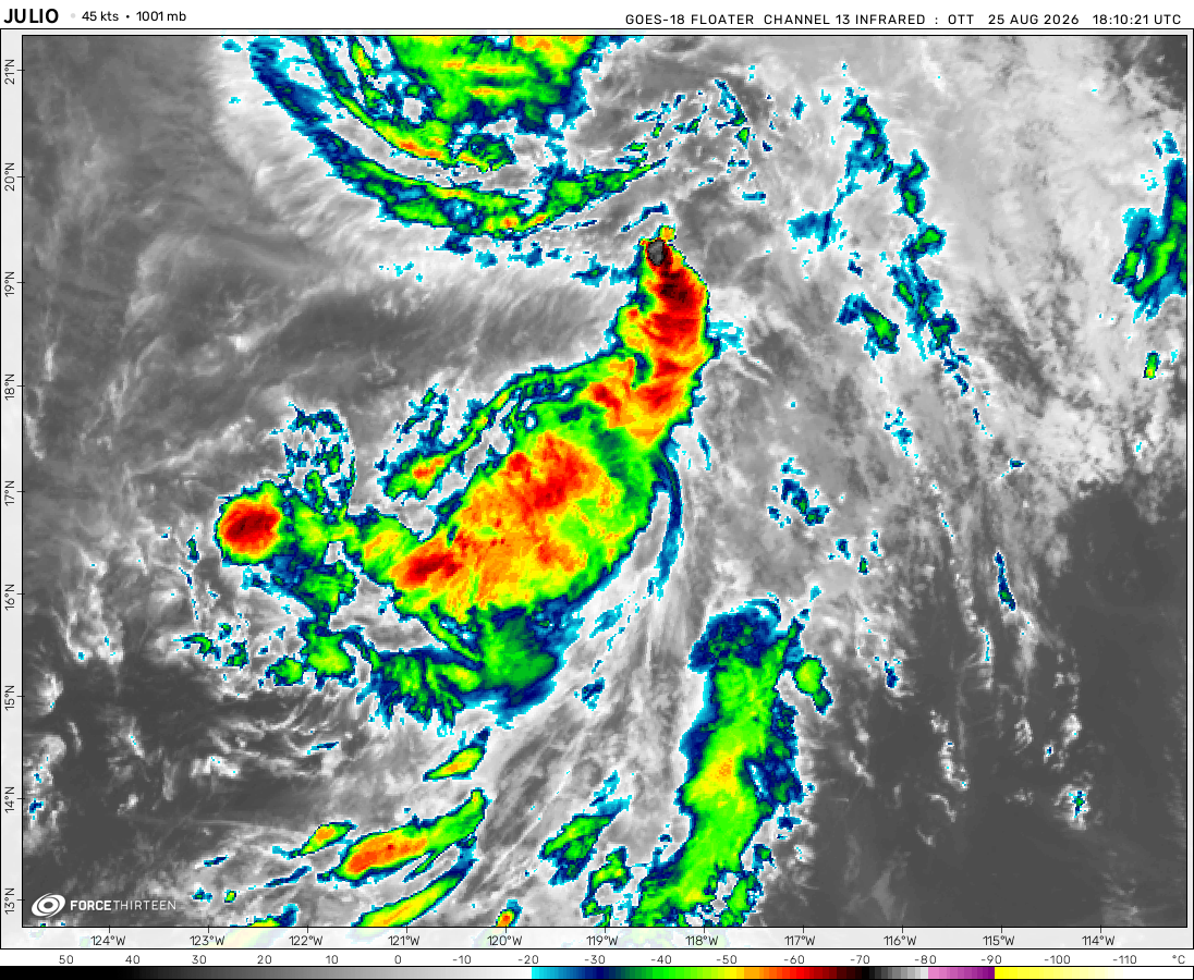 View more imageryAnimated GIF
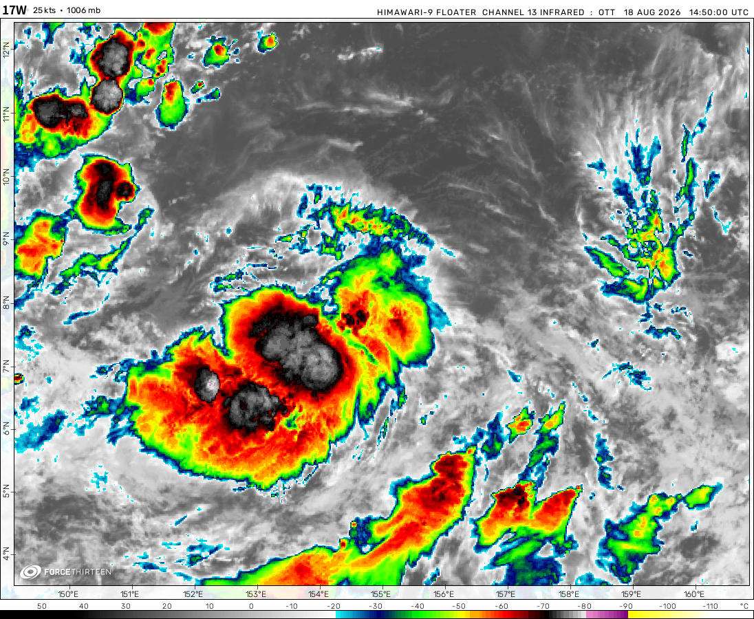 View more imageryAnimated GIF
 View more imageryAnimated GIF
 View more imageryAnimated GIF
 View more imageryAnimated GIF
 View more imageryAnimated GIF
 View more imageryAnimated GIF
 View more imageryAnimated GIF
You guys can click the storm icon to check more information on the system.
-RyanKnack
Force 13 Web Updater
possibly so far it has been very border line
NOOOOOOOOOOOOO 93S IS DYING
it was so close…
Didn’t the MFR upgrade it to a tropical Depression?
That was before
Do you guys think 93S will form?
NNNNNNNNNNNNNNNNNNNNNNNNNNNNNNNNOOOOOOOOOOOOOOOOOOOOOOOOOOOOOOOO
Well it did
Now we wait and wait and wait and wait and wait and wait for something to happen
for me looking on the tracker is like christmas. It’s fun but you never know what you may or may not get.
yep
whats next?
Only time will tell
hmm
hmm
The latest few GFS runs show a marginal tropical storm forming at about 30N30W in approximately 36 hours from a surface trough currently located at about 30N40W. This is in the Eastern Atlantic
Do you guys think Harold will make it to Category 5?
yes, and already had, or will be a category five again
Why does it say moving west at 2,189mph?!
He did
I have a feeling that Harold is going to be a weaker Pam
Pam is 896 hPa,Harold is 924 hPa
But,Pam is weaker than Zoe and Winston
Zoe is 890 hPa,Winston is 884 hPa.
that is way to low for Winston, Zoe’s is correct, but Winston is probably like, 894mb at least.
HAROLD the beast
I thought Harold died off a long time ago
I think that was Herold.
The Other one was in Southwest Indian Ocean This One In South Pacific
That was Herold in the SWIO
Wow. Harold looks triggered
hello i was new to this since mid-Febuary and i love the updates on storms and the hurricane seasons
There’s a tropical storm or a cyclone next to argentina , max winds arround 55 mph
I think it’s only wind.
Tropical storm Irondo!
I think 98P could have the potential of intensifying up to a tropical storm. 91S too.
4 storms
Woah 4 storms
Welp everything is ded
Finally an invest has formed