Tropical Storm Lala was located near 37.3°N, 178.8°W, or about 634 miles (1020 km) north of Midway Atoll. Lala has maximum sustained winds of 40 knots and a minimum central pressure of 1000 millibars.
Tropical Storm Dolly was located near 13.6°N, 39.6°W, or about 1000 miles (1610 km) west of Mindelo, Cabo Verde. Dolly has maximum sustained winds of 35 knots and a minimum central pressure of 1007 millibars.
Tropical Storm Karina was located near 10.7°N, 111.4°W, or about 560 miles (902 km) south of Socorro Island, Mexico. Karina has maximum sustained winds of 40 knots and a minimum central pressure of 1001 millibars.
Tropical Storm Lowell was located near 11.2°N, 134.0°W, or about 1378 miles (2218 km) west-southwest of Clarion Island, Mexico. Lowell has maximum sustained winds of 35 knots and a minimum central pressure of 1006 millibars.
Typhoon Saudel was located near 28.1°N, 122.6°E, or about 221 miles (356 km) north-northeast of Taipei City, Taiwan. Saudel has maximum sustained winds of 70 knots and a minimum central pressure of 968 millibars.
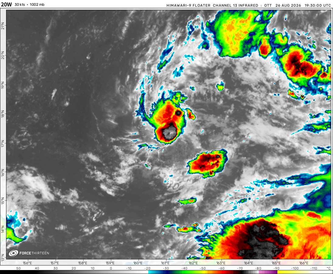
Tropical Storm 20W was located near 17.5°N, 164.1°E, or about 208 miles (334 km) southwest of Wake Island. 20W has maximum sustained winds of 55 knots and a minimum central pressure of 990 millibars.
Tropical Storm Etau was located near 23.1°N, 167.8°E, or about 274 miles (441 km) north-northeast of Wake Island. Etau has maximum sustained winds of 45 knots and a minimum central pressure of 995 millibars.
According to a weather forecaster called Ryan Hall, Phillipe is expected to become a tropical storm or hurricane, and Rina will lift north and die out.
90B will precipitate heavy rain probably in WB and Bangladesh.
bringbackcyclonefreddy
2 years ago
99A might become something.
acay
2 years ago
also, why is there usually big typhoons around April and May for the WPAC, but not for the Atlantic basin?
acay
2 years ago
we have nothing much developing: 13W died (frick it, rain dumpers), same thing for Phillippe; 91L is well-organized but not really spinning, likely to be something significant; 93W and 94W being disorganized, blowing up good cloud tops, their future is uncertain (prob another disappointment lol)
Agnes is stong because Ophelia merged with a extratrop
acay
2 years ago
Phillippe getting sheared, 91L and 93W are expected to be something significant for both basins, 13W dumping rains, the Australian region be cooking SSTs, and the powerful storm Agnes!
Cookies help us ensure our site works securely, continually make improvements, and personalize your browsing experience.
Click 'Accept All Cookies' to get the best browsing experience. You can change these settings at any time by clicking 'Manage My Cookies' below.
Functional
Always active
The technical storage or access is strictly necessary for the legitimate purpose of enabling the use of a specific service explicitly requested by the subscriber or user, or for the sole purpose of carrying out the transmission of a communication over an electronic communications network.
Preferences
The technical storage or access is necessary for the legitimate purpose of storing preferences that are not requested by the subscriber or user.
Statistics
The technical storage or access that is used exclusively for statistical purposes.The technical storage or access that is used exclusively for anonymous statistical purposes. Without a subpoena, voluntary compliance on the part of your Internet Service Provider, or additional records from a third party, information stored or retrieved for this purpose alone cannot usually be used to identify you.
Marketing
The technical storage or access is required to create user profiles to send advertising, or to track the user on a website or across several websites for similar marketing purposes.

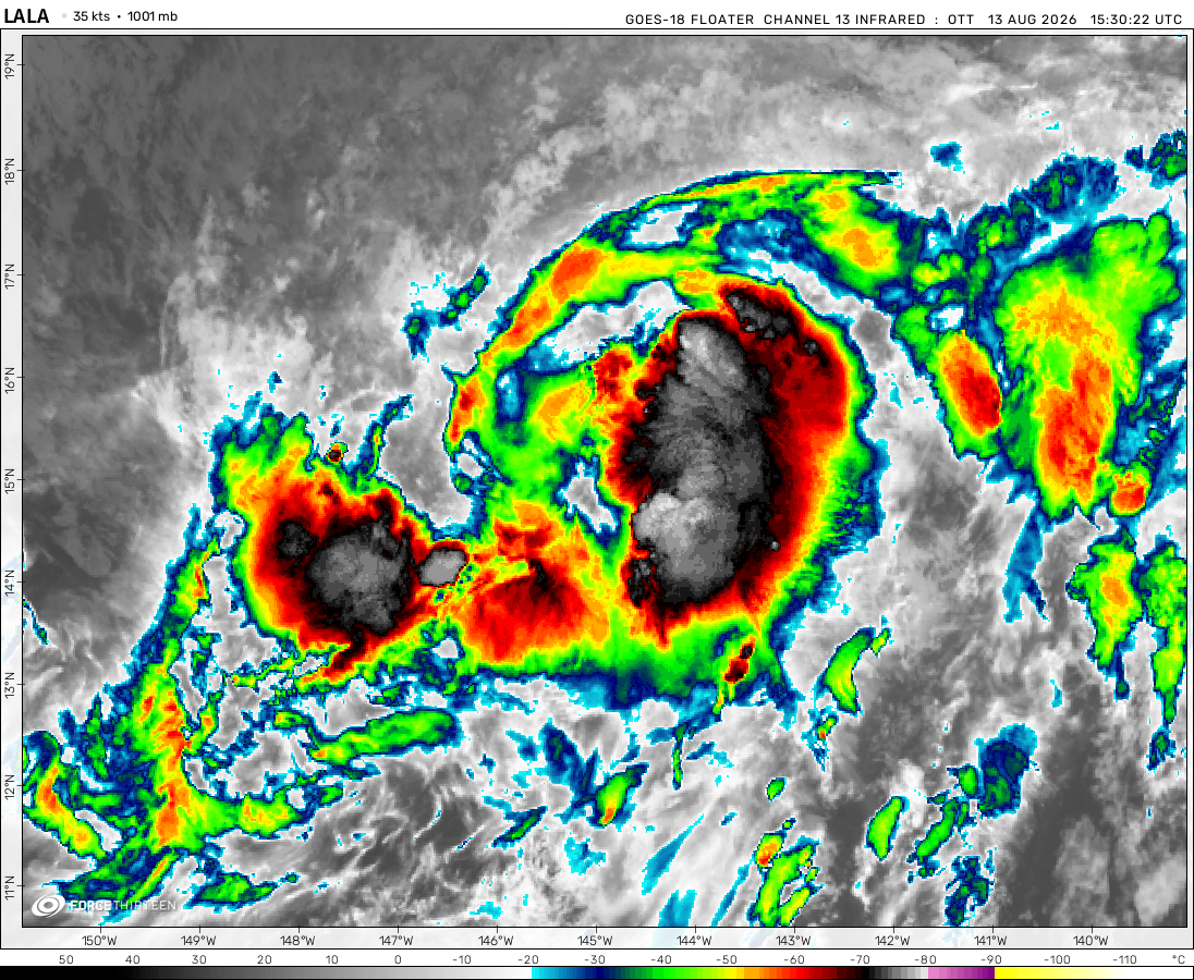 View more imageryAnimated GIF
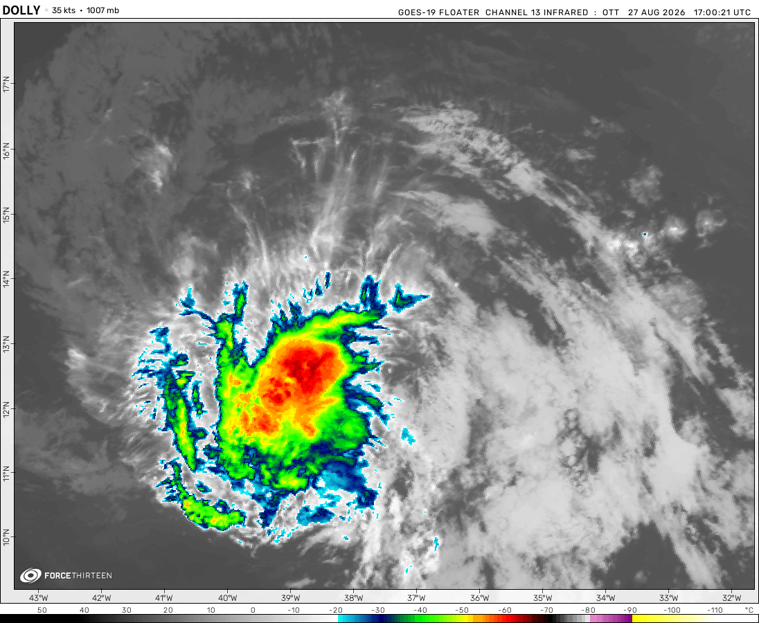 View more imageryAnimated GIF
 View more imageryAnimated GIF
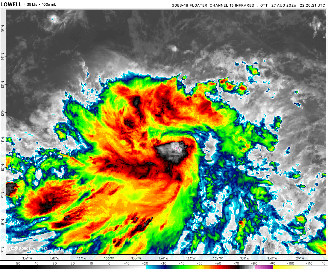 View more imageryAnimated GIF
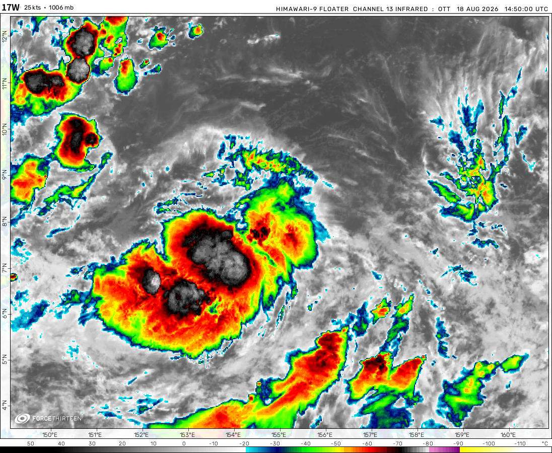 View more imageryAnimated GIF
 View more imageryAnimated GIF
 View more imageryAnimated GIF
where did my post go?
idk why but it seems to be rlly familiar…
https://bnn.network/world/israel/typhoon-koinu-intensifies-taiwan-in-path-of-potential-threat/
no cat 5 for me, that’s a good thing to know 😀
There could be a small possibility of another hurricane forming this month. We are still not into the Greek alphabet.
I actually don’t know why Phillipe isn’t intensifying fast enough,… maybe wind shear.
typhoon koinu posing a threat to taiwan, phillippe is expected to strengthen soon
we prob gonna have another cat 5 in WPAC soon, puppy be looking good!
Just like I expected, Phillipe was soon to be a hurricane in the middle of the week, and Rina soon to die out.
wont be a hurricane anymore, but a strong extratropical system.
ya siuuu, koinu is forming an eye, cat 3 expected the next morning.
Koinu is rapidly intensifying, change my mind
Koinu is expected to be a significant typhoon, getting sheared but will rapidly intensify soon when organized
And Ryan Hall is a YouTuber: https://www.youtube.com/@RyanHallYall
According to a weather forecaster called Ryan Hall, Phillipe is expected to become a tropical storm or hurricane, and Rina will lift north and die out.
the north indian ocean has woken up
90B will precipitate heavy rain probably in WB and Bangladesh.
99A might become something.
also, why is there usually big typhoons around April and May for the WPAC, but not for the Atlantic basin?
we have nothing much developing: 13W died (frick it, rain dumpers), same thing for Phillippe; 91L is well-organized but not really spinning, likely to be something significant; 93W and 94W being disorganized, blowing up good cloud tops, their future is uncertain (prob another disappointment lol)
93W has a formation alert now
and now its Koinu
Agnes is stong because Ophelia merged with a extratrop
Phillippe getting sheared, 91L and 93W are expected to be something significant for both basins, 13W dumping rains, the Australian region be cooking SSTs, and the powerful storm Agnes!
And you call agnes a powerful storm? Potentialy, 91l could become a hurricane or lift north as a short lasting tropical storm.
Maybe I spoke to soon cause Agnes became a bomb cyclone, wow.
And by short-lasting, I meant long-lasting. Cause it’s been a while since Phillipe has formed.