Tropical Storm Lala was located near 37.3°N, 178.8°W, or about 634 miles (1020 km) north of Midway Atoll. Lala has maximum sustained winds of 40 knots and a minimum central pressure of 1000 millibars.
Tropical Storm Dolly was located near 13.6°N, 39.6°W, or about 1000 miles (1610 km) west of Mindelo, Cabo Verde. Dolly has maximum sustained winds of 35 knots and a minimum central pressure of 1007 millibars.
Tropical Storm Karina was located near 10.7°N, 111.4°W, or about 560 miles (902 km) south of Socorro Island, Mexico. Karina has maximum sustained winds of 40 knots and a minimum central pressure of 1001 millibars.
Tropical Storm Lowell was located near 11.2°N, 134.0°W, or about 1378 miles (2218 km) west-southwest of Clarion Island, Mexico. Lowell has maximum sustained winds of 35 knots and a minimum central pressure of 1006 millibars.
Typhoon Saudel was located near 28.1°N, 122.6°E, or about 221 miles (356 km) north-northeast of Taipei City, Taiwan. Saudel has maximum sustained winds of 70 knots and a minimum central pressure of 968 millibars.
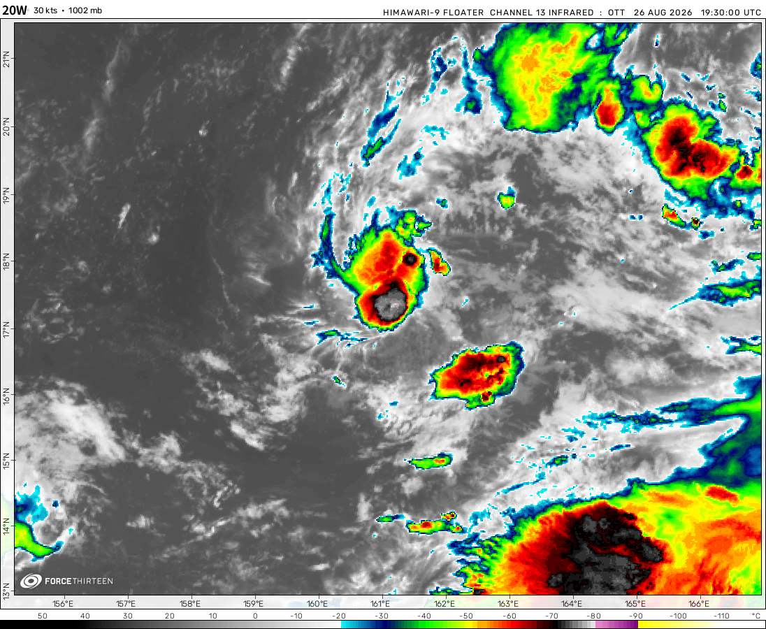
Tropical Storm 20W was located near 17.5°N, 164.1°E, or about 208 miles (334 km) southwest of Wake Island. 20W has maximum sustained winds of 55 knots and a minimum central pressure of 990 millibars.
Tropical Storm Etau was located near 23.1°N, 167.8°E, or about 274 miles (441 km) north-northeast of Wake Island. Etau has maximum sustained winds of 45 knots and a minimum central pressure of 995 millibars.
Seems like 05A will get the name “Tej” soon, as well as Tammy still a cat 1, could intensify further to cat 2, the remnants of Sanba, and Norma making landfall tomorrow. as well as guest star Lola possibly joining us soon. 91E will still likely become Otis, as well as 92B being a weaker cyclone, and maybe getting the name “Hamoon.”
Cookies help us ensure our site works securely, continually make improvements, and personalize your browsing experience.
Click 'Accept All Cookies' to get the best browsing experience. You can change these settings at any time by clicking 'Manage My Cookies' below.
Functional
Always active
The technical storage or access is strictly necessary for the legitimate purpose of enabling the use of a specific service explicitly requested by the subscriber or user, or for the sole purpose of carrying out the transmission of a communication over an electronic communications network.
Preferences
The technical storage or access is necessary for the legitimate purpose of storing preferences that are not requested by the subscriber or user.
Statistics
The technical storage or access that is used exclusively for statistical purposes.The technical storage or access that is used exclusively for anonymous statistical purposes. Without a subpoena, voluntary compliance on the part of your Internet Service Provider, or additional records from a third party, information stored or retrieved for this purpose alone cannot usually be used to identify you.
Marketing
The technical storage or access is required to create user profiles to send advertising, or to track the user on a website or across several websites for similar marketing purposes.

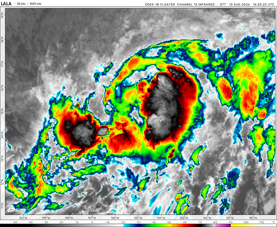 View more imageryAnimated GIF
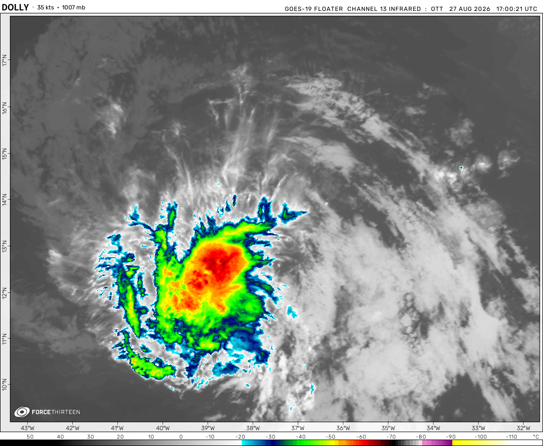 View more imageryAnimated GIF
 View more imageryAnimated GIF
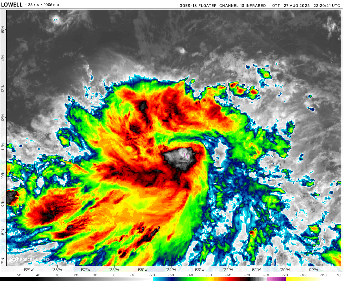 View more imageryAnimated GIF
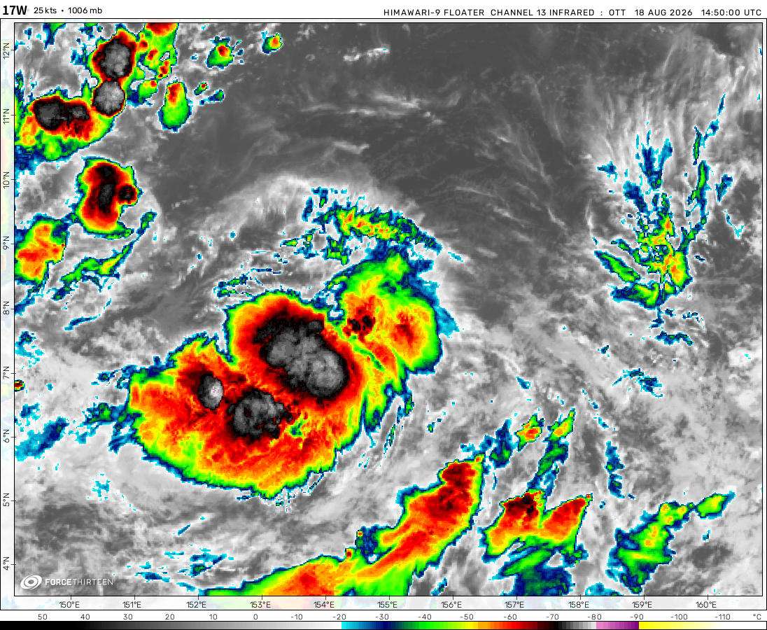 View more imageryAnimated GIF
 View more imageryAnimated GIF
 View more imageryAnimated GIF
Seems like 05A will get the name “Tej” soon, as well as Tammy still a cat 1, could intensify further to cat 2, the remnants of Sanba, and Norma making landfall tomorrow. as well as guest star Lola possibly joining us soon. 91E will still likely become Otis, as well as 92B being a weaker cyclone, and maybe getting the name “Hamoon.”
Tammy is now a Hurricane
Why does it still say tammy is a tropical storm its a hurricane now
Norma still seems to be rapidly intensifying with W ring thickening around its eye. Also CMG is developing nicely.
Idalia the Snowman.
why not giving updates on Storm Babet?
This is a TROPICAL tracking website,but if you want to see windstorm data,look at eu force 13
They gave updates on Agnes tho
Updates for Agnes were given on this website.
Unfortunately, we no longer have team members to keep these storm floaters operational.
I insist you crew to continue monitor those storms because they can be destructive like Storm Daniel 🙂
We could see 16W soon and maybe Hurricane Norma, also short lived Tammy is still possible
Tropical Depression Sean’s convection seems to be blowing up, will it make a unexpected comeback?
bolaven’s being a strong ex-cyclone, sean is still there struggling, and many potential
invests for the basins
94l, another storm in the Atlantic could be named Tammy but could either became a category 1 hurricane or just an ocean riding tropical storm
It has just strengthened again.
The peak intensity of Bolaven should be around 170 knots.
Typhoon Koinu
How did you make this?
Probably AI
Bolaven has just reached 180 mph.
New update on Bolaven: Now a category 5 super typhoon topping 180 miles per hour.
these monsters r cooling our earth, let’s appreciate it (not for their devastation tho)
well, at least one of those storms isn’t me.
It will stay a super typhoon for a little while.
Yep just like I expected, Bolaven a category 5 super typhoon and tropical storm Sean in the Atlantic.
What’s the current intensity of Bolaven and will it intensify even further?
Yes it the wind speed will be 150 knots according to estimates. It’s currently only 140 knots
Wiat no oops, sorry I meant Bolaven.