Tropical Storm Lowell was located near 12.9°N, 147.0°W, or about 713 miles (1148 km) southeast of Hilo, Hawaii. Lowell has maximum sustained winds of 55 knots and a minimum central pressure of 995 millibars.
The remnants of Saudel was located near 19.5°N, 112.9°E, or about 180 miles (289 km) east-southeast of Haikou, Hainan Island. Saudel has maximum sustained winds of 25 knots and a minimum central pressure of 994 millibars.
Invest 96W was located near 23.0°N, 115.8°E, or about 114 miles (184 km) east-northeast of Hong Kong. 96W has maximum sustained winds of 20 knots and a minimum central pressure of 997 millibars.
Tropical Depression Five was located near 28.1°N, 91.0°W, or about 140 miles (225 km) south-southwest of New Orleans, Louisiana. Five has maximum sustained winds of 30 knots and a minimum central pressure of 1012 millibars.
Hurricane Karina was located near 17.4°N, 125.4°W, or about 705 miles (1134 km) west of Clarion Island, Mexico. Karina has maximum sustained winds of 115 knots and a minimum central pressure of 950 millibars.
Subtropical Storm Bang-lang was located near 44.1°N, 169.6°E, or about 795 miles (1279 km) southeast of Petropavlovsk-Kamchatsky, Russia. Bang-lang has maximum sustained winds of 40 knots and a minimum central pressure of 999 millibars.
Subtropical Depression Etau was located near 36.2°N, 168.4°E, or about 997 miles (1604 km) northwest of Midway Atoll. Etau has maximum sustained winds of 30 knots and a minimum central pressure of 1003 millibars.
Invest 94W was located near 22.3°N, 132.2°E, or about 252 miles (406 km) south-southeast of Minami-Daitō Island, Japan. 94W has maximum sustained winds of 30 knots and a minimum central pressure of 999 millibars.
Invest 95E was located near 12.5°N, 107.8°W, or about 484 miles (778 km) south-southeast of Socorro Island, Mexico. 95E has maximum sustained winds of 30 knots and a minimum central pressure of 1006 millibars.
Invest 95W was located near 14.1°N, 149.8°E, or about 342 miles (550 km) east of Hagåtña, Guam. 95W has maximum sustained winds of 15 knots and a minimum central pressure of 1007 millibars.
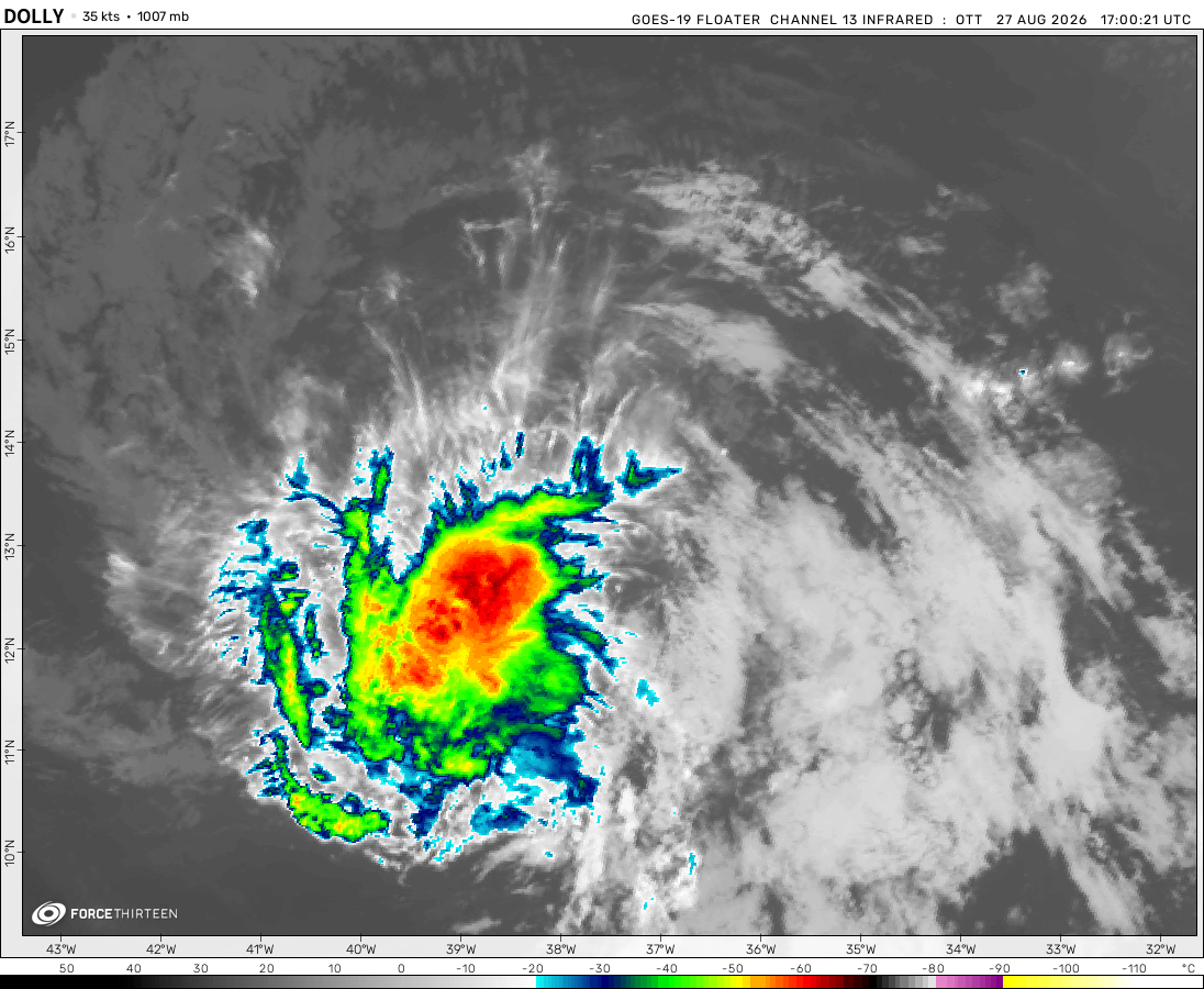
The remnants of Dolly was located near 20.0°N, 70.6°W, or about 113 miles (182 km) north-northwest of Santo Domingo, Dominican Republic. Dolly has maximum sustained winds of 30 knots and a minimum central pressure of 1013 millibars.
Now he says “And in the central pacific, we are still waiting for Hone. It’s been 5 years!”
F13 Fan
2 years ago
Also 95S has formed
F13 Fan
2 years ago
This is actually turning into 2023-24 Hypothetical Litia Von Lucernea season!
CyclonicUpdates
2 years ago
Mar 20, 2024: Currently, the storm on the right is what’s left of Cyclone Megan, which peaked on Mar 17 at about
105 mph and a pressure of 957 mb according to zoom earth.On the left is Cyclone Neville, which is peaking at about 80 mph and a pressure of 983 mb according to zoom earth and is forecasted to move west while continuing to strengthen.
acay
2 years ago
if u come across this post, dislike it
justmeranti
2 years ago
Babe wake up, Neville just got named.
acay
2 years ago
mine is RIPE
acay
2 years ago
tell me a word that best describes the environmental conditions where Megan is located just few days ago?
According to OW/HS, they are expecting that this storm is expected to make a tropical storm landfall in Mozambique early tomorrow. This storm is already producing about 7 inches of rain on the coast. After that, they expect that it will slowly move away in the cold Indian Ocean, affecting none.
Current Wind: 70 MPH
Pressure: 997 MB
Moving 7 MPH NW
Cookies help us ensure our site works securely, continually make improvements, and personalize your browsing experience.
Click 'Accept All Cookies' to get the best browsing experience. You can change these settings at any time by clicking 'Manage My Cookies' below.
Functional
Always active
The technical storage or access is strictly necessary for the legitimate purpose of enabling the use of a specific service explicitly requested by the subscriber or user, or for the sole purpose of carrying out the transmission of a communication over an electronic communications network.
Preferences
The technical storage or access is necessary for the legitimate purpose of storing preferences that are not requested by the subscriber or user.
Statistics
The technical storage or access that is used exclusively for statistical purposes.The technical storage or access that is used exclusively for anonymous statistical purposes. Without a subpoena, voluntary compliance on the part of your Internet Service Provider, or additional records from a third party, information stored or retrieved for this purpose alone cannot usually be used to identify you.
Marketing
The technical storage or access is required to create user profiles to send advertising, or to track the user on a website or across several websites for similar marketing purposes.

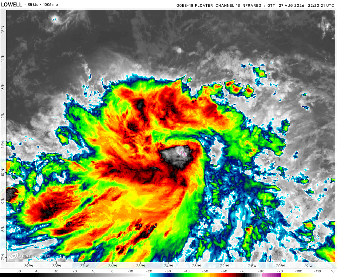 View more imageryAnimated GIF
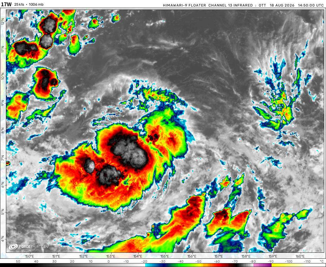 View more imageryAnimated GIF
 View more imageryAnimated GIF
 View more imageryAnimated GIF
 View more imageryAnimated GIF
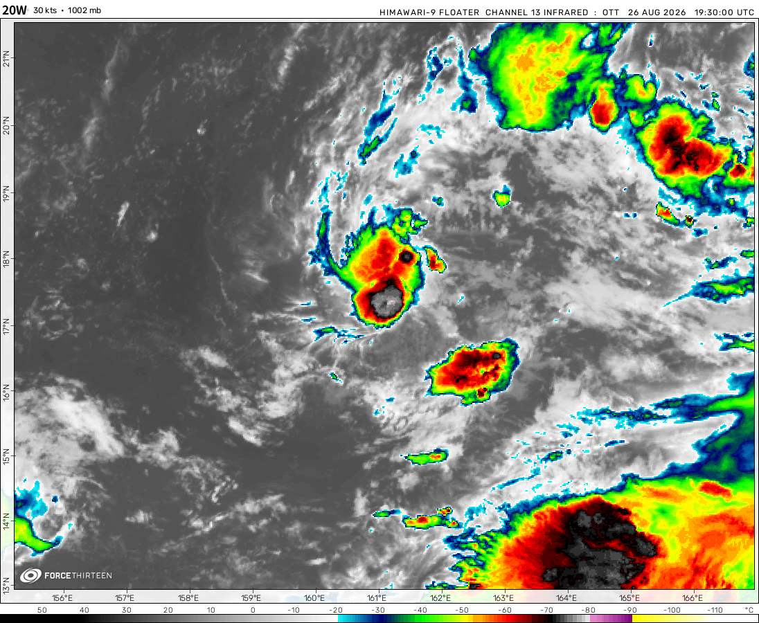 View more imageryAnimated GIF
 View more imageryAnimated GIF
 View more imageryAnimated GIF
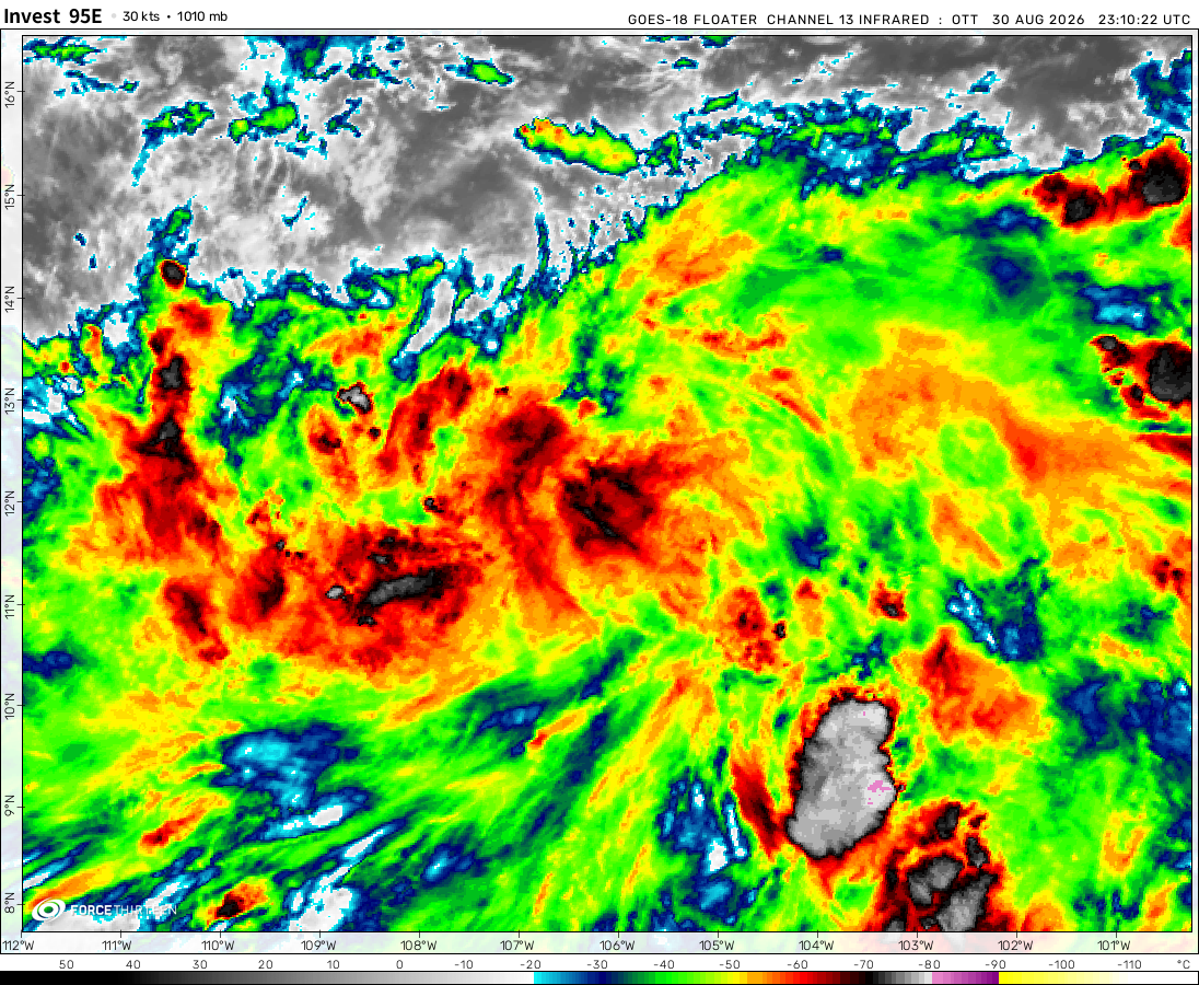 View more imageryAnimated GIF
 View more imageryAnimated GIF
 View more imageryAnimated GIF
Potential Gamane: MaUrItIoUs Im CoMiN fOr U
Mauritius: NOOOOOOOOOOO! I’m still recovering from Freddie and I have scars from Belal
Force thirteen when will you make the 2023 NIO season?
….
i hope one day there will be a wind shear analysis map in this website
The most popular thing F13 has said is… “And in the central pacific, we are still waiting for Hone.”
Now he says “And in the central pacific, we are still waiting for Hone. It’s been 5 years!”
Also 95S has formed
This is actually turning into 2023-24 Hypothetical Litia Von Lucernea season!
Mar 20, 2024: Currently, the storm on the right is what’s left of Cyclone Megan, which peaked on Mar 17 at about
105 mph and a pressure of 957 mb according to zoom earth.On the left is Cyclone Neville, which is peaking at about 80 mph and a pressure of 983 mb according to zoom earth and is forecasted to move west while continuing to strengthen.
if u come across this post, dislike it
Babe wake up, Neville just got named.
mine is RIPE
tell me a word that best describes the environmental conditions where Megan is located just few days ago?
megan’s trying to open an eye
POV: MEGAN HENDERSON TRIES TO BECOME A CYCLONE
Megan reached category 3 on Zoom earth
Is that a HURRICANE in the extreame north Atlantic?
Nope, its an extratropical cyclone with a tropical storm force winds. Just telling lol
That is spinning!!!!!!!!!!!!!
What
Tip’s record has been broken!
Ahah
According to OW/HS, they are expecting that this storm is expected to make a tropical storm landfall in Mozambique early tomorrow. This storm is already producing about 7 inches of rain on the coast. After that, they expect that it will slowly move away in the cold Indian Ocean, affecting none.
Current Wind: 70 MPH
Pressure: 997 MB
Moving 7 MPH NW
Things are active again!
Hi I’m back again.