Tropical Storm Lala was located near 31.9°N, 173.7°W, or about 337 miles (542 km) northeast of Midway Atoll. Lala has maximum sustained winds of 55 knots and a minimum central pressure of 988 millibars.
Tropical Storm Moke was located near 15.0°N, 154.3°W, or about 330 miles (532 km) south of Hilo, Hawaii. Moke has maximum sustained winds of 40 knots and a minimum central pressure of 1002 millibars.
Typhoon Saudel was located near 22.6°N, 139.4°E, or about 194 miles (312 km) southwest of Iwō-Tō Island, Japan. Saudel has maximum sustained winds of 110 knots and a minimum central pressure of 949 millibars.
Tropical Storm Narra was located near 20.5°N, 108.1°E, or about 140 miles (225 km) west-northwest of Haikou, Hainan Island. Narra has maximum sustained winds of 40 knots and a minimum central pressure of 992 millibars.
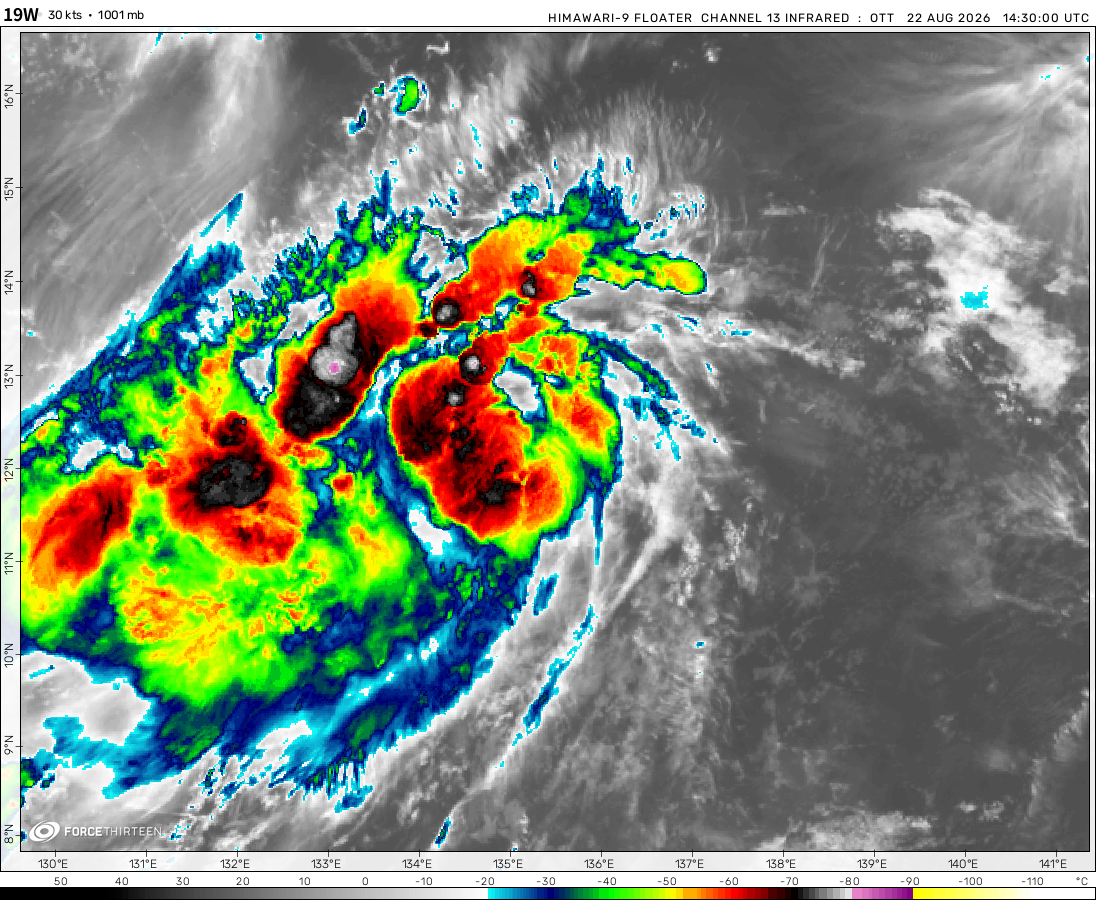
Tropical Depression 19W was located near 13.7°N, 136.5°E, or about 307 miles (494 km) north-northwest of Yap, Micronesia. 19W has maximum sustained winds of 30 knots and a minimum central pressure of 1001 millibars.
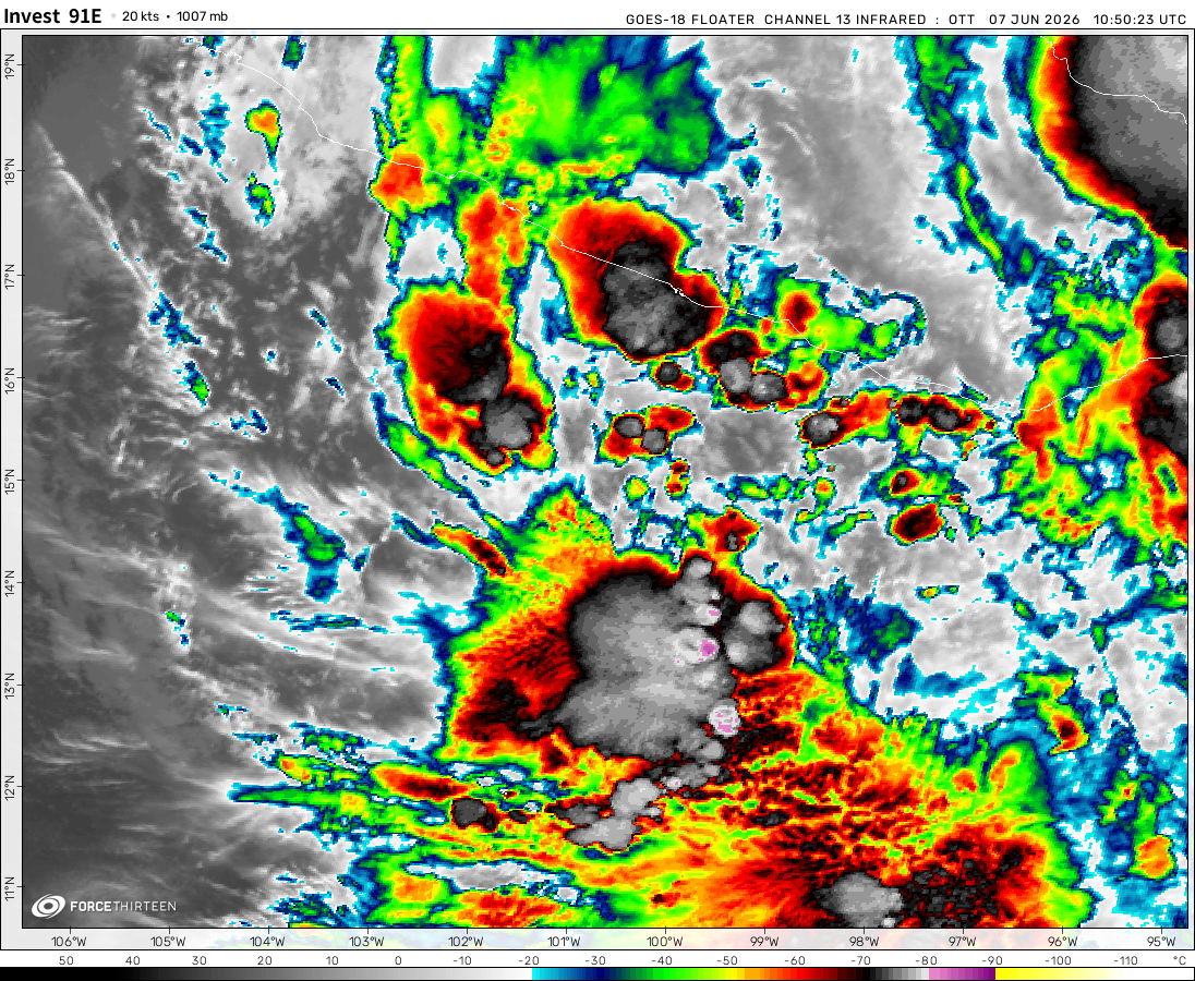
Invest 91E was located near 10.3°N, 122.7°W, or about 771 miles (1241 km) southwest of Clarion Island, Mexico. 91E has maximum sustained winds of 25 knots and a minimum central pressure of 1007 millibars.
Invest 92E was located near 14.9°N, 113.7°W, or about 248 miles (400 km) south-southeast of Clarion Island, Mexico. 92E has maximum sustained winds of 40 knots and a minimum central pressure of 1003 millibars.
Invest 94W was located near 25.5°N, 120.2°E, or about 91 miles (147 km) west-northwest of Taipei City, Taiwan. 94W has maximum sustained winds of 30 knots and a minimum central pressure of 999 millibars.
Invest 95L was located near 28.3°N, 60.0°W, or about 397 miles (639 km) southeast of Hamilton, Bermuda. 95L has maximum sustained winds of 20 knots and a minimum central pressure of 1015 millibars.
Cookies help us ensure our site works securely, continually make improvements, and personalize your browsing experience.
Click 'Accept All Cookies' to get the best browsing experience. You can change these settings at any time by clicking 'Manage My Cookies' below.
Functional
Always active
The technical storage or access is strictly necessary for the legitimate purpose of enabling the use of a specific service explicitly requested by the subscriber or user, or for the sole purpose of carrying out the transmission of a communication over an electronic communications network.
Preferences
The technical storage or access is necessary for the legitimate purpose of storing preferences that are not requested by the subscriber or user.
Statistics
The technical storage or access that is used exclusively for statistical purposes.The technical storage or access that is used exclusively for anonymous statistical purposes. Without a subpoena, voluntary compliance on the part of your Internet Service Provider, or additional records from a third party, information stored or retrieved for this purpose alone cannot usually be used to identify you.
Marketing
The technical storage or access is required to create user profiles to send advertising, or to track the user on a website or across several websites for similar marketing purposes.

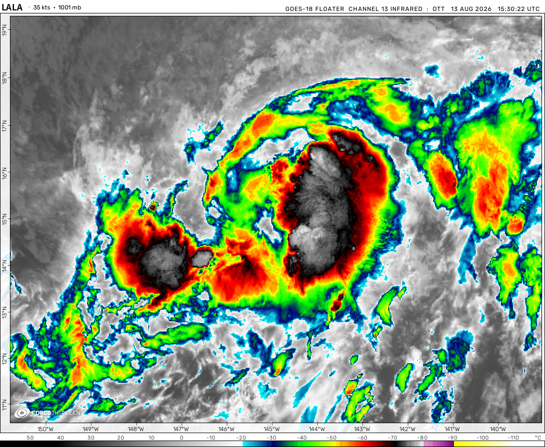 View more imageryAnimated GIF
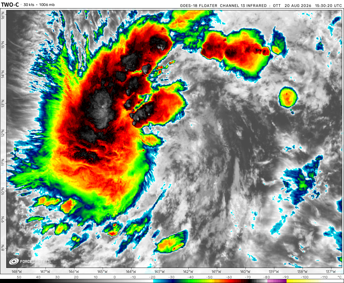 View more imageryAnimated GIF
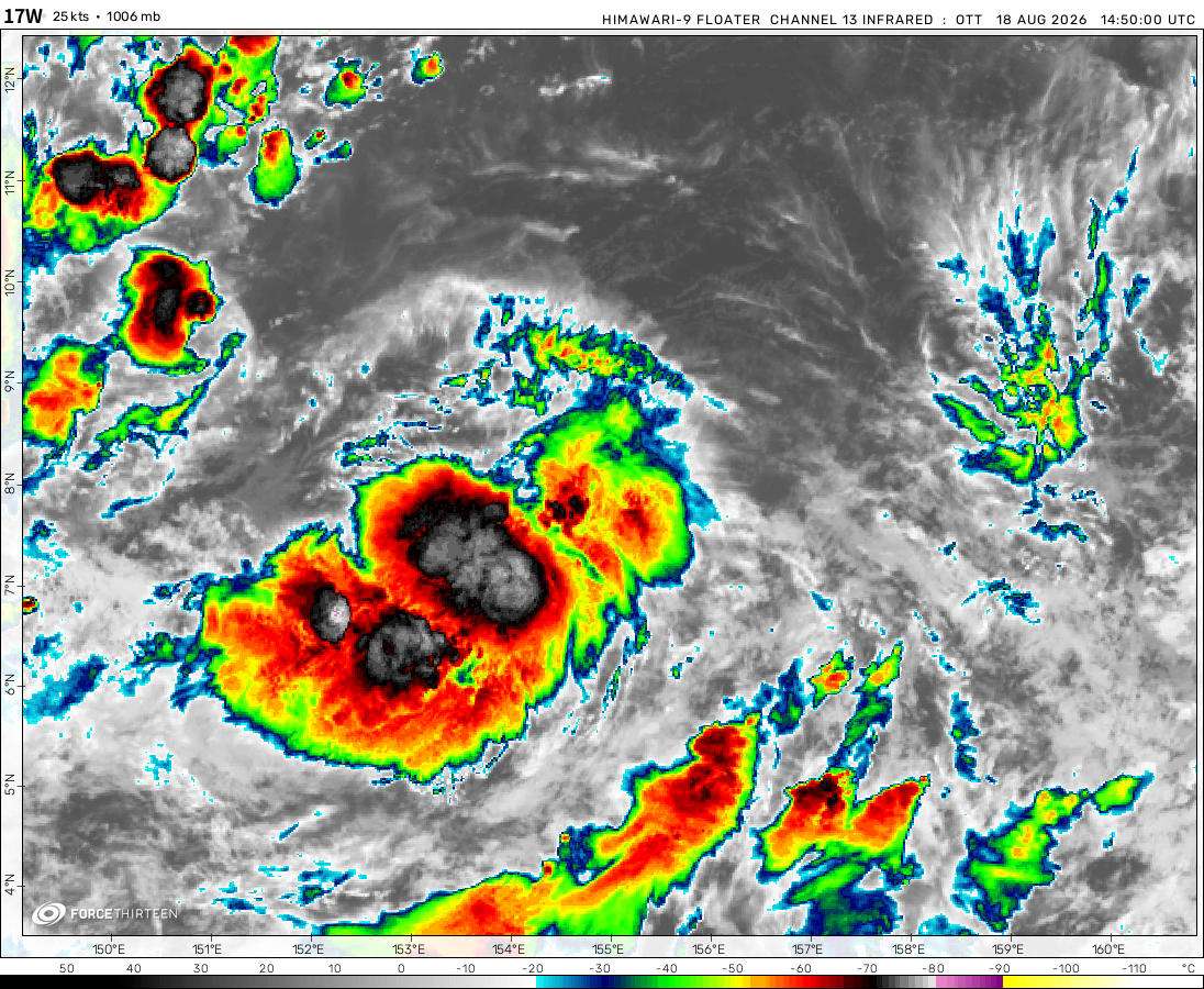 View more imageryAnimated GIF
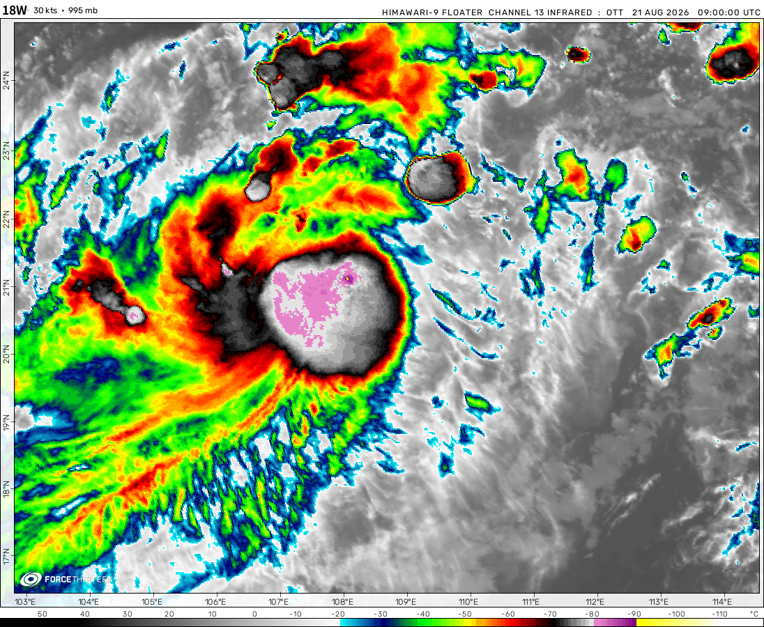 View more imageryAnimated GIF
 View more imageryAnimated GIF
 View more imageryAnimated GIF
 View more imageryAnimated GIF
 View more imageryAnimated GIF
 View more imageryAnimated GIF
So far, in just the first two weeks of June, Eastern Pacific has already produced three tropical storms (Amanda, 1/2
Boris & Cristina) 2/2
TD 03E formed, 03E will strengthen to tropical storm and naming Cristina later today.
Boris has formed at 0900 UTC (June 8), it bring heavy rain in Southern Mexico.
Tropical Depression 02E has formed. (NHC Special Bulletin: 1412UTC)
Invest 91E (pre-Boris/Cristina) expected to form today, while 92E (pre-Boris/Cristina) will form tonight or tomorrow.
starting off with Amanda! It’s not gonna last for long though but two tropical systems there near Mexico
Pacific hurricane season was officially started with pre-Amanda
Farewell
…Whatever happened to all the products?
80P? Hmm interesting one in SPac
I hate hurricanes
Dang, there is an extratropical cyclone southwest of Australia with a minimal pressure of 927 mbar. This is ridiculous.
Sinlaku is no longer active
Typhoon Sinlaku has become the first typhoon that below than 900 hPa/mbar since Typhoon Surigae (2021).
how about bolaven and mawar
Sorry I mean in April, but I forgot to write down.
First super typhoon in this season (ST Sinlaku), estimate peak at 150 knots (170 mph/280 km/h).
Possible tropical development near Florida coast?
ah hack nah
Maila is the most intense cyclone in Solomon Sea, am I right?
Will 90W Be the next surigae?
I found Bryan Norcross and Hurricanes Irma and Maria in the Epstein Files – also today is my bday
It’s official. Melissa had 190 mph winds. The provided image is an excerpt from Melissa’s TCR.